
Earthwork virtual construction method based on BIM + GIS technology

A technology for earthwork and construction methods, applied in structured data retrieval, instruments, geographic information databases, etc., can solve problems such as calculation errors, prone to errors, time-consuming and labor-intensive, etc. The effect of production efficiency

Active Publication Date: 2020-05-22
福建建工集团有限责任公司 +1
View PDF5 Cites 6 Cited by
  • Summary
  • Abstract
  • Description
  • Claims
  • Application Information

AI Technical Summary

Problems solved by technology

[0005] The traditional earthwork balance calculation method is to use the "grid method" to draw an "earthwork balance map". The data collection of each original elevation is time-consuming and laborious and prone to errors. mistake

Method used


Image

  • Earthwork virtual construction method based on BIM + GIS technology

Examples


specific Embodiment approach

[0029] 1. Determine the scope of the UAV aerial survey. Use Google Earth (Google Maps) on the ground station to determine the aerial survey scope of the project by clicking and selecting, and carry out reasonable flight sorties division, optimize the aerial photography plan, and improve operational efficiency.

[0030] 2. Route planning and parameter setting. The flight parameters of forward and inclined aerial surveys generally include altitude, speed, shooting interval, heading distance, lateral distance, etc. Different parameter settings affect the accuracy of the final model and the efficiency of aerial photography.

[0031] 3. After the ground station is set up and the UAV is assembled, the aerial survey operation can start. The UAV will take equidistant photos of the ground at a constant speed according to the overlap rate, path, range and other parameters set by the ground station, and the operator can observe the position of the UAV and the real-time flight parameters...


PUM


Abstract

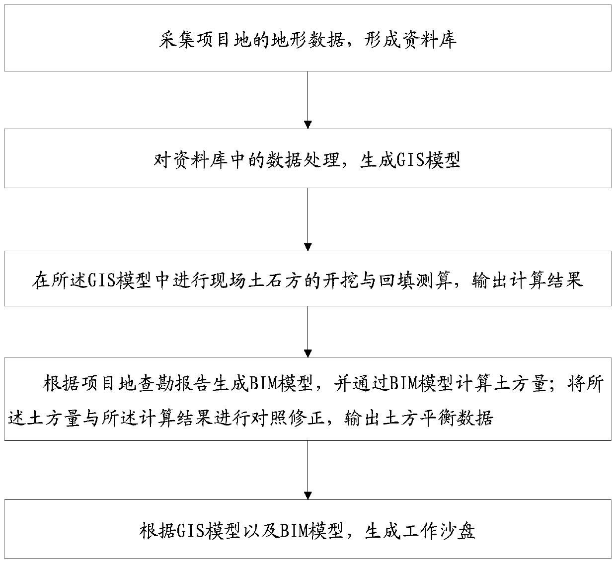
The invention provides an earthwork virtual construction method based on the BIM + GIS technology, and the method comprises the steps: collecting the topographic data of a project site through employing the forward and oblique photography technology of an unmanned plane, and forming a database; processing data information by using a Bentley Context Capture to generate a GIS model; and carrying outexcavation and backfill measurement and calculation of an on-site earthwork in the GIS model, and outputting a calculation result; the method does not stay on a traditional square grid method to drawan earthwork balance diagram for rough estimation of the engineering quantity any more, so engineering quantity calculation time is saved, the accuracy of a calculation result is improved, measurement of the distance, the high layer, the area and the size can be directly conducted on the model, excavation and fill can also be directly calculated, and errors are extremely small. The method can also be used for auditing BIM model measurement errors, and the BIM and GIS data are utilized, so the accuracy of earthwork data is doubly guaranteed, and guarantees are provided for reasonably making aconstruction plan, accurately mastering the construction progress and finally settling accounts.

Description

technical field [0001] The invention relates to a virtual construction method of earthwork based on BIM+GIS technology. Background technique [0002] Earthworks include earth excavation, backfilling and site formation. Earthwork balance refers to the calculation of the amount of earthwork that needs to be excavated at high places in the site. The traditional earthwork balance calculation method is to use the "grid method" to draw an "earthwork balance map" to calculate the amount of earthwork that needs to be excavated at high places in the site and the amount of earthwork that needs to be backfilled at low places, so that the earthwork that is transported into and out of the plan can be known quantity. When planning foundation excavation and construction, it is necessary to minimize the amount of earthwork transported in and out, which not only affects the earthwork cost (the calculation error of earthwork balance can sometimes lead to an additional payment of nearly 100%...

Claims


Application Information

Patent Timeline
IPC IPC(8): G06F30/13G06F16/29G06Q50/08
CPCG06F16/29G06Q50/08Y02A90/10
Inventor 林章凯倪杨程彬王宗成曾庆友郑景昌郑立郑侃翁世平黄伟兴陈至
Owner 福建建工集团有限责任公司
Learn More