A GNSS multi-source information fusion navigation method for suppressing multi-path at sea
A technology of multi-source information fusion and navigation method, applied in the field of calculation, calculation or counting, can solve the problem of simple multi-path error model, and achieve the effect of improving positioning accuracy and low cost
- Summary
- Abstract
- Description
- Claims
- Application Information
AI Technical Summary
Problems solved by technology
Method used
Image
Examples
Embodiment Construction
[0029] The technical solution of the invention will be described in detail below in conjunction with the accompanying drawings.
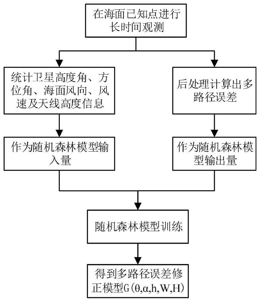
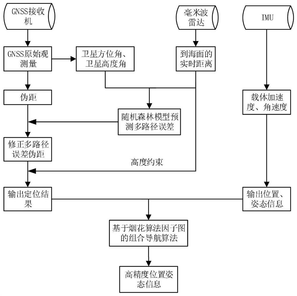
[0030] For the multi-path scene on the sea surface, the data information of GNSS, IMU and millimeter-wave radar is collected, and the multi-path error model is obtained by real-time analysis and processing of the multi-path environment on the sea surface based on the random forest algorithm. The multi-path error model is used to correct the GNSS data. The factor graph optimization algorithm is fused with IMU and millimeter-wave radar to estimate the position and dynamic information of the aircraft, and output more accurate and reliable positioning and navigation data.
[0031] The GNSS\IMU\millimeter-wave radar integrated navigation scheme disclosed in this application suppresses the multipath effect of maritime UAV positioning, such as figure 2 As shown, there are three stages.
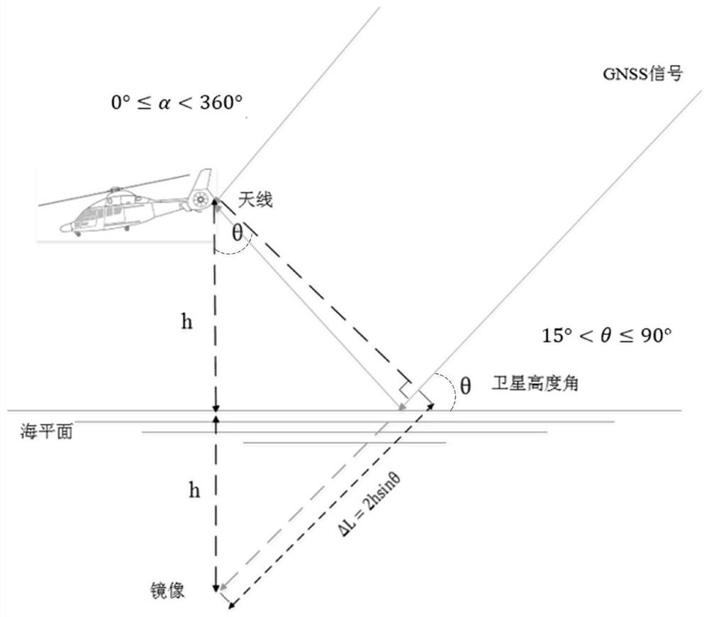
[0032] The first stage is the construction of the GNSS multipath er...
PUM
 Abstract
Description
Claims
Application Information
 - R&D
- Intellectual Property
- Life Sciences
- Materials
- Tech Scout
- Unparalleled Data Quality
- Higher Quality Content
- 60% Fewer Hallucinations
Browse by: Latest US Patents, China's latest patents, Technical Efficacy Thesaurus, Application Domain, Technology Topic, Popular Technical Reports.
© 2025 PatSnap. All rights reserved.Legal|Privacy policy|Modern Slavery Act Transparency Statement|Sitemap|About US| Contact US: help@patsnap.com


