Rotary laser radar and SLAM robot for indoor map construction and positioning

A lidar and indoor map technology, applied in the field of robotics, can solve the problems of low data accuracy and difficulty in building three-dimensional maps, and achieve the effect of ensuring comprehensiveness, high resolution and safety

Active Publication Date: 2020-06-09
青岛聚远网络科技有限公司
View PDF7 Cites 3 Cited by
  • Summary
  • Abstract
  • Description
  • Claims
  • Application Information

AI Technical Summary

Problems solved by technology

[0003] The purpose of the present invention is to overcome the shortcomings of the prior art, seek to design a SLAM robot for indoor map construction and positioning, and solve the problem of the existing SLAM robot acquisition. The accuracy of environmental data is low, making it difficult to construct an accurate 3D map

Method used


Image

  • Rotary laser radar and SLAM robot for indoor map construction and positioning
  • Rotary laser radar and SLAM robot for indoor map construction and positioning
  • Rotary laser radar and SLAM robot for indoor map construction and positioning

Examples


Embodiment

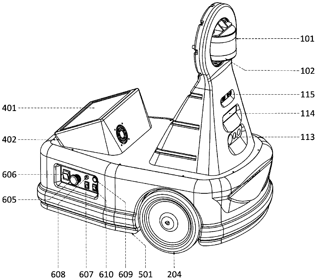
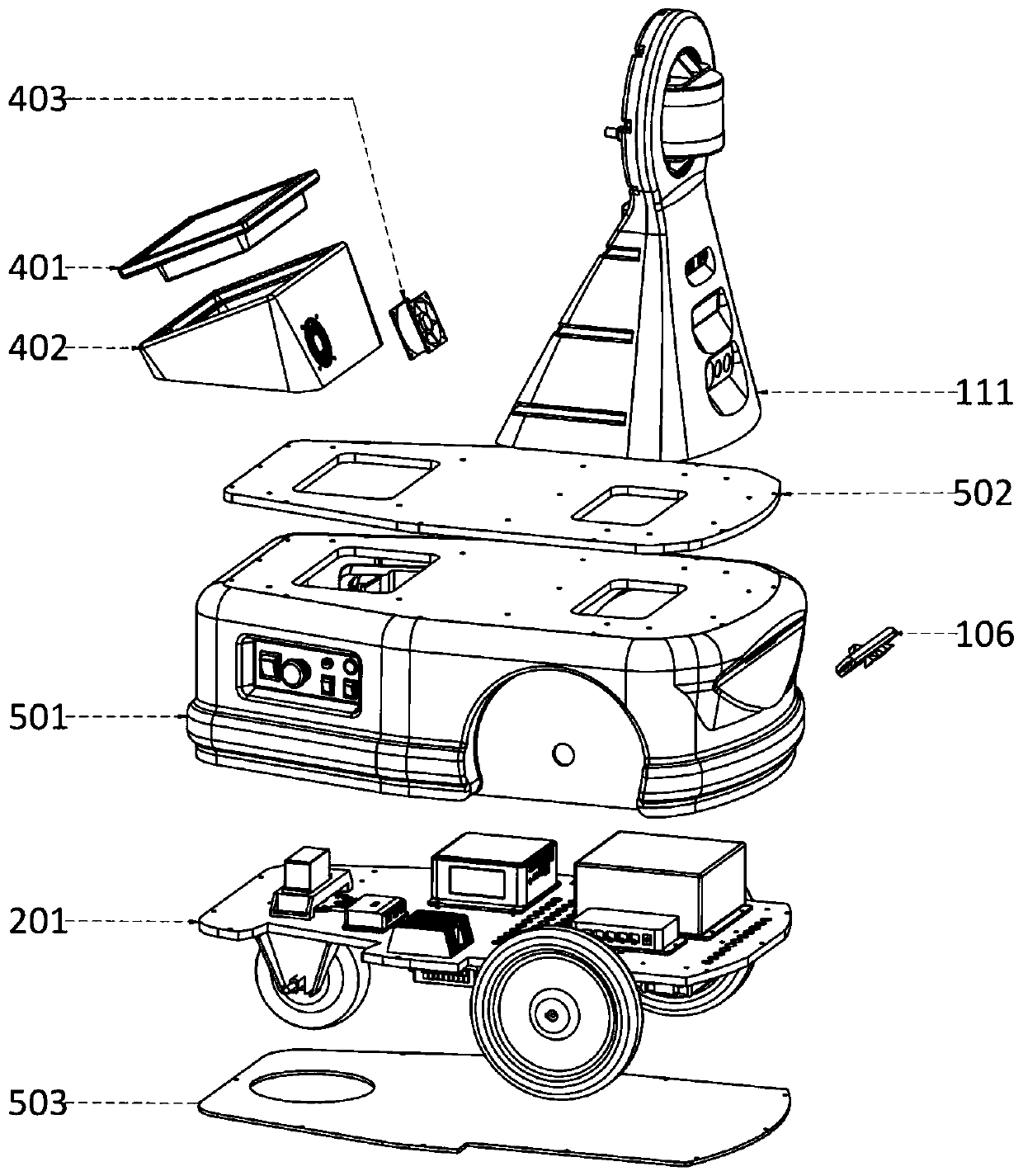
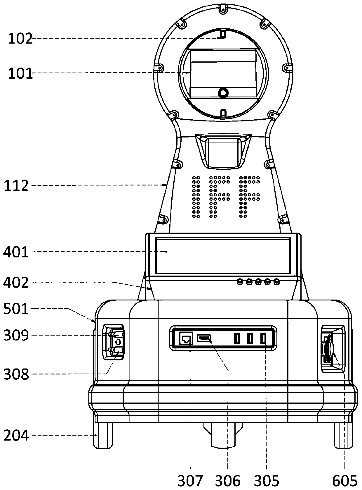
[0037] Such as figure 1 As shown, the SLAM robot for indoor map construction and positioning involved in the present invention includes an environment scanning unit 1, a motion unit 2, a data processing unit 3, a display unit 4, a main body shell 5, a power supply unit 6 and a pose capture unit 7; The scanning unit 1 scans the surrounding environment of the SLAM robot through the camera module and the rotating lidar to obtain environmental information data; the motion unit 2 is used to realize the walking movement of the robot; the data processing unit 3 constructs a three-dimensional map, obstacle avoidance and positioning based on the acquired data; display Unit 4 is used to display the results obtained by the data processing unit to realize human-computer interaction; the main body shell 5 provides support and protection for other units of the robot from external damage; the power supply unit 6 provides electrical energy for the robot; the pose capture unit 7 is used to cap...


PUM


Abstract

The invention discloses a rotary laser radar and an SLAM robot for indoor map construction and positioning. A 3D laser radar is rotationally connected with a fixed seat through a laser radar support;the SLAM robot constructed and positioned by the indoor map formed by the rotary laser radar can achieve full-angle detection of the surrounding environment, and in addition, the robot further comprises a camera module for collecting front image data and a pose capturing unit for collecting the position and pose of the robot. The rotary 3D laser radar, the multi-angle camera and the pose capturingunit cooperate and supplement with one another, comprehensive and accurate environment information around the robot can be obtained, and the most basic and important data source is provided for constructing the accurate and complete three-dimensional map.

Description

Technical field: [0001] The invention belongs to the technical field of robots, and in particular relates to a rotating laser radar and a SLAM robot for building and positioning an indoor map. Background technique: [0002] With the advancement of science and technology and the development of society, positioning and orientation are becoming more and more important. In 1964, the United States established the Global Positioning System GPS to achieve accurate outdoor positioning. However, it is more difficult for complex and high-precision indoor positioning and indoor mapping. At present, the cutting-edge positioning technology direction is SLAM, real-time positioning and map construction technology. This technology is currently widely used in AGV, driverless cars, virtual reality and other fields. At present, the industry divides SLAM into two categories: laser SLAM and visual SLAM. However, most SLAM robots have certain limitations in mapping and positioning capabilities,...

Claims


Application Information

Patent Timeline
Patent Type & Authority Applications(China)
IPC IPC(8): B25J5/00B25J9/16
CPCB25J5/007B25J9/16B25J9/1694B25J9/1697B25J9/1664
Inventor 阿里·纳玛提赵东杰葛树志黄致远法里纳兹·戈拉米
Owner 青岛聚远网络科技有限公司
Why Eureka
Try Eureka