
Seismic imaging method

An imaging and regional technology, which is applied in the field of geophysical exploration, can solve the problems of difficulty in accurately reflecting the change law of prestack depth migration imaging, low signal-to-noise ratio of vertical and horizontal velocity changes, affecting the accuracy of seismic imaging, etc. The effect of level, final imaging accuracy, and data accuracy

Active Publication Date: 2020-08-14
BC P INC CHINA NAT PETROLEUM CORP +1
View PDF4 Cites 1 Cited by
  • Summary
  • Abstract
  • Description
  • Claims
  • Application Information

AI Technical Summary

Problems solved by technology

[0004] However, due to the complex underground structure, fragmentation of fault blocks, large vertical and horizontal velocity changes, and low signal-to-noise ratio, the initial velocity model obtained in the above initial velocity modeling method is the same as that required in prestack depth migration imaging. There is a large difference in the velocity of the data, which is difficult to accurately reflect the changing law of pre-stack depth migration imaging, which in turn affects the accuracy of seismic imaging.

Method used


Image

  • Seismic imaging method
  • Seismic imaging method
  • Seismic imaging method

Examples


Embodiment Construction

[0065] In order to make the objectives, technical solutions and advantages of the present disclosure clearer, the embodiments of the present disclosure will be further described in detail below with reference to the accompanying drawings.

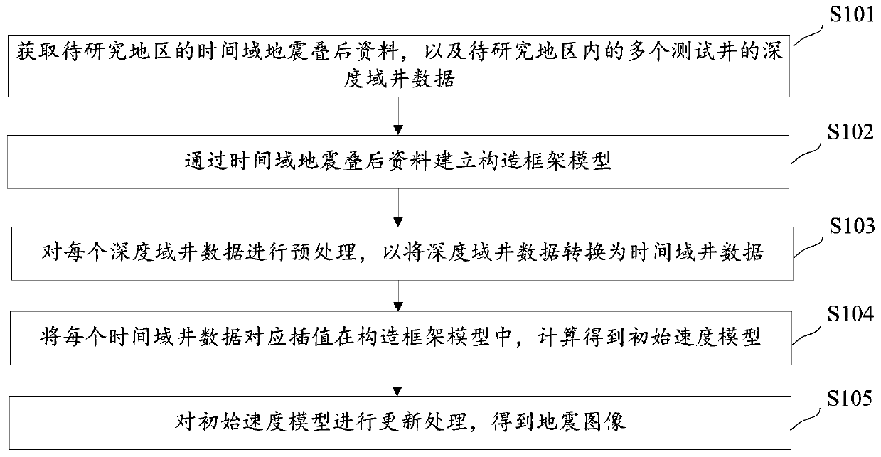
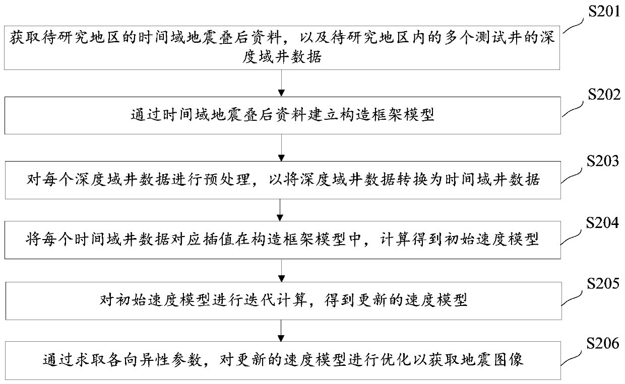
[0066] Embodiments of the present disclosure provide a seismic imaging method, such as figure 1 As shown, the method of seismic imaging includes:

[0067] S101: Acquire post-stack seismic data in the time domain of the area to be studied, and well data in the depth domain of multiple test wells in the area to be studied.

[0068] In the above implementation manner, the time-domain seismic post-stack data are known data, and by collecting the time-domain seismic post-stack data in the area to be studied, the geological structure of the area to be studied can be roughly determined, and a structural frame model is established for the subsequent step 102 prepare. The test wells in the area to be studied are the test wells selected in the test...


PUM


Abstract

The invention provides a seismic imaging method, which belongs to the technical field of geophysical exploration. The seismic imaging method comprises the steps of acquiring time domain seismic post-stack data of a to-be-studied area and depth domain well data of a plurality of test wells in the to-be-studied area; establishing a structural frame model through time domain seismic post-stack data;preprocessing each piece of depth domain well data to convert the depth domain well data into time domain well data; correspondingly interpolating each piece of time domain well data into the construction framework model, and calculating to obtain an initial speed model; and optimizing and updating the initial velocity model, and performing pre-stack depth migration processing on the pre-stack seismic data to obtain a seismic image. By means of the seismic imaging method, the imaging precision can be higher.

Description

technical field [0001] The present disclosure belongs to the technical field of geophysical exploration, and in particular, relates to a method for seismic imaging. Background technique [0002] With the rapid development of computer software and hardware technology, prestack depth migration has been widely used in the field of seismic exploration migration imaging technology. It has unique advantages in seismic data imaging of complex surface and complex structures, and has become a key technology for seismic data imaging processing. However, prestack depth migration is also the most comprehensive and most difficult process in seismic data processing, and it faces many technical challenges in velocity modeling and migration methods. Experience shows that the imaging quality of prestack depth migration is closely related to the accuracy of the velocity model, especially the accuracy of the initial velocity model. That is to say, the accuracy of the initial velocity model w...

Claims


Application Information

Patent Timeline
IPC IPC(8): G01V1/30
CPCG01V1/303G01V1/282G01V2210/6222G01V2210/61
Inventor 李建峰张小芳张少华于海生赵玲芝程玉坤
Owner BC P INC CHINA NAT PETROLEUM CORP
Learn More