Surveying and mapping device and method

A technology of surveying and mapping device and drawing terminal, which is applied in the field of surveying and mapping, which can solve the problems of not being easy to fly and the outline of the measured area is not accurate enough, so as to achieve the effect of reducing operation steps

Active Publication Date: 2020-08-18
杭州元节空间科技有限公司
View PDF15 Cites 3 Cited by
  • Summary
  • Abstract
  • Description
  • Claims
  • Application Information

AI Technical Summary

Problems solved by technology

[0005] The deficiencies in the existing technology are: the flight of the drone is operated by remote control, it is not easy t

Method used


Image

  • Surveying and mapping device and method
  • Surveying and mapping device and method
  • Surveying and mapping device and method

Examples


Embodiment 1

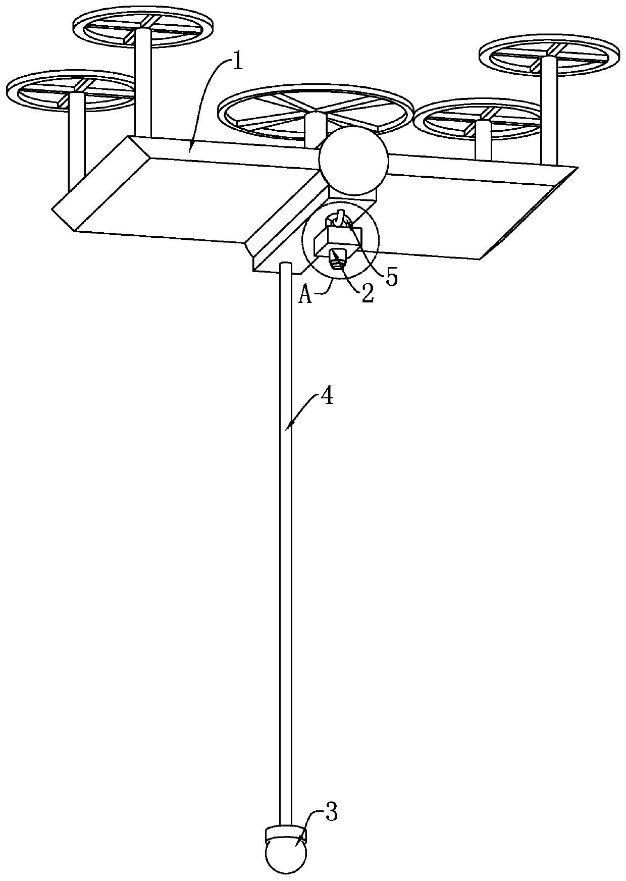
[0050] Embodiment 1, a kind of surveying and mapping device, with reference to figure 1 , comprising a drone 1, a sling 4 fixedly connected to the bottom of the sling 1, a GPS positioning device 3 fixedly connected to the bottom of the sling 4, and a drawing terminal wirelessly connected to the GPS locating device 3, the drawing terminal can rely on a computer , chips, servers and other implementations, in this embodiment, a notebook computer is selected for implementation.

[0051] The UAV 1 circles around the area to be measured, locates it through the GPS positioning device 3, and records the walking path of the UAV 1 on the drawing terminal. Multiple coordinate points on the walking path of UAV 1 are fitted into a linear discrete curve, and the discrete curve is the boundary line of the area to be measured in the drawing. During the movement of UAV 1, there will be swings on the left and right sides, which is not easy Strictly fly in accordance with the area to be tested,...

Embodiment 2

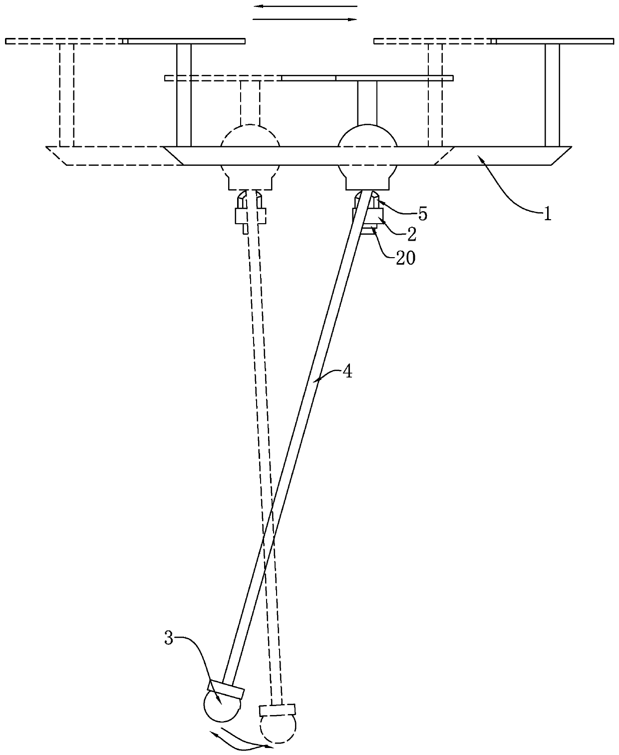
[0096] Embodiment 2, the difference between this embodiment and embodiment 1 is that, with reference to Figure 13 , 14 , both sides of the suspension rope 4 are provided with a suspension assembly, and the suspension assembly includes two clamping plates 7 that are rotatably connected to the bottom of the drone 1, the suspension rope 4 is located between the two clamping plates 7, and the clamping plate 7 It is elongated. In one state, the length direction of the clamping plate 7 is parallel to the length direction of the suspension rope 4. The column suspension rope 4 can be clamped by the clamping plate 7 to prevent the suspension rope 4 from swinging. Two mutually attracting magnets 70 are arranged on the opposite sides of the plates 7, through the magnets 70, the two clamping plates 7 are attracted to each other, so that the two clamping plates 7 are close to each other, and then the two clamping plates are clamped The sling 4 between 7, the magnet 70 is located at the e...


PUM


Abstract

The invention discloses a surveying and mapping device, and relates to the technical field of surveying and mapping, the key points of the technical scheme are as follows: the surveying and mapping device comprises an unmanned aerial vehicle body and a GPS positioning device arranged below the unmanned aerial vehicle body. The GPS positioning device is wirelessly connected with a drawing terminal;the drawing terminal receives the position information of the GPS positioning device and records the position information of the GPS positioning device in real time; the GPS positioning device is suspended below the unmanned aerial vehicle, and the drawing terminal is provided with a fitting unit used for fitting a position path on the GPS positioning device into a linear discrete curve. The technical problem that a method for surveying and mapping through unmanned aerial vehicle photographing is not accurate enough is solved, and the method has the advantage of improving surveying and mapping accuracy.

Description

technical field [0001] The invention relates to the technical field of surveying and mapping, in particular to a surveying and mapping device and method. Background technique [0002] Surveying and mapping is surveying and drawing, based on computer technology, photoelectric technology, network communication technology, space science and information science, with global navigation satellite positioning system (GNSS), remote sensing (RS) and geographic information system (GIS) as the technical core , select the existing feature points and boundaries on the ground and obtain the graphics and position information reflecting the current situation of the ground by means of measurement, for engineering construction, planning and design and administrative management. [0003] In surveying and mapping, it is necessary to measure the area of ​​the measured area. An existing method for calculating the area of ​​the measured area in surveying and mapping is to use a drone to take pictu...

Claims


Application Information

Patent Timeline
IPC IPC(8): G01B7/32G01C15/00G01S19/42G01R31/382G05D1/10B64D47/00
CPCB64D47/00G01B7/32G01C15/00G01S19/42G05D1/101G01R31/382
Inventor 赵景辉袁敏杰范淼珍毕甜甜钟水清
Owner 杭州元节空间科技有限公司
Why Eureka
Try Eureka