Dense height map construction method suitable for leg-foot robot planning

A map construction and height map technology, which is applied to vehicle position/route/altitude control, instruments, two-dimensional position/channel control, etc. high precision effect

Active Publication Date: 2020-08-28
ZHEJIANG UNIV
View PDF6 Cites 6 Cited by
  • Summary
  • Abstract
  • Description
  • Claims
  • Application Information

AI Technical Summary

Problems solved by technology

Dense maps are mainly used in the research of 3D reconstruction and semantic maps, but due to the large amount of data, it brings great challenges to map storage and processing on real-time mobile robot systems

Method used


Image

  • Dense height map construction method suitable for leg-foot robot planning
  • Dense height map construction method suitable for leg-foot robot planning
  • Dense height map construction method suitable for leg-foot robot planning

Examples


Embodiment Construction

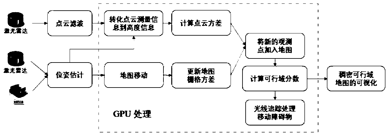
[0040] Below, the technical solution of the present invention will be further described in conjunction with the accompanying drawings and specific embodiments:

[0041] Such as figure 1 , the present invention provides a dense map construction method, comprising the following steps:

[0042] Step 1: Use lidar to obtain point cloud information of the surrounding environment at a frequency of 10-20 Hz, and the point cloud information is mapped to a local height map. In the local height map, the height measurement value is a Gaussian probability distribution, which is approximately Among them, p is the measured height value, δ p 2 is the variance. In the lidar coordinate system S, obtain a single measurement value from the lidar to the terrain Convert it to the corresponding height value p, specifically:
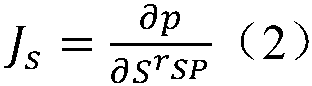
[0043]

[0044] in, Represents the inverse of the rotation matrix of the lidar coordinate system S transformed to the global map coordinate system M; is the dista...


PUM


Abstract

The invention discloses a dense height map construction method, and belongs to the technical field of dense height map construction. The construction method specifically comprises the following steps:using the Gaussian distribution model to estimate the measurement value of the laser radar, and mapping the same to corresponding grids of a local map so as to perform multi-frame data fusion; updating map grid covariance according to the robot pose information, correspondingly moving the local map, and clearing dynamic obstacles so as to form a complete local dense map. The method overcomes thedefects that an existing dense map is large in data size, large in construction calculation amount and not timely in updating, has the advantages of being convenient to construct, high in constructionprecision and the like, can complete real-time construction, and can be directly used for navigation tasks of the legged robot.

Description

technical field [0001] The invention relates to a dense height map construction technology, in particular to a dense height map construction method suitable for legged robot planning. Background technique [0002] Mobile robot is a comprehensive system integrating environmental perception, dynamic decision-making and planning, behavior control and execution. It is not only widely used in industry, agriculture, medical treatment, service and other industries, but also in urban security, defense and space detection Harmful and extremely dangerous occasions such as fields have been well applied. In recent years, legged robots have attracted worldwide attention and become a research hotspot because of their excellent navigability in complex terrain. Compared with wheeled and tracked robots, leg-footed robots not only have the same motion control behaviors as forward, backward and turning, but also realize the "stride" action by controlling the position of the forefoot and rear ...

Claims


Application Information

Patent Timeline
Patent Type & Authority Applications(China)
IPC IPC(8): G05D1/02
CPCG05D1/0257G05D1/0276
Inventor 王越潘一源熊蓉
Owner ZHEJIANG UNIV
Why Eureka
Try Eureka