Method for identifying thunderstorm cloud clusters in satellite cloud atlas
A technology of satellite cloud image and identification method is applied in the field of identification of thunderstorm clouds in satellite cloud images, and can solve the problem of inability to accurately locate thunderstorm clouds and the like.
- Summary
- Abstract
- Description
- Claims
- Application Information
AI Technical Summary
Problems solved by technology
Method used
Image

Examples
Embodiment Construction
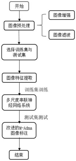
[0062] Such as Figure 5 As shown, the present invention provides a kind of identification method of thunderstorm cloud group in satellite image, comprises the steps:
[0063] Step 1, image preprocessing;
[0064] Step 2, labeling of meteorological cloud map;
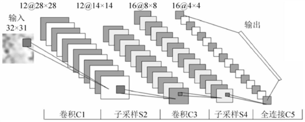
[0065] Step 3, building a convolutional neural network model;
[0066] Step 4, improve the training model;
[0067] Step 1 includes:
[0068] Step 1-1, satellite image data analysis:
[0069] According to the electromagnetic wave wavelength used by the Japanese sunflower meteorological observation satellite in the observation process, the original transmission data of the satellite cloud image is analyzed into an infrared cloud image, and the geographic coordinates in the satellite cloud image are identified according to the method provided by the sunflower meteorological observation satellite data set , continuously represent all positions of the spherical surface of the earth in the plane of the satellite cloud i...
PUM
 Abstract
Description
Claims
Application Information