
Measuring method of a coal mine roadway local slope measuring instrument

A coal mine roadway and measurement method technology, which is applied in the direction of measuring devices, measuring inclinations, instruments, etc., can solve the problems of low measurement efficiency, dimness, and large measurement errors, and achieve the effect of high measurement accuracy and simple calculation ideas

Active Publication Date: 2022-05-20
内蒙古蒙泰不连沟煤业有限责任公司
View PDF6 Cites 0 Cited by
  • Summary
  • Abstract
  • Description
  • Claims
  • Application Information

AI Technical Summary

Problems solved by technology

Since the coal mine roadway needs to measure the slope of its bottom after it is built, it is used for acceptance, but most of the current slope measuring instruments are improved based on protractors, which mainly read the measured values ​​​​by human eyes, and the measurement error is relatively large. Moreover, the coal mine roadway is dim and fuzzy, and auxiliary equipment such as lights are needed to read the value, which is not only troublesome to carry, but also has low measurement efficiency.

Method used


Image

  • Measuring method of a coal mine roadway local slope measuring instrument
  • Measuring method of a coal mine roadway local slope measuring instrument
  • Measuring method of a coal mine roadway local slope measuring instrument

Examples


Embodiment Construction

[0027] The following will clearly and completely describe the technical solutions in the embodiments of the present invention with reference to the accompanying drawings in the embodiments of the present invention. Obviously, the described embodiments are only some, not all, embodiments of the present invention. Based on the embodiments of the present invention, all other embodiments obtained by persons of ordinary skill in the art without making creative efforts belong to the protection scope of the present invention.

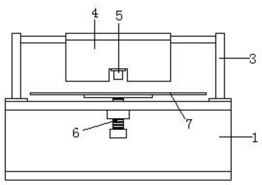
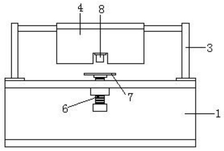
[0028] see Figure 1-10 , the present invention provides a technical solution: the measuring instrument mainly includes a measuring base 1 and a control box 2, the control box 2 is fixed in the middle of the top base of the measuring base 1, and brackets are fixed on both sides of the top base of the measuring base 1 3. The bracket 3 on one side of the measuring base 1 is connected to a counterweight plate 4 through a bearing 9, and a first infrared distance m...


PUM


Abstract

The invention discloses a method for measuring a local slope measuring instrument of a coal mine roadway. The measurement and value of the relevant values ​​of the roadway slope; the control box mainly includes the control circuit board, touch screen, single-chip microcomputer and battery, and the control box is used for the calculation and display of the relevant values ​​​​of the roadway slope. The measurement steps are divided into two steps: 1. Before measuring the slope, place the measuring instrument on the horizontal plane for benchmark calibration; The slope value is read. The invention is a portable coal mine roadway local slope measuring instrument, which is not affected by the dim line of sight in the roadway. It mainly automatically measures the local slope of the coal mine roadway ground through a geometric algorithm. The calculation idea is simple, and the measurement and calculation of the slope can be quickly completed. High precision.

Description

technical field [0001] The invention relates to the field of coal mine detection, in particular to a measuring method for a local slope measuring instrument of a coal mine roadway. Background technique [0002] Mine roadway is a general term for various underground spaces excavated in different directions, at different inclination angles, according to different sections and lengths in different rocks, serving different ranges and used for different purposes. Mine roadways are named and classified according to their spatial size, inclination direction, location, service scope and purpose. Since the coal mine roadway needs to measure the slope of its bottom after it is built, it is used for acceptance, but most of the current slope measuring instruments are improved based on protractors, which mainly read the measured values ​​​​by human eyes, and the measurement error is relatively large. Moreover, the coal mine roadway is dim and fuzzy, and auxiliary equipment such as light...

Claims


Application Information

Patent Timeline
Patent Type & Authority Patents(China)
IPC IPC(8): G01C9/00G01C25/00
CPCG01C9/00G01C25/00
Inventor 陈张昱
Owner 内蒙古蒙泰不连沟煤业有限责任公司
Learn More