
A method for online extraction of video satellite data identification features

A technology for satellite data and identification features, which is applied in the field of image processing to achieve the effects of expanding differences, segmenting backgrounds, and reducing pixel information loss.

Active Publication Date: 2021-04-23
BEIJING UNIV OF CIVIL ENG & ARCHITECTURE
View PDF14 Cites 0 Cited by
  • Summary
  • Abstract
  • Description
  • Claims
  • Application Information

AI Technical Summary

Problems solved by technology

[0004] The object of the present invention is to provide a kind of method of online extraction video satellite data identification feature, thus solve the foregoing problems existing in the prior art

Method used


Image

  • A method for online extraction of video satellite data identification features
  • A method for online extraction of video satellite data identification features
  • A method for online extraction of video satellite data identification features

Examples


Embodiment 1

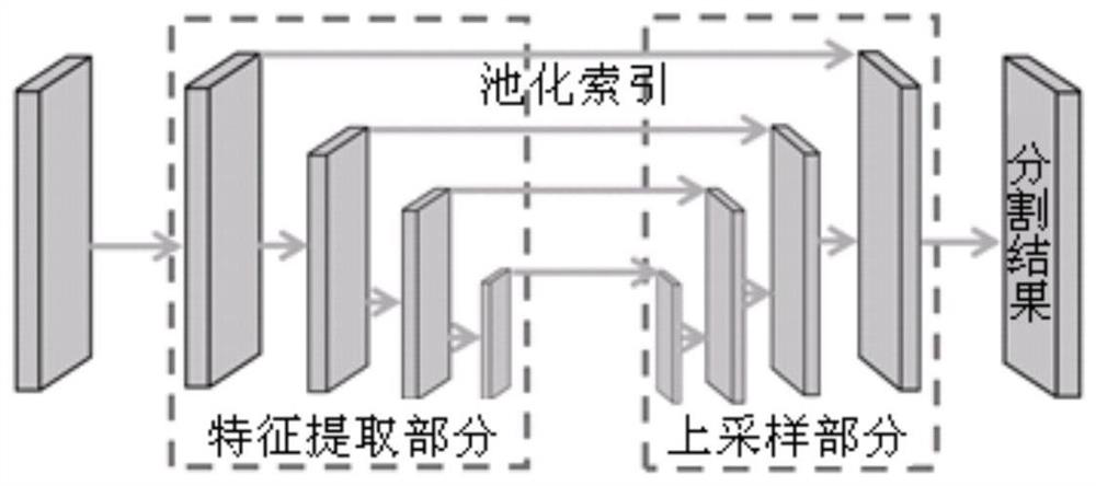
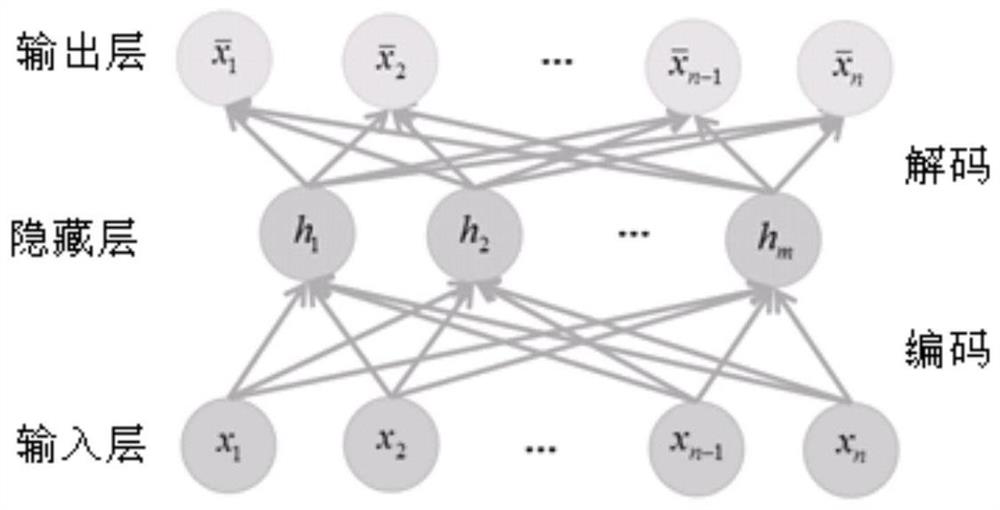
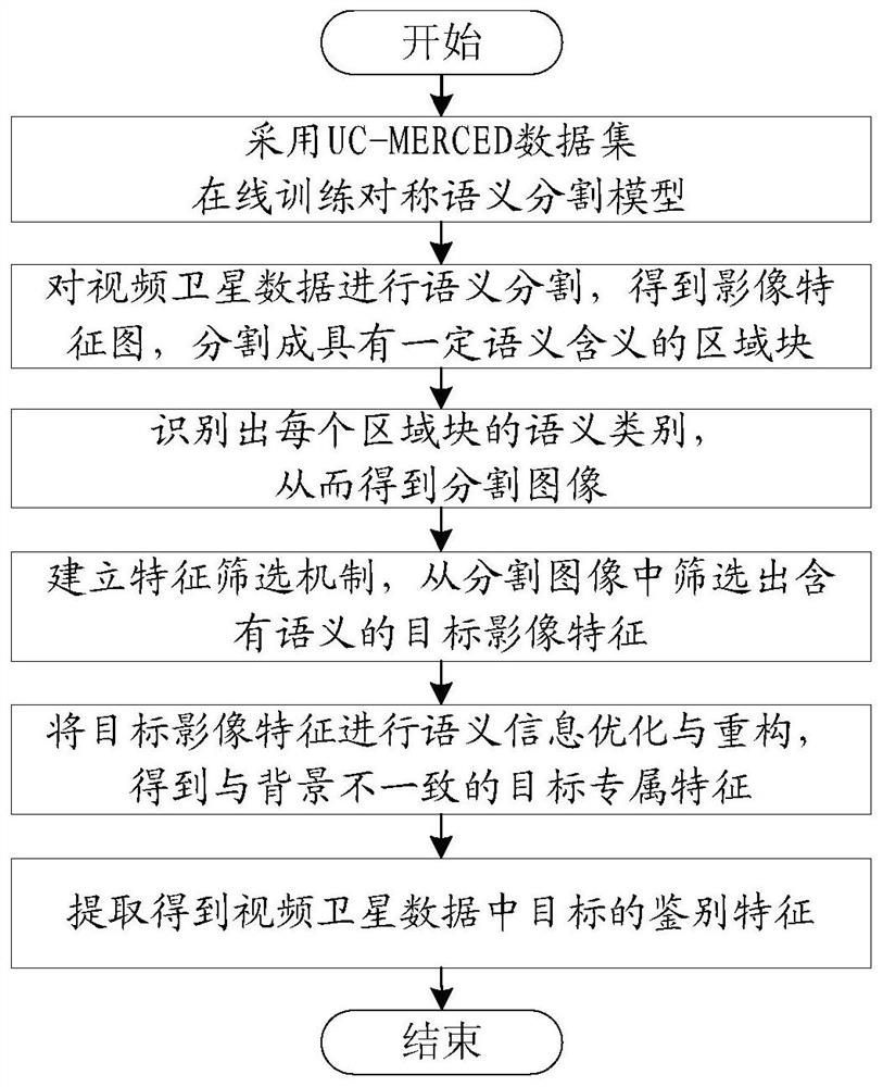
[0031] This embodiment discloses a method for online extraction of identification features of video satellite data. First, an image of video satellite data is obtained, and data labeling is performed on the acquired image. The semantic segmentation model and the self-encoding network model extract discriminative features, which specifically include the following steps:

[0032] S1, using the UC-MERCED dataset to train the symmetric semantic segmentation model online in order to more effectively obtain the image features in the video satellite data;

[0033] S2, use the trained symmetric semantic segmentation model to semantically segment video satellite data, obtain a series of image feature maps, and finally segment them into regional blocks with certain semantic meanings, and identify the semantic category of each regional block, thus obtaining Segmented images with pixel-wise semantic annotations;

[0034] S3, establish a feature screening mechanism, and filter out target ...


PUM


Abstract

The invention discloses a method for extracting identification features of video satellite data online, and relates to the technical field of image processing of video satellite data; the method for extracting identification features in the invention acquires images of video satellite data and performs data labeling on the acquired images, Then, the marked area after data annotation is used as the range of discriminative feature extraction, and the symmetric semantic segmentation model is trained online, and the discriminative features are extracted by using the trained symmetric semantic segmentation model and the self-encoding network model. This method not only effectively reduces the pixel information loss caused by the forward propagation process, but also accurately locates the segmentation boundary of the image; at the same time, the self-encoder network model automatically learns features from unlabeled data. After the high-level semantic information, the self-encoding network can be used to compress and restore the semantic information to obtain a clearer feature description, thereby expanding the differences between different backgrounds and achieving a better background segmentation effect.

Description

technical field [0001] The invention relates to the technical field of image processing, in particular to a method for online extraction of identification features of video satellite data. Background technique [0002] In the field of machine learning and computer vision applications, it is generally believed that there are two mainstream ways for machines to understand the world: "similarity" and "discrimination". Although in the prior art, deep learning theory has been used to detect and process terrestrial video images, there have been mature applications. However, due to the fundamental differences between video satellite data and terrestrial video data, including different shooting angles, different observation angles, different sensor platforms, different spatial resolutions, different imaging methods, and different image contrasts, it is impossible to use images in computer vision applications. The processing method is directly applied to the video satellite. [000...

Claims


Application Information

Patent Timeline
Patent Type & Authority Patents(China)
IPC IPC(8): G06K9/00G06K9/34G06K9/46G06K9/62G06N3/08
CPCG06N3/08G06V20/13G06V20/40G06V10/267G06V10/462G06F18/217G06F18/24G06F18/214
Inventor 吕京国曹逸飞运则辉耿宇
Owner BEIJING UNIV OF CIVIL ENG & ARCHITECTURE
Learn More