Method and system for quickly judging dangerousness of power tower
A power tower and dangerous technology, which is applied in the field of quickly determining the danger of power towers, can solve the problems of single, one-sided judgment indicators, and inability to respond to towers as a whole, and achieve the effect of avoiding one-sidedness, avoiding judgment, and enriching judgment dimensions
- Summary
- Abstract
- Description
- Claims
- Application Information
AI Technical Summary
Problems solved by technology
Method used
Image
Examples
Embodiment 1
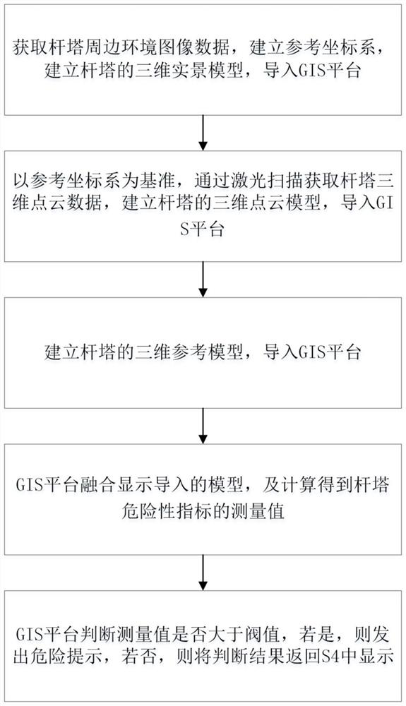
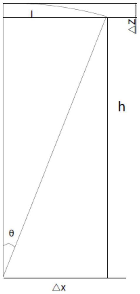
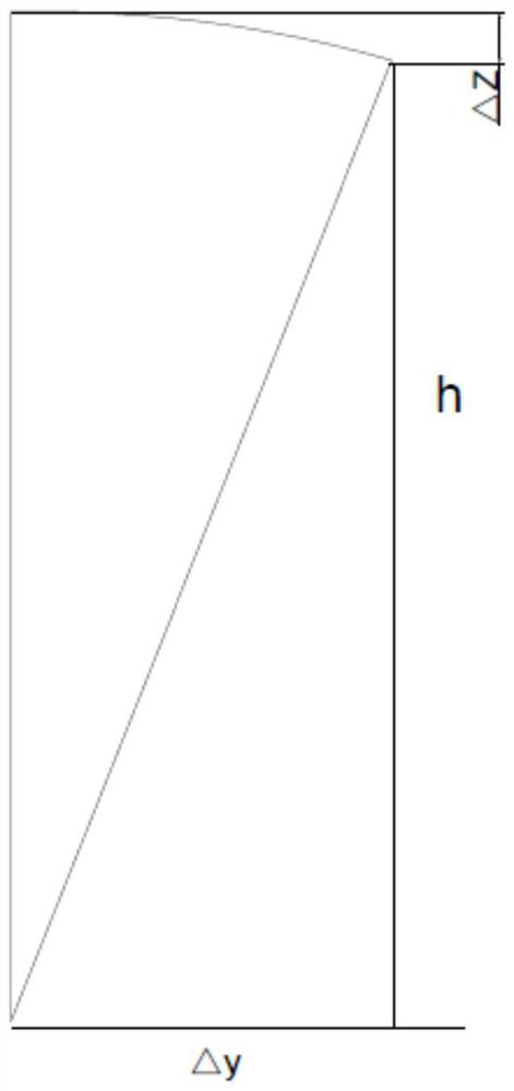
[0057] Such as Figure 1 to Figure 3 An embodiment of a method for quickly determining the danger of a power pole, comprising the following steps:
[0058] S1: Acquire the image data of the surrounding environment of the tower, establish a reference coordinate system, establish a three-dimensional real scene model of the tower, and import it into the GIS (Geographic Information System) platform;
[0059] S2: Based on the reference coordinate system, obtain the 3D point cloud data of the tower through laser scanning, establish the 3D point cloud model of the tower, and import it into the GIS (Geographic Information System) platform;
[0060] S3: According to the known design files of the tower, establish a three-dimensional reference model of the tower, and import it into the GIS (Geographic Information System) platform;
[0061] S4: The GIS (Geographic Information System) platform integrates and displays the imported model, and calculates the measured value of the tower's ris...
Embodiment 2
[0099] Such as Figure 4 Shown is a system for quickly judging the danger of power towers, including a GIS platform and a real scene building module connected electrically to the GIS platform, a point cloud scanning module, and a reference model conversion module. The real scene building module establishes a three-dimensional real scene model of the tower and It is imported into the GIS platform for display. The point cloud scanning module draws the point cloud data of the tower and imports it into the GIS platform for fusion display with the 3D real scene model. The reference model conversion module converts the design data of the tower into a 3D reference model and imports it In the GIS platform, the GIS platform calculates the measured value of the tower deformation by comparing the point cloud data with the 3D reference model, and judges whether it exceeds the threshold.
PUM
 Abstract
Description
Claims
Application Information
 - R&D
- Intellectual Property
- Life Sciences
- Materials
- Tech Scout
- Unparalleled Data Quality
- Higher Quality Content
- 60% Fewer Hallucinations
Browse by: Latest US Patents, China's latest patents, Technical Efficacy Thesaurus, Application Domain, Technology Topic, Popular Technical Reports.
© 2025 PatSnap. All rights reserved.Legal|Privacy policy|Modern Slavery Act Transparency Statement|Sitemap|About US| Contact US: help@patsnap.com


