Rainfall prediction method and system based on wavelet decomposition
A technology of wavelet decomposition and forecasting method, which is applied in forecasting, instrumentation, data processing applications, etc., can solve the problems of less research, and achieve the effects of high accuracy, strong promotion, and wide versatility in watersheds
- Summary
- Abstract
- Description
- Claims
- Application Information
AI Technical Summary
Problems solved by technology
Method used
Image
Examples
Embodiment 1
[0044] This embodiment provides a rainfall prediction method based on wavelet decomposition;
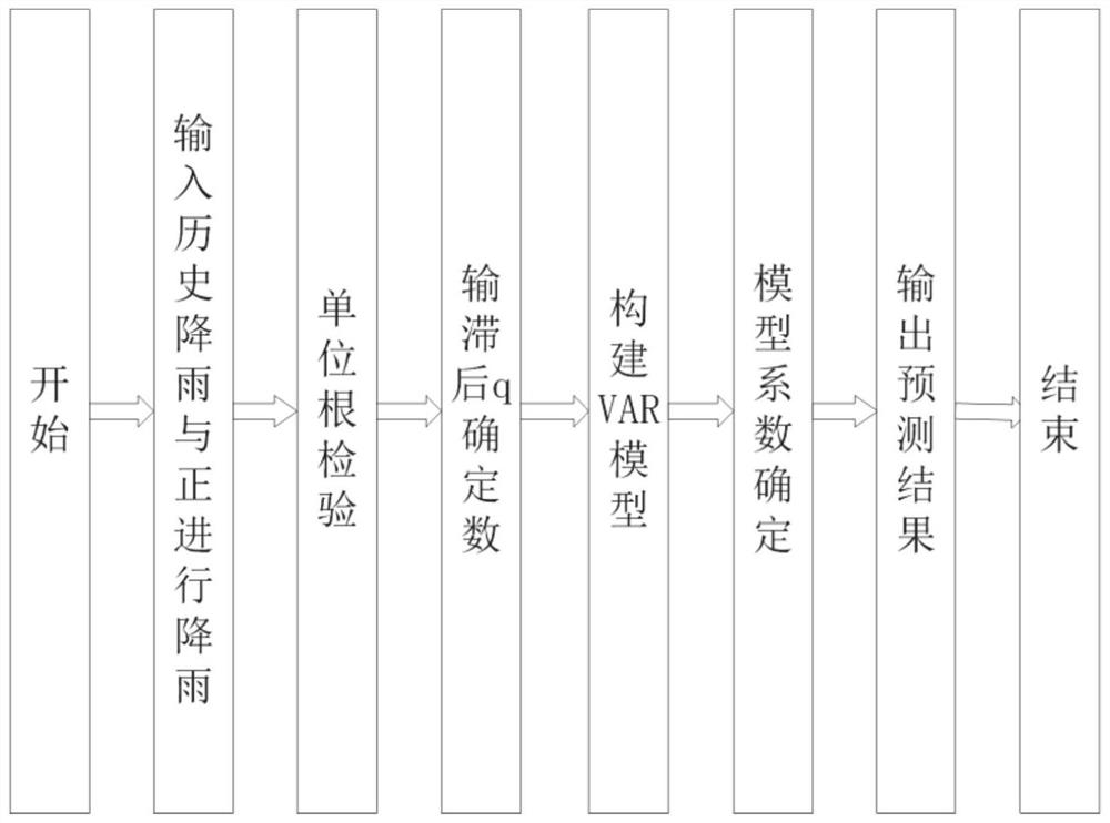
[0045] Rainfall prediction method based on wavelet decomposition, including:
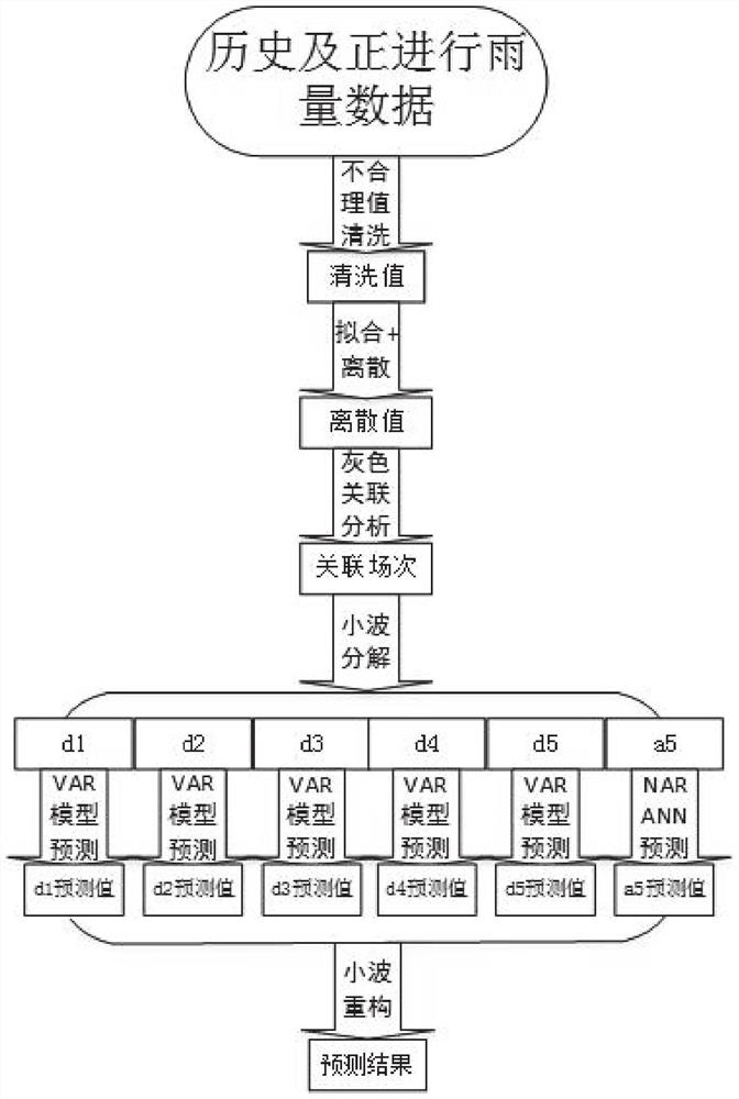
[0046] S101: Obtain several historical rainfall time series and the current ongoing rainfall time series;
[0047] S102: From several historical rainfall time series, filter out several historical rainfall time series with correlation with the current ongoing rainfall time series greater than the set threshold;
[0048] S103: Decompose several historical rainfall time series and current rainfall time series whose correlation degree is greater than the set threshold, and obtain low frequency components (d1-d5) and high frequency components (a5) respectively;
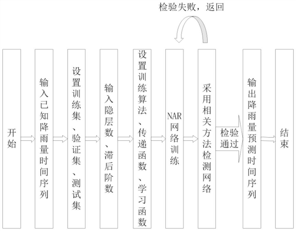
[0049] S104: building a VAR model for the low-frequency component to predict, and obtaining the low-frequency component prediction; building a NAR neural network for the high-frequency component to predict, and obtaining the high-frequency component ...
Embodiment 1
[0101] The Tuhai River is located in the south of the Haihe River Basin in Shandong Province. It flows through the four cities of Liaocheng, Dezhou, Jinan and Binzhou in turn, and flows into the Bohai Bay at Dongfenggang Storm Station, Zhanhua County, Binzhou City. The drainage area is 13,296km 2 . The annual average rainfall in the Tuhai River Basin is 616.62mm, and the main source of runoff is rainfall, which is mainly concentrated in July-August. During the flood season, flood disasters occur frequently, and droughts and floods or consecutive droughts and floods often occur. The threat to the safety of people's life and property in the basin is relatively large, which seriously restricts the economic development of the basin. Therefore, this example selects the historical rainfall data of 9 fields and the real-time data of the 10th field of ongoing rainfall at Yanggu Station in the Tuhai River Basin as an example to predict the amount of ongoing rainfall.
[0102] The Raida ...
Embodiment 2
[0117] The Tuhai River is located in the south of the Haihe River Basin in Shandong Province. It flows through the four cities of Liaocheng, Dezhou, Jinan and Binzhou in turn, and flows into the Bohai Bay at Dongfenggang Storm Station, Zhanhua County, Binzhou City. The drainage area is 13,296km 2 . The annual average rainfall in the Tuhai River Basin is 616.62mm, and the main source of runoff is rainfall, which is mainly concentrated in July-August. During the flood season, flood disasters occur frequently, and droughts and floods or consecutive droughts and floods often occur. The threat to the safety of people's life and property in the basin is relatively large, which seriously restricts the economic development of the basin. Therefore, this example selects the historical rainfall data of 6 events and the real-time data of the 7th field of ongoing rainfall at Dong'a Station in the Tuhai River Basin as an example, and forecasts the amount of ongoing rainfall.
[0118] The R...
PUM
 Abstract
Description
Claims
Application Information
 - R&D
- Intellectual Property
- Life Sciences
- Materials
- Tech Scout
- Unparalleled Data Quality
- Higher Quality Content
- 60% Fewer Hallucinations
Browse by: Latest US Patents, China's latest patents, Technical Efficacy Thesaurus, Application Domain, Technology Topic, Popular Technical Reports.
© 2025 PatSnap. All rights reserved.Legal|Privacy policy|Modern Slavery Act Transparency Statement|Sitemap|About US| Contact US: help@patsnap.com


