

Mobile equipment positioning system, related method, device and equipment
A mobile device and positioning system technology, applied in the direction of measuring devices, navigation, instruments, etc., can solve the problems of low positioning accuracy and real-time performance of equipment, and achieve the effect of high positioning real-time performance and high positioning accuracy
- Summary
- Abstract
- Description
- Claims
- Application Information
AI Technical Summary
Problems solved by technology
Method used
Image

Examples
no. 1 example
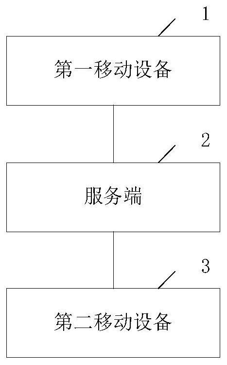
[0175] Please refer to figure 1 , which is an example diagram of an embodiment of a mobile device positioning system provided in this application. A mobile device positioning system provided in the present application includes: a first mobile device 1 , a server 2 and a second mobile device 2 .
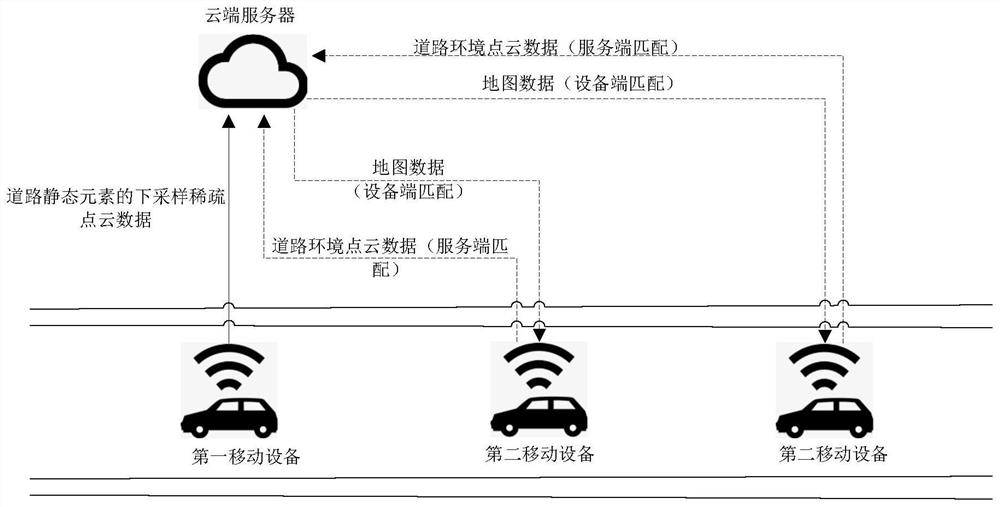
[0176] The system provided by the embodiment of the present application realizes the processing process of mobile device positioning including two stages: 1. Map data generation stage. In this stage, map data is generated through the interaction between the first mobile device (referred to as the map collection vehicle) and the server. The map data It can be compressed sparse point cloud data covering all road static elements (road features) in the target road area, or compressed sparse point cloud data including some road static elements, and complete points of some road static elements Cloud data can also be compressed sparse point cloud data that only includes some road static el...
no. 2 example
[0260] In the above embodiments, a mobile device positioning system is provided, and correspondingly, the present application also provides a method for generating map data. This method corresponds to the embodiment of the above method.
[0261] Please refer to Figure 5 , which is a flow chart of an embodiment of the method for generating map data of the present application. The execution body of the method includes a map data generating device, which can be deployed on the first mobile device. Since the method embodiment is basically similar to the system embodiment 1, the description is relatively simple, and for relevant details, refer to the part of the description of the system embodiment 1. The method embodiments described below are illustrative only.
[0262] A method for generating map data in this embodiment includes:
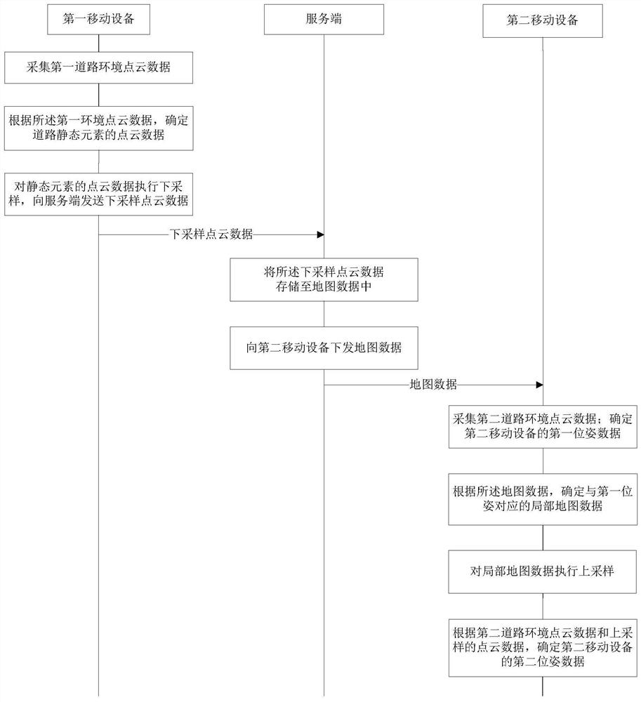
[0263] Step S501: Collect road environment point cloud data.
[0264] Step S503: Compress the point cloud data of road static elements to be comp...
no. 3 example
[0274] Please refer to Figure 6 , which is a schematic diagram of an embodiment of the map data generation device of the present application. The present application also provides a device for generating map data. Since the device embodiment is basically similar to the method embodiment, the description is relatively simple, and for relevant parts, refer to the part of the description of the method embodiment. The device embodiments described below are illustrative only.
[0275] A device for generating map data in this embodiment includes:
[0276] A data collection unit 601, configured to collect road environment point cloud data;
[0277] A data compression unit 603, configured to compress the point cloud data of road static elements to be compressed in the road environment point cloud data;
[0278] The data sending unit 605 is configured to send the compressed point cloud data to the server, so that the server can store the compressed point cloud data in the map data...
PUM
 Abstract
Description
Claims
Application Information