

ArcGIS-based large-scale three-dimensional city scene generation method
A large-scale, urban technology, applied in the fields of smart cities, ArcGIS data processing, and 3D visualization, can solve the problems that buildings cannot fit the actual situation, take a long time, and cannot display the real layout of the city, etc., and achieve a good effect of assisting decision-making
- Summary
- Abstract
- Description
- Claims
- Application Information
AI Technical Summary
Problems solved by technology
Method used
Image

Examples
Embodiment 1
[0042] A large-scale 3D urban scene generation method based on ArcGIS includes the following steps:
[0043] Steps to establish a model library: the model library includes a building model library and an environmental model library;
[0044] The architectural model library contains various types of architectural models. According to POI (POI: Point of interest. The Chinese name "point of interest" means any meaningful point on the map that is not geographically meaningful: such as shops, bars, gas stations, hospitals, Station.) The classification divides the model into a specific type of building, specifically divided into two types: medium and small. The medium category is the building category, and the small category is the building with a specific name. Each medium category contains a default model;
[0045] The building model library records various attributes of the building model, including: building model file, building model number, building category, building model na...
Embodiment 2
[0057] According to the POI classification, buildings are divided into residential buildings, office buildings, shopping malls, hospitals, schools, public services and park building types.
Embodiment 3
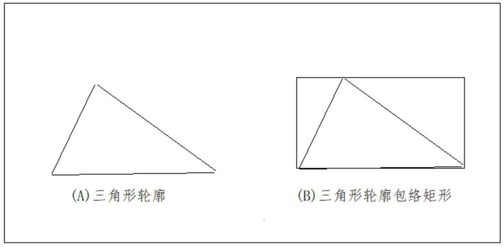
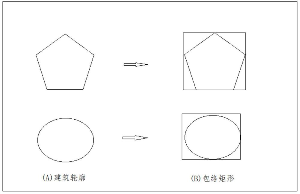
[0059] All building outlines are a series of longitude and latitude coordinates in the data storage. First, the Mercator projection transformation is used to convert all the longitude and latitude coordinates into two-dimensional coordinates. Four variables maxX, minX, maxY, and minY are set to represent the horizontal and vertical coordinates of the building outline. extreme value;
[0060] Take the first coordinate point, assign its abscissa to maxX and minX by default, and assign its ordinate to maxY and minY, and traverse each coordinate point in turn;
[0061] If the abscissa of the judgment point is greater than maxX, replace the value of maxX; if it is smaller than minX, replace minX;
[0062] If the ordinate of the judgment point is greater than maxY, replace the value of maxY, if it is less than minY, replace minY; after the traversal judgment is completed, (minX, minY), (minX, maxY), (maxX, maxY), (maxX, minY) is the enveloping rectangle of the building outline, the...
PUM
 Abstract
Description
Claims
Application Information