Supercharge Your Innovation With Domain-Expert AI Agents!

Target high-precision sensing method based on multiple roadside sensors

A multi-sensor and sensor technology, applied to instruments, satellite radio beacon positioning systems, measuring devices, etc., can solve the problems of complex use, data association logic and parameters, and low accuracy, and achieve the effect of reducing requirements and costs

Pending Publication Date: 2022-02-11
浙江海康智联科技有限公司
View PDF1 Cites 0 Cited by
  • Summary
  • Abstract
  • Description
  • Claims
  • Application Information

AI Technical Summary

Problems solved by technology

Use the visual sensor and the millimeter-wave radar for target detection and visual ranging; project the millimeter-wave radar detection target onto the pixel coordinate system, match and track with the visual sensor detection target, and obtain the target coordinate xy after weighted average; The coordinates are converted into station coordinates ENU, and then converted into GPS; this method has the following disadvantages: 1. The accuracy of monocular distance measurement is low, which directly affects the positioning accuracy and fusion performance; 2. Fusion in the pixel coordinate system, data association The logic and parameters are complex; 3. The use of the ENU coordinate system is complex, and the rotation angles of the E-axis, N-axis, and U-axis of the roadside fusion equipment need to be obtained separately

Method used


Image

  • Target high-precision sensing method based on multiple roadside sensors
  • Target high-precision sensing method based on multiple roadside sensors
  • Target high-precision sensing method based on multiple roadside sensors

Examples


Embodiment Construction

[0058] next combined with Figure 1-5 A specific embodiment of the present invention is described in detail.

[0059] A high-precision target perception method based on roadside multi-sensors,

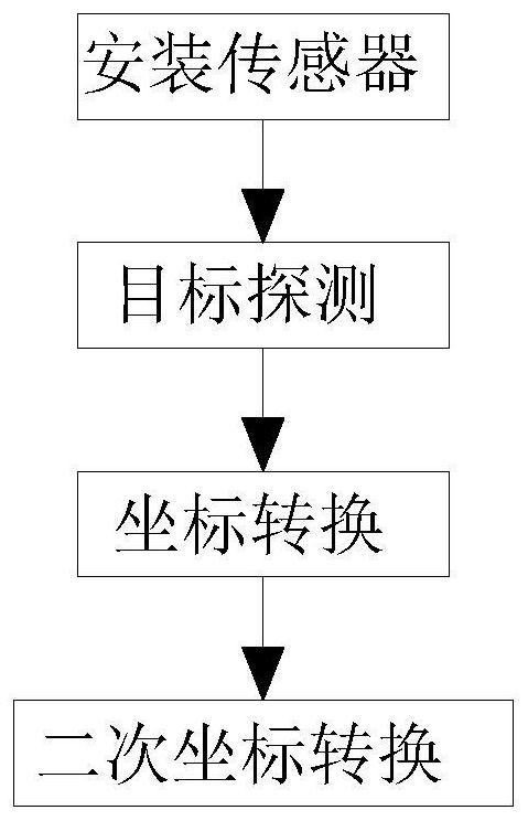
[0060] This method mainly includes the following steps:

[0061] S1, install the sensor, and obtain the GPS coordinates of the sensor;

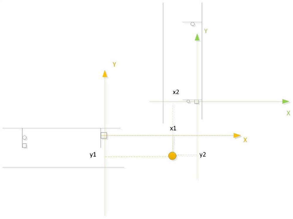
[0062] S2, target detection, use each sensor to detect the target, and obtain the coordinates of the target under each sensor;

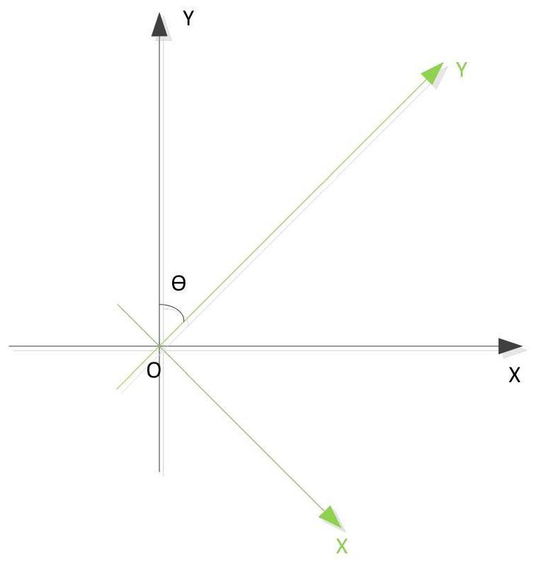
[0063] S3, coordinate transformation, will target under each sensor Convert coordinates to GPS coordinates;

[0064] S4, secondary coordinate conversion, converting the GPS coordinates into other coordinates.

[0065] To describe the above steps in detail:

[0066] For the installed sensor of S1, obtain the GPS of the sensor, and install the sensor on the roadside, such as the gantry, street lamp, electric police pole, etc. The sensor can be a camera, millimeter wave radar, laser radar, etc., and use RTK and other equi...


PUM


Abstract

The invention discloses a target high-precision sensing method based on multiple roadside sensors. The method comprises the following steps of installing the sensors, and obtaining GPS coordinates of the sensors; target detection, performing target detection by using each sensor to obtain coordinates of a target under each sensor; coordinate conversion, converting the coordinates of the target under each sensor into GPS (Global Positioning System) coordinates, including conversion from pixel coordinates to GPS coordinates, conversion from radar coordinates to GPS coordinates, and GPS coordinates of the target detected by a laser radar; and secondary coordinate conversion, converting the GPS coordinates into other coordinates. According to the method, a plurality of methods are fused; the GPS positioning information of the target can be obtained only by using the roadside sensor, a problem that GPS positioning is inaccurate when GPS signals are weak is avoided, meanwhile, a sensor does not need to be installed on a vehicle, and the requirement for the vehicle and the cost are reduced.

Description

technical field [0001] The invention relates to the field of roadside sensing, in particular to a method for high-precision sensing of targets based on roadside multi-sensors. Background technique [0002] In autonomous driving, environmental awareness is a crucial part. The use of vehicle sensors for environmental perception requires each vehicle to be equipped with one or more sensors, which has high requirements for vehicle sensors and vehicle computing power, and increases the cost of the vehicle. The use of roadside sensors for environmental perception can not only solve the problems of computing power and cost, but also solve the problem of environmental perception performance of vehicle sensors under target occlusion and long distances. The detection principles and coordinate representations of various sensors on the roadside are different. How to use multiple sensors on the roadside for target positioning and fusion is very important. [0003] In the prior art, for...

Claims


Application Information

Patent Timeline
IPC IPC(8): G01S7/40G01S7/497G01S19/23
CPCG01S7/40G01S7/497G01S19/23
Inventor 刘甜甜
Owner 浙江海康智联科技有限公司
Features
  • R&D
  • Intellectual Property
  • Life Sciences
  • Materials
  • Tech Scout
  • Unparalleled Data Quality
  • Higher Quality Content
  • 60% Fewer Hallucinations
Learn More