Method for calculating distance of aircraft deviating from runway center line based on QAR data
A calculation method and centerline technology, applied in the field of civil aviation safety, can solve problems such as misjudgment and calculation comparison
- Summary
- Abstract
- Description
- Claims
- Application Information
AI Technical Summary
Problems solved by technology
Method used
Image
Examples
Embodiment
[0024] The present invention provides a kind of calculation method based on QAR data aircraft deviation runway center line distance, it comprises the following steps:
[0025] Step 1: Determine the runway on which the aircraft will land based on the GPS signal data or approach runway number data recorded in the QAR data. That is, first of all, it is necessary to determine which airport the plane lands on and which runway in the airport.
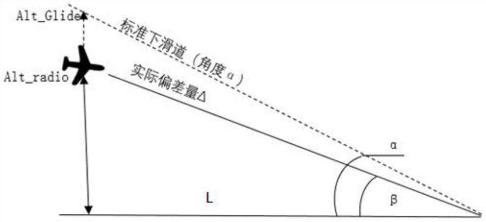
[0026] Step 2: Get the length of the runway S and the distance L1 between the LOC signal station and the end of the runway from the airport database, such as figure 1 shown.
[0027] Step 3: Calculate the real-time distance L3 between the aircraft and the threshold of the runway when the aircraft is approaching blindly. The specific calculation method is as follows:
[0028] (1) Calculate the angle β between the real-time straight-line distance of the aircraft relative to the ILS glide platform space and the projected distance on the groun...
PUM
 Abstract
Description
Claims
Application Information
 - R&D
- Intellectual Property
- Life Sciences
- Materials
- Tech Scout
- Unparalleled Data Quality
- Higher Quality Content
- 60% Fewer Hallucinations
Browse by: Latest US Patents, China's latest patents, Technical Efficacy Thesaurus, Application Domain, Technology Topic, Popular Technical Reports.
© 2025 PatSnap. All rights reserved.Legal|Privacy policy|Modern Slavery Act Transparency Statement|Sitemap|About US| Contact US: help@patsnap.com


