
Map image processing method, device and equipment and readable storage medium

A map image and processing method technology, applied in the fields of equipment, readable storage media, devices, and map image processing methods, can solve problems such as time-consuming and complex calculations, achieve simple boundary lines, improve robustness, and save positioning time Effect

Pending Publication Date: 2022-03-01
DONGFENG COMML VEHICLE CO LTD
View PDF0 Cites 0 Cited by
  • Summary
  • Abstract
  • Description
  • Claims
  • Application Information

AI Technical Summary

Problems solved by technology

[0003] The main purpose of the present invention is to provide a map image processing method, device, equipment and readable storage medium, aiming at solving the problem of determining whether a certain coordinate is in the administrative area due to the irregular closed curve of the boundary line of the administrative area in the prior art. Complicated and time-consuming technical issues for calculations within the borderline

Method used


Image

  • Map image processing method, device and equipment and readable storage medium
  • Map image processing method, device and equipment and readable storage medium
  • Map image processing method, device and equipment and readable storage medium

Examples


Embodiment Construction

[0045] It should be understood that the specific embodiments described here are only used to explain the present invention, not to limit the present invention.

[0046] In a first aspect, an embodiment of the present invention provides a map image processing device.

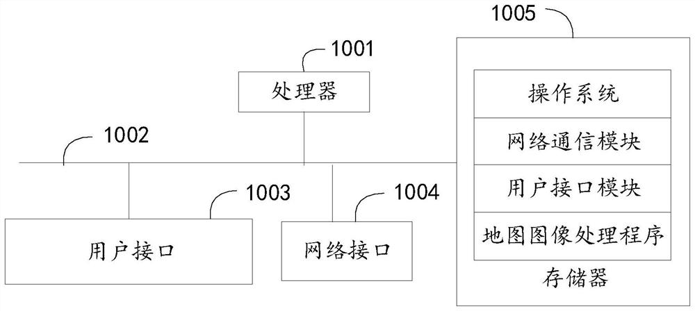
[0047] refer to figure 1 , figure 1 It is a schematic diagram of the hardware structure of the map image processing device involved in the solution of the embodiment of the present invention. In the embodiment of the present invention, the map image processing device may include a processor 1001 (such as a central processing unit, CPU), a communication bus 1002, a user interface 1003, a network interface 1004, and a memory 1005. Wherein, the communication bus 1002 is used to realize the connection and communication between these components; the user interface 1003 can include a display screen (Display), an input unit such as a keyboard (Keyboard); the network interface 1004 can optionally include a standard wir...


PUM


Abstract

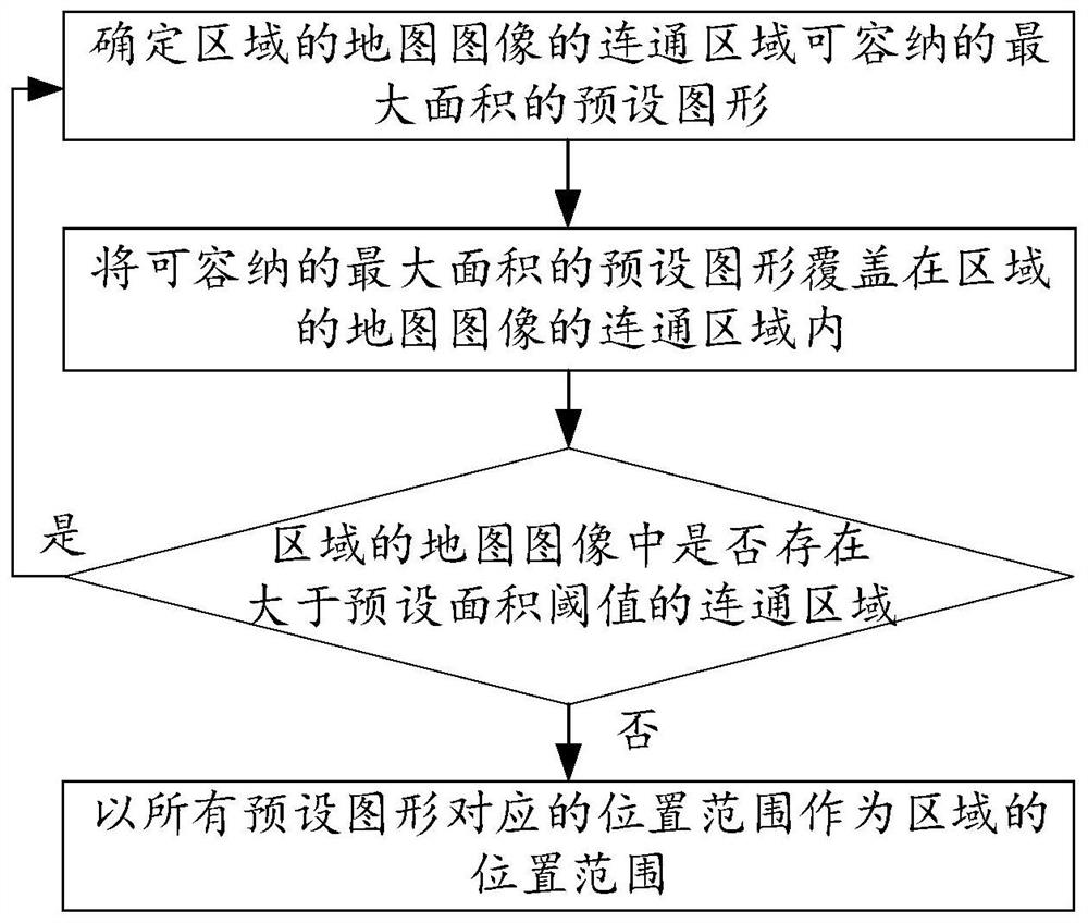
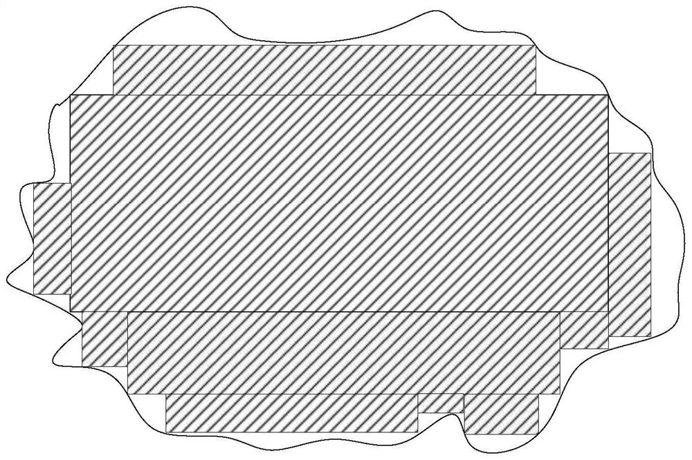
The invention provides a map image processing method, device and equipment and a readable storage medium, and the method comprises the steps: repeatedly executing a preset graph with the maximum area, which can be accommodated by a communication region of a map image of a determined region, a step of covering a preset graph with an receivable maximum area in a connected region of the map image of the region until a connected region larger than a preset area threshold does not exist in the map image of the region; and taking the position range corresponding to all the preset graphs as the position range of the region. According to the method, the map image of the area is processed, the position range of the simple graph with the point located inside or outside the area is used for replacing the position range of the covered map area, the positioning of the target object in the map area is simplified, and the positioning robustness is improved while the positioning time is saved.

Description

technical field [0001] The present invention relates to the field of big data analysis technology of intelligent network connection of transportation, in particular to a map image processing method, device, equipment and readable storage medium. Background technique [0002] In commercial vehicle transportation, it is necessary to locate the administrative area where the target vehicle is located according to vehicle monitoring, so as to conduct intelligent network connection and big data analysis of the target vehicle. Specifically, in the prior art, it is generally determined whether a certain coordinate is within the boundary line according to the boundary line of the administrative area to determine the location of the administrative area where the vehicle is located. However, since the boundary line of general administrative regions is a simple closed irregular curve, its irregularity makes it difficult to judge a point in the boundary line in calculation, and the calcu...

Claims


Application Information

Patent Timeline
IPC IPC(8): G06T7/62G06T7/187G06T7/136G06T7/66G06T7/70
CPCG06T7/62G06T7/187G06T7/136G06T7/66G06T7/70
Inventor 余亮陈秀
Owner DONGFENG COMML VEHICLE CO LTD
Learn More