
Multi-factor integrated arid region ecological environment remote sensing monitoring method

An ecological environment and remote sensing monitoring technology, applied in the field of remote sensing geosciences, can solve problems such as weak integration of ecological factors, insufficient regional adaptability, and poor spatial expression performance, and achieve the effects of enhancing sensitivity, enriching texture details, and reducing noise interference

Pending Publication Date: 2022-03-25
NANJING UNIV
View PDF0 Cites 5 Cited by
  • Summary
  • Abstract
  • Description
  • Claims
  • Application Information

AI Technical Summary

Problems solved by technology

[0004] The technical problem to be solved in the present invention is: to overcome the problems of poor spatial expression performance, weak ecological factor integration and insufficient regional adaptability when the existing ecological environment monitoring method is applied in a large area, and propose a multi-factor integrated remote sensing of ecological environment in arid areas monitoring method

Method used


Image

  • Multi-factor integrated arid region ecological environment remote sensing monitoring method
  • Multi-factor integrated arid region ecological environment remote sensing monitoring method
  • Multi-factor integrated arid region ecological environment remote sensing monitoring method

Examples


Embodiment Construction

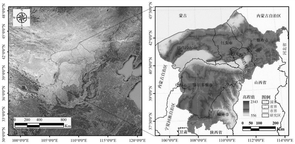
[0057] The present invention will be described in detail below according to the accompanying drawings, so as to make the technical route and operation steps of the present invention clearer. The example study area of ​​the present invention is the Hubao Eyu urban agglomeration, and its position is shown as figure 1 As shown, the monitoring period is from 2000 to 2020.

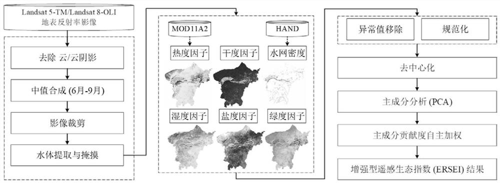
[0058] The flow chart of a multi-factor integrated remote sensing monitoring method for ecological environment in arid areas proposed in this example is as follows figure 2 shown, including the following steps:

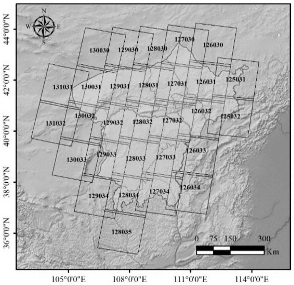
[0059] Step 1: Prepare Landsat surface albedo images with a long-term time series of 30 m resolution in the area of ​​interest. The specific time includes 2000, 2005, 2010, 2015 and 2020, and the images from 2000 to 2010 are Landsat5TM Images, the images from 2015 to 2020 are Landsat 8OLI images. The CFMASK algorithm is used to detect cloud coverage and cloud shadow areas and masked. The processed ...


PUM


Abstract

The invention relates to a multi-ecological factor integrated arid region ecological environment remote sensing monitoring method, and belongs to the technical field of remote sensing geoscience application. On the basis of optical remote sensing images, starting from the angle of coupling ecological system components, on the basis of considering green degree (NDVI), humidity (Wet), dryness (NDBSI) and heat (LST) ecological factors, an enhanced remote sensing ecological index (ERSEI) is constructed in combination with a developed comprehensive salinity index (CSI) and water network density (WND) remote sensing estimation model, and remote sensing comprehensive evaluation of the ecological environment of the arid region is achieved through the index. The ERSEI utilizes principal component analysis to design a principal component contribution rate autonomous weight distribution mode, comprehensive characterization is carried out on each ecological factor, and then the ecological environment quality is quantitatively measured. The method considers the main composition of an ecological system and the characteristics of the arid region environment, can automatically, quickly and efficiently integrate the quality thematic data of the large-scale ecological environment of the earth surface, and provides a new method for the normalized monitoring of the ecological environment of the arid region.

Description

technical field [0001] The invention relates to a multi-factor integrated remote sensing monitoring method for an ecological environment in an arid area, and belongs to the technical field of remote sensing geoscience applications. Background technique [0002] With the increase of climate change and human activities, many regional and global ecological and environmental problems have become increasingly prominent. Quickly and efficiently characterizing and measuring regional ecological environment quality from the spatial scale is a necessary prerequisite for normal monitoring of target areas. Accurately understanding the status and changing trends of ecological environment quality is of great significance for strengthening ecological environment governance and regional planning, and responding to global environmental changes. Significance. [0003] Remote sensing technology has the characteristics of timely information acquisition, wide coverage, and strong periodicity, a...

Claims


Application Information

Patent Timeline
IPC IPC(8): G06V20/13G01N21/3577G01N21/25G06Q10/06G06Q50/26G01N21/17
CPCG01N21/25G01N21/3577G06Q10/06393G06Q50/26G01N2021/1793
Inventor 杜培军张伟郭山川王欣林聪张鹏
Owner NANJING UNIV
Learn More