Land classification area measuring and calculating device for land management

A land and area technology, which is applied in the field of land classification and area measurement devices for land management, can solve the problems of inaccurate satellite positioning, measurement area error, poor signal, etc., and achieve the effects of easy portability, stable movement and convenient use.

Pending Publication Date: 2022-03-29
徐庆光
View PDF7 Cites 1 Cited by
  • Summary
  • Abstract
  • Description
  • Claims
  • Application Information

AI Technical Summary

Problems solved by technology

[0004] At present, the measurement of the length of the land will use the mu meter to use satellite positioning to measure the land area. However, the problem of poor signal is prone to occur outdoors, resulting in inaccurate satellite positioning and errors in the measurement area. At the same time, small When measuring the area of ​​the range, the satellite positioning will have a slight deviation, resulting in the problem that the small area cannot be measured

Method used


Image

  • Land classification area measuring and calculating device for land management
  • Land classification area measuring and calculating device for land management
  • Land classification area measuring and calculating device for land management

Examples


Embodiment 1

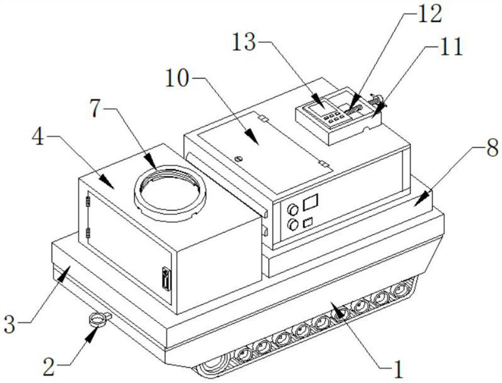
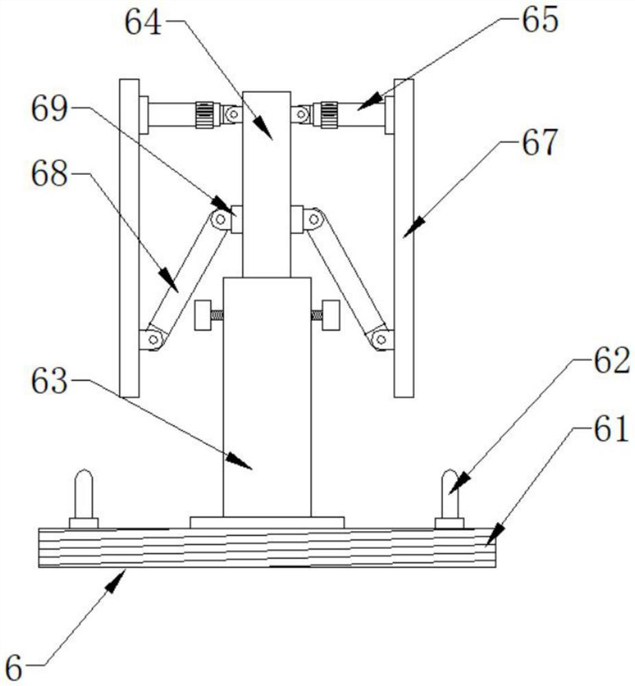
[0028] Such as Figure 1-7 As shown, the present invention provides a land classification area measurement device for land management, comprising a crawler chassis 1, the front end of the crawler chassis 1 is provided with a hanging ring 2, the top surface of the crawler chassis 1 is provided with a shock absorber 3, and the shock absorber 3 One side of the top surface is provided with a storage box 4, and the interior of the storage box 4 is placed with a tow bar 5 and an outdoor mobile antenna device 6. The side is provided with a bottom box 8, and the inside of the bottom box 8 is provided with a tape measuring device 9, and the top surface of the bottom box 8 is provided with a cabinet 10, and the top surface of the cabinet 10 is provided with a placement platform 11, and the placement platform 11 is a rectangular fence structure. One side of the platform 11 is provided with a locking screw 12, and the top of the locking screw 12 is provided with a rubber top block, and th...


PUM


Abstract

The invention discloses a land classification area measuring and calculating device for land management, which comprises a crawler chassis, a hanging ring is arranged at the front end of the crawler chassis, a damping plate is arranged on the surface of the top end of the crawler chassis, a storage box is arranged on one side of the surface of the top end of the damping plate, and a traction rod and an outdoor mobile antenna device are placed in the storage box. An antenna mounting annular seat is mounted on the surface of the top end of the storage box, a tape measuring device is arranged in the bottom box, a placement table is arranged on the surface of the top end of the case, a locking screw is arranged on one side of the placement table, and a mu measuring instrument is placed in the placement table. The outdoor mobile antenna device can be assembled in an area with poor signals, so that signals are provided for the mu measuring instrument, the mu measuring instrument can be accurately positioned, the inclination angle of the strip-shaped line can be freely adjusted, the use is more convenient, and the outdoor mobile antenna device can be folded after being used and is more convenient to carry.

Description

technical field [0001] The invention relates to the field of land surveying, in particular to a land classification area measuring and calculating device for land management. Background technique [0002] Land planning refers to the long-term arrangements for the rational use of land in a country or a certain region according to the prospects and needs of economic development. The aim is to ensure that the use of land can meet the requirements of the proportional development of various sectors of the national economy. The planning is based on the distribution and allocation of existing natural resources, technical resources and human resources, so as to ensure that the land is fully and effectively used without causing waste due to human factors. The overall planning of land use is the overall arrangement and layout of land development, utilization, management and protection in space and time in a certain area according to the requirements of national social and economic su...

Claims


Application Information

Patent Timeline
Patent Type & Authority Applications(China)
IPC IPC(8): G01B5/26G01B5/00
CPCG01B5/26G01B5/0004
Inventor 徐庆光
Owner 徐庆光
Why Eureka
Try Eureka