Error monitoring and estimating method for underwater autonomous navigation system based on multi-means fusion

An autonomous navigation system and error technology, applied in navigation calculation tools, measuring devices, instruments, etc., can solve problems such as oscillation divergence, influence on correction results, and influence on physical field feature matching and positioning performance, so as to improve positioning accuracy and overcome inertial navigation The effect of error accumulating over time

Active Publication Date: 2022-04-12
TIANJIN NAVIGATION INSTR RES INST
View PDF7 Cites 0 Cited by
  • Summary
  • Abstract
  • Description
  • Claims
  • Application Information

AI Technical Summary

Problems solved by technology

However, since the inertial navigation error manifests as oscillation and divergence, the oscillation error term not only affects the performance of physical field feature matching positioning, but also affects the correction effect of physical field matching positioning information on inertial navigation.

Method used


Image

  • Error monitoring and estimating method for underwater autonomous navigation system based on multi-means fusion
  • Error monitoring and estimating method for underwater autonomous navigation system based on multi-means fusion
  • Error monitoring and estimating method for underwater autonomous navigation system based on multi-means fusion

Examples


Embodiment Construction

[0047] Embodiments of the present invention will be described in further detail below in conjunction with the accompanying drawings.

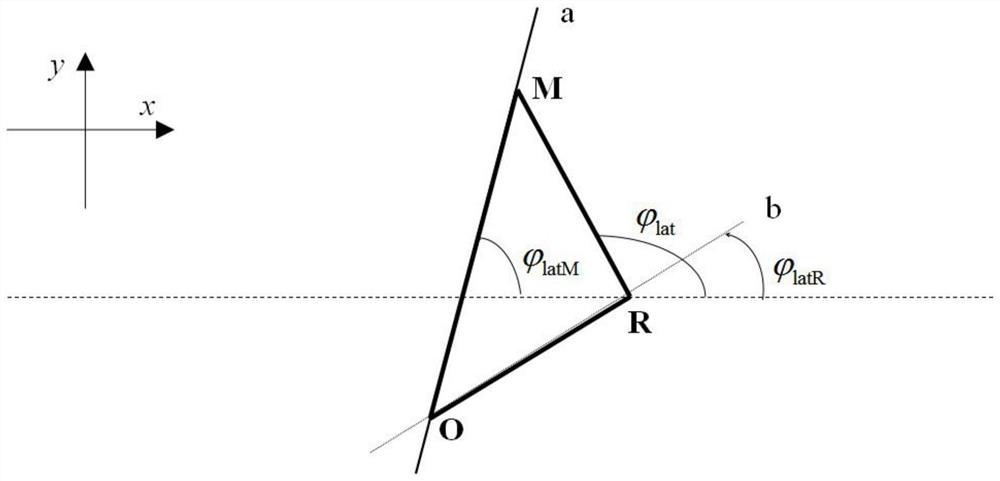
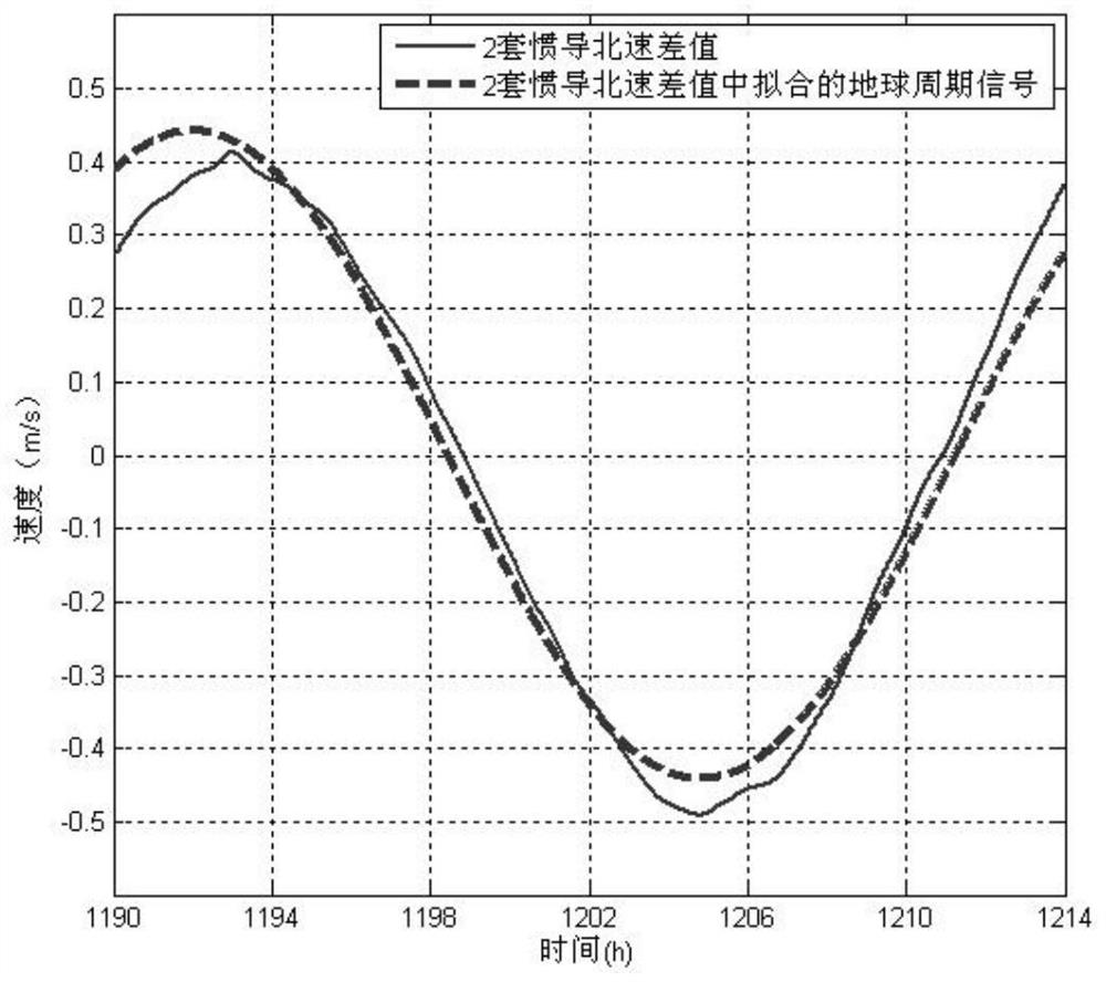
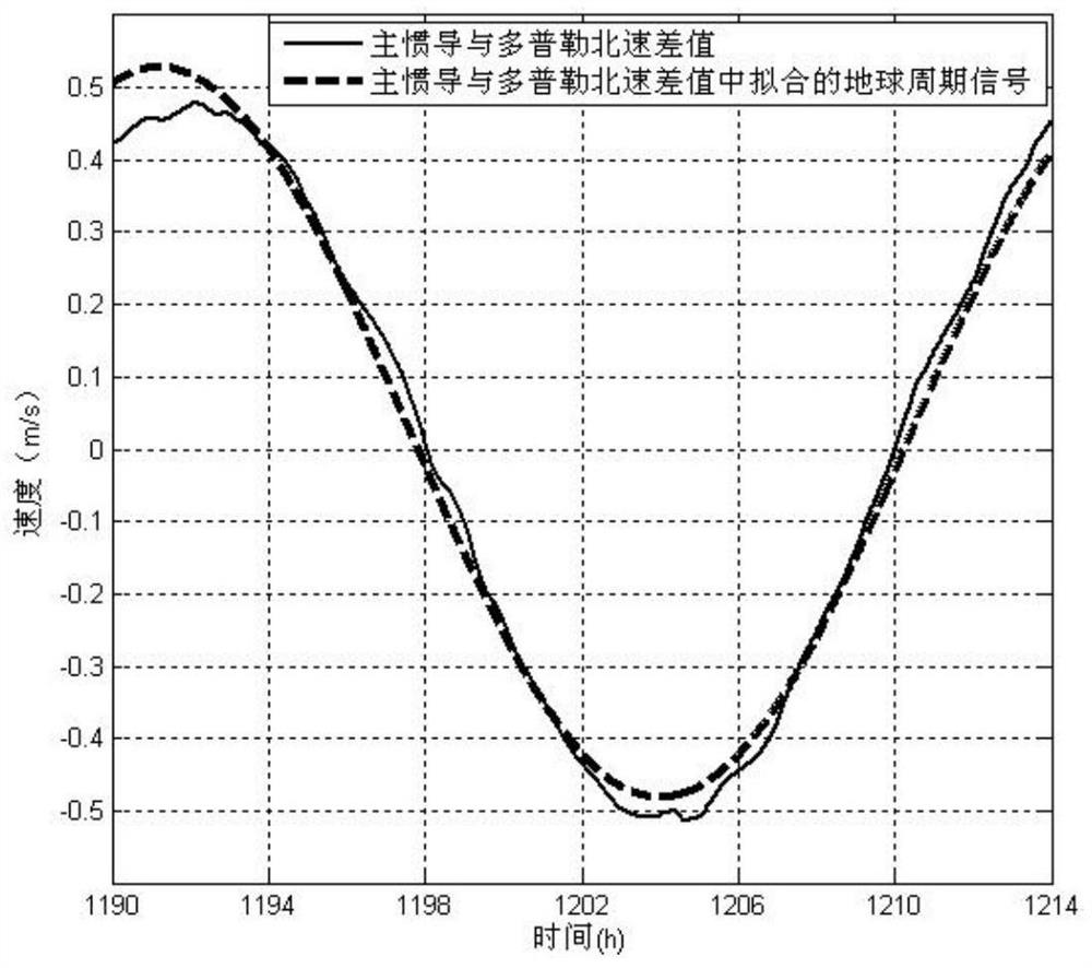
[0048] The present invention is realized in the long-endurance navigation system of the underwater platform composed of two sets of high-precision inertial navigation, Doppler sonar bottom velocity measurement and positioning system and marine physical field feature matching positioning system, wherein the two sets of high-precision inertial navigation are respectively The main inertial navigation and reference inertial navigation, the two sets of inertial navigation have the same accuracy level, and use the same damping network. The variation of inertial navigation position error is dominated by the earth's periodic oscillation. According to the characteristics of the carrier's motion profile, two sets of inertial navigation and Doppler sonar are used to realize the monitoring and monitoring of the main inertial navigation's position. Compensa...


PUM


Abstract

The invention relates to an error monitoring and estimating method for an underwater autonomous navigation system based on multi-means fusion, which is technically characterized by comprising the following steps of: acquiring earth periodic oscillation term phases in two sets of inertial navigation latitude errors based on a speed difference value between main inertial navigation and reference inertial navigation and two sets of inertial navigation speed observation errors taking Doppler speed as a benchmark; decomposing the earth periodic oscillation items in the longitude difference and the latitude difference of the two sets of inertial navigation by using the phase information to obtain the earth periodic oscillation items in respective longitude and latitude errors of the two sets of inertial navigation; taking the longitude and latitude of the main inertial navigation after compensating the earth periodic oscillation error as a position reference for physical field measurement, carrying out physical field feature matching, and taking the matched position as a reference to obtain an inertial navigation longitude and latitude error at a tp moment; and finally, accurate longitude and latitude error estimation of inertial navigation is obtained. The method is reasonable and can be used for inertial navigation error source estimation and compensation correction, the problem that inertial navigation errors are accumulated along with time is solved, and the long-endurance autonomous navigation positioning precision of the underwater platform is remarkably improved.

Description

technical field [0001] The technical field of marine navigation of the present invention relates to an underwater autonomous navigation system of a deep-sea platform, in particular to an error monitoring and estimation method for an underwater autonomous navigation system based on multi-means fusion. Background technique [0002] Due to the limited underwater application of various navigation methods such as satellite navigation and celestial navigation, deep-sea platforms mainly use inertial navigation, which has limited capabilities, and there is still a big gap between the growing demand for long-term high-precision navigation information guarantee. . [0003] The output information of the inertial navigation system has the characteristics of high resolution, real-time, and full parameters. It is the core means of long-endurance navigation for underwater platforms. However, its errors accumulate and diverge over time, resulting in a decrease in accuracy, which is difficul...

Claims


Application Information

Patent Timeline
Patent Type & Authority Applications(China)
IPC IPC(8): G01C25/00G01C21/20
CPCY02A90/30
Inventor 李晓平宫京王永召
Owner TIANJIN NAVIGATION INSTR RES INST
Why Eureka
Try Eureka