Mountain topography surveying and mapping device for data information collection based on electrochromic fluid

A data information, topographic mapping technology, applied in the directions of surveying devices, surveying and navigation, surveying instruments, etc., can solve problems such as unstable placement and easy to be blown down by mountain winds, surveying and mapping devices cannot be placed stably, and data information collection is inconvenient, etc. Achieve the effect of avoiding damage to surveying and mapping equipment, facilitating leveling operations, and ensuring accuracy

Pending Publication Date: 2022-05-13
峡江县慧泓信息技术有限公司
View PDF0 Cites 2 Cited by
  • Summary
  • Abstract
  • Description
  • Claims
  • Application Information

AI Technical Summary

Problems solved by technology

[0003] In view of the above situation, in order to overcome the defects of the prior art, the present invention provides a mountain terrain surveying and mapping device for data information collection based on electrovariable fluids, aiming at data that is not placed smoothly and is easily blown down by mountain winds due to potholes on the ground. The problem of inconvenient information collection, creatively uses the characteristics of electro-variable fluids to perform solid-liquid conversion in the presence or absence of an electric field, so that the adhesive and stable components can firmly adsorb the uneven surface, which solves the existing technology The difficult problem that the surveying and mapping device cannot be placed stably on the bumpy mountain surface ensures the accuracy of the collected data information; this solution uses the auxiliary support component and the support locking component together to facilitate the user’s adjustment of the surveying and mapping device. The leveling operation solves the problem of low surveying and mapping data information caused by difficult leveling, and improves the accuracy of the data information; this solution adjusts the clamping mechanism so that the surveying and mapping equipment is firmly fixed on the clamping The top wall of the base avoids damage to the surveying and mapping equipment caused by accidental drops; this scheme facilitates the user to adjust the surveying and mapping equipment according to the actual situation by setting a rotating component, which improves the practicability of the device and facilitates Users collect data information through this device
[0005] Aiming at the problem of unstable placement and easy to be blown down by mountain winds caused by potholes on the ground, this solution creatively uses the characteristic of solid-liquid conversion of electrochangeable fluid in the presence or absence of electric field, so that the bonding and stability of components It can firmly adsorb the uneven surface, which solves the problem that the surveying and mapping device cannot be placed firmly on the uneven mountain surface, which is difficult to solve in the existing technology, and ensures the accuracy of the collected data information.

Method used


Image

  • Mountain topography surveying and mapping device for data information collection based on electrochromic fluid
  • Mountain topography surveying and mapping device for data information collection based on electrochromic fluid
  • Mountain topography surveying and mapping device for data information collection based on electrochromic fluid

Examples


Embodiment Construction

[0037] The technical solutions in the embodiments of the present invention will be clearly and completely described below in conjunction with the accompanying drawings in the embodiments of the present invention. Obviously, the described embodiments are only some of the embodiments of the present invention, not all of them; based on The embodiments of the present invention and all other embodiments obtained by persons of ordinary skill in the art without making creative efforts belong to the protection scope of the present invention.

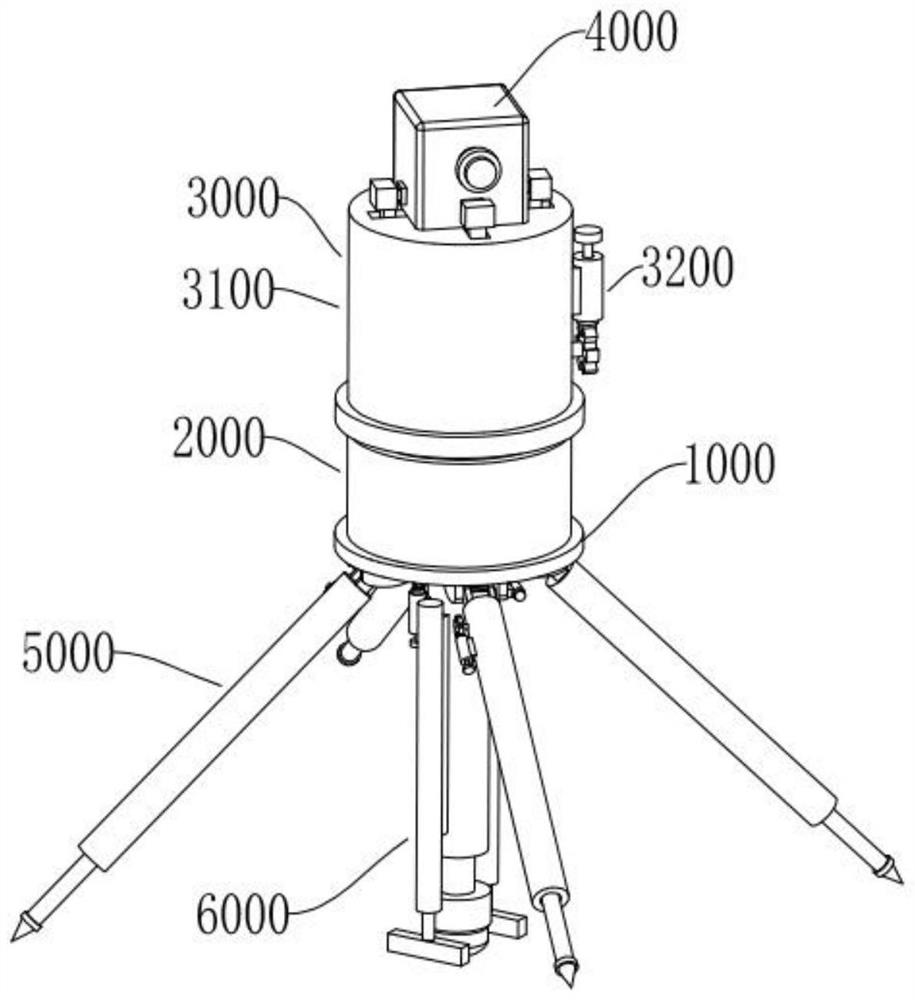
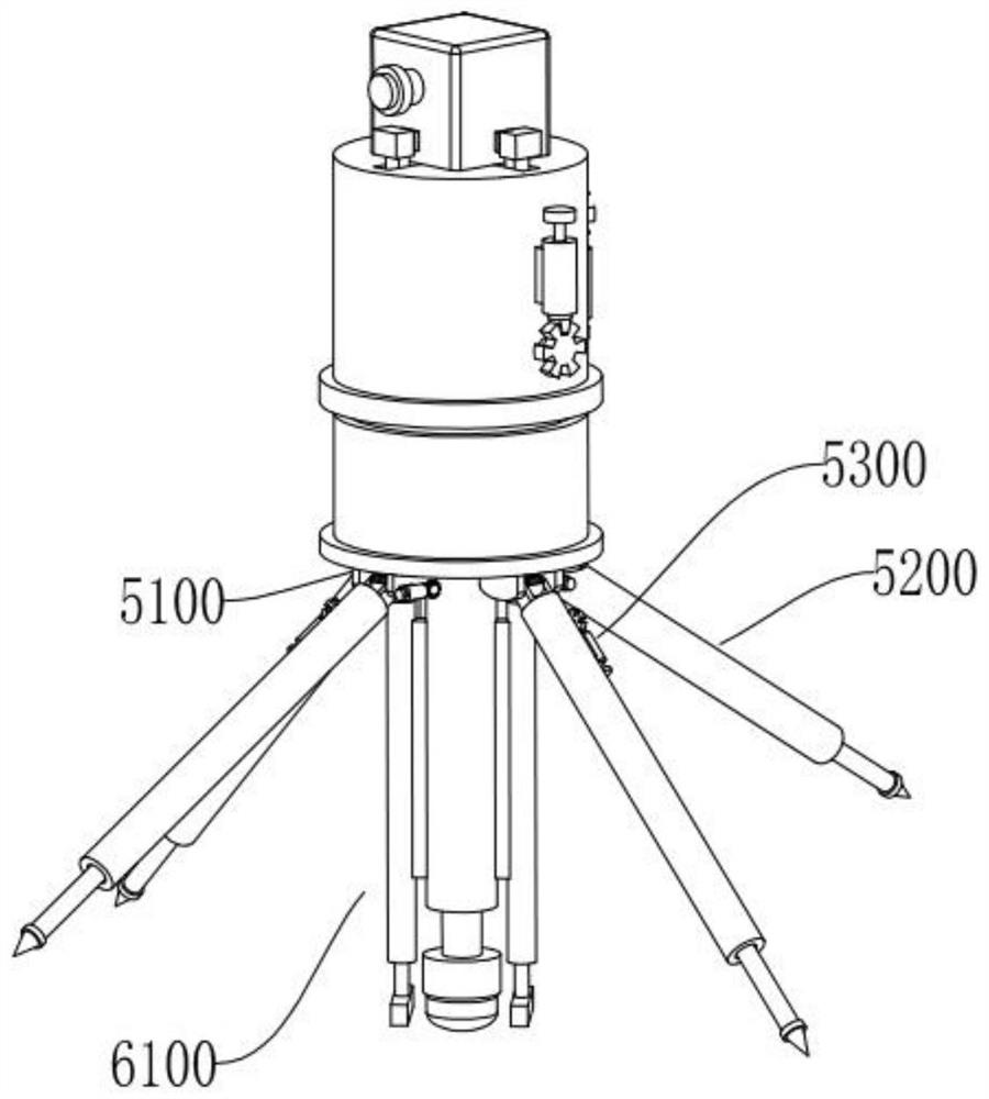
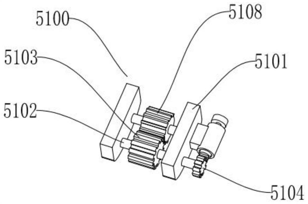
[0038] refer to figure 1 , figure 2 , Figure 9 , Figure 10 with Figure 11 , the mountain terrain surveying and mapping device for data information collection based on electrovariable fluid proposed by the present invention, including a substrate 1000, a rotating assembly 2000, a clamping mechanism 3000, a surveying and mapping device 4000, an auxiliary support mechanism 5000, and an electrovariable fluid bonding and stabilizing mechanism ...


PUM


Abstract

The invention discloses an electrochromic fluid-based mountain topography surveying and mapping device for data information collection, which comprises a base plate, a rotating assembly, a clamping mechanism, surveying and mapping equipment, an auxiliary supporting mechanism and an electrochromic fluid fitting and stabilizing mechanism, and is characterized in that the rotating assembly is arranged on the top wall of the base plate; the rotating assembly is arranged on the base plate, the clamping mechanism is arranged on the rotating assembly and above the rotating assembly, the surveying and mapping equipment is arranged on the clamping mechanism, the auxiliary supporting mechanism is arranged on the bottom wall of the base plate, and the electrochromic fluid attaching and stabilizing mechanism is arranged on the bottom wall of the base plate. The invention belongs to the technical field of mountain topography surveying and mapping, and particularly relates to a mountain topography surveying and mapping device for data information collection based on electrochromic fluid. The mountain topography surveying and mapping device is anti-blowing down, stable to place, good in fixing effect and convenient to level and adjust.

Description

technical field [0001] The invention belongs to the technical field of mountain terrain surveying and mapping, and specifically refers to a mountain terrain surveying and mapping device for data information collection based on electrovariable fluid. Background technique [0002] When collecting data information, especially when collecting data information on mountainous terrain, surveying and mapping devices are needed to complete the work of data information collection. The surveying and mapping device is adjusted, and the clamping structure of the existing surveying and mapping device is difficult to effectively fix the surveying and mapping equipment, which may easily cause the surveying and mapping equipment to be damaged due to falling, resulting in economic losses. Because the mountainous terrain is often uneven, it is not easy to use The operator places the surveying and mapping device on the ground stably and it is inconvenient to adjust the surveying and mapping dev...

Claims


Application Information

Patent Timeline
Patent Type & Authority Applications(China)
IPC IPC(8): G01C15/00
CPCG01C15/00
Inventor 余清华
Owner 峡江县慧泓信息技术有限公司
Why Eureka
Try Eureka