Clear sky surface net long wave radiation integrated inversion method and system
A long-wave radiation and surface technology, applied in design optimization/simulation, geographic information database, structured data retrieval, etc., can solve problems such as incoming and large errors, and achieve the effect of improving inversion accuracy
- Summary
- Abstract
- Description
- Claims
- Application Information
AI Technical Summary
Problems solved by technology
Method used
Image
Examples
Embodiment 1
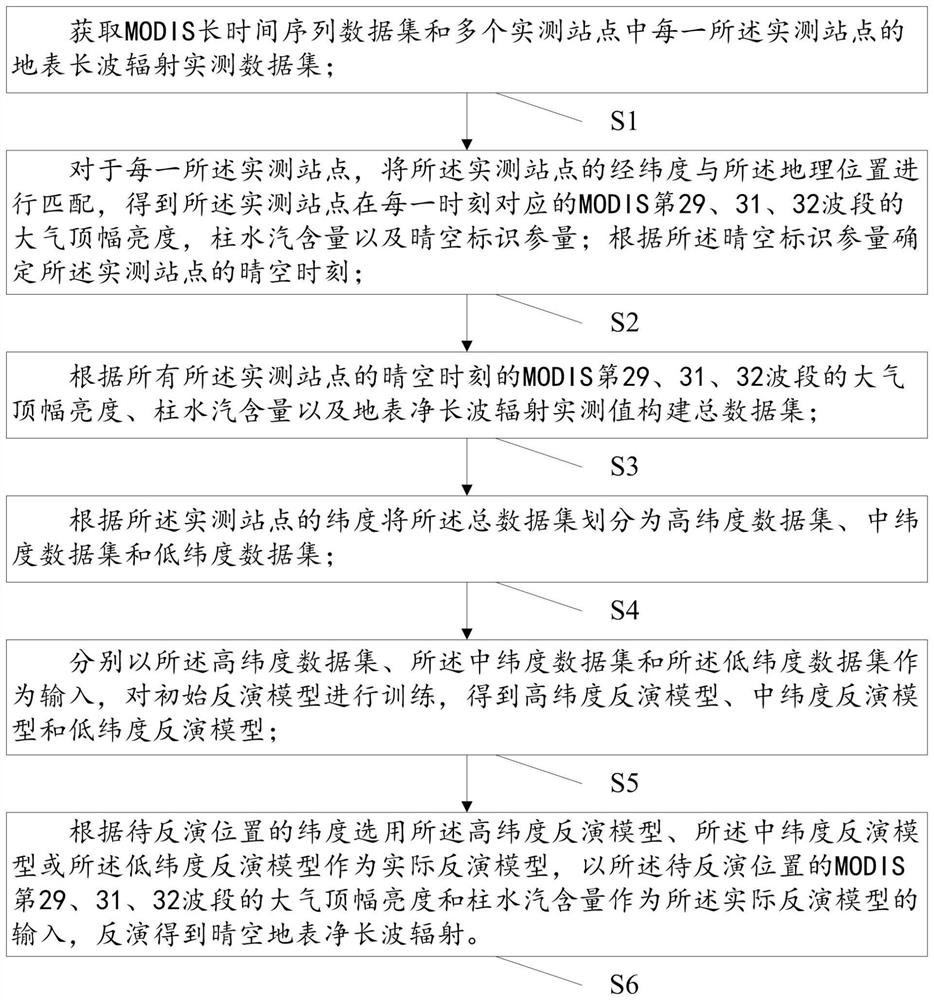
[0030] The clear-sky surface net long-wave radiation is calculated using a component algorithm. The component algorithm refers to inverting the surface down-going long-wave radiation and the ground-surface up-going long-wave radiation respectively, and then subtracting the ground-surface up-going long-wave radiation from the ground down-going long-wave radiation to obtain the clear-sky surface net long-wave radiation. At present, there are mainly three methods to invert and calculate the surface upgoing and downgoing long-wave radiation: (1) ground station measurement, although this method is currently considered to be the most accurate method to obtain the surface downgoing long-wave radiation and the surface upgoing long-wave radiation, but the ground observation The number of stations is extremely limited, not all stations have these two variables, and the ground observation stations are not evenly distributed around the world; (2) satellite inversion method, which is current...
Embodiment 2
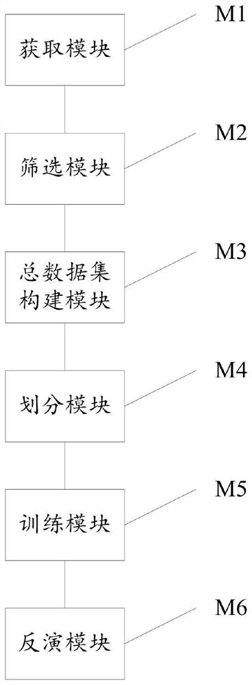
[0087] This embodiment is used to provide an integrated inversion system for clear-sky surface net long-wave radiation, such as figure 2 As shown, the integrated inversion system includes:
[0088] The obtaining module M1 is used to obtain the MODIS long-time series data set and the surface long-wave radiation measured data set of each of the measured sites in a plurality of measured sites; the MODIS long-time series data set includes MODIS data at multiple moments; The measured surface long-wave radiation data set includes measured values of surface net long-wave radiation at multiple times; the MODIS data and the measured value of surface net long-wave radiation have a one-to-one correspondence; the MODIS data includes multiple geographic locations and each Atmospheric top brightness, column water vapor content and clear sky identification parameters of MODIS bands 29, 31, and 32 corresponding to the above geographic locations;
[0089] The screening module M2 is used to...
PUM
 Abstract
Description
Claims
Application Information
 - R&D
- Intellectual Property
- Life Sciences
- Materials
- Tech Scout
- Unparalleled Data Quality
- Higher Quality Content
- 60% Fewer Hallucinations
Browse by: Latest US Patents, China's latest patents, Technical Efficacy Thesaurus, Application Domain, Technology Topic, Popular Technical Reports.
© 2025 PatSnap. All rights reserved.Legal|Privacy policy|Modern Slavery Act Transparency Statement|Sitemap|About US| Contact US: help@patsnap.com


