

Method for inverting atmospheric water vapor content from MODIS (Moderate Resolution Imaging Spectroradiometer) data
A technology of atmospheric water vapor content and data inversion, which is applied in the direction of measuring devices, material analysis through optical means, instruments, etc., can solve the problems of complex inversion methods and difficulty in satisfying the personal development and use of scientific researchers, and achieve reduction of calculation time, Strong practicability and the effect of reducing unknowns
- Summary
- Abstract
- Description
- Claims
- Application Information
AI Technical Summary
Problems solved by technology
Method used
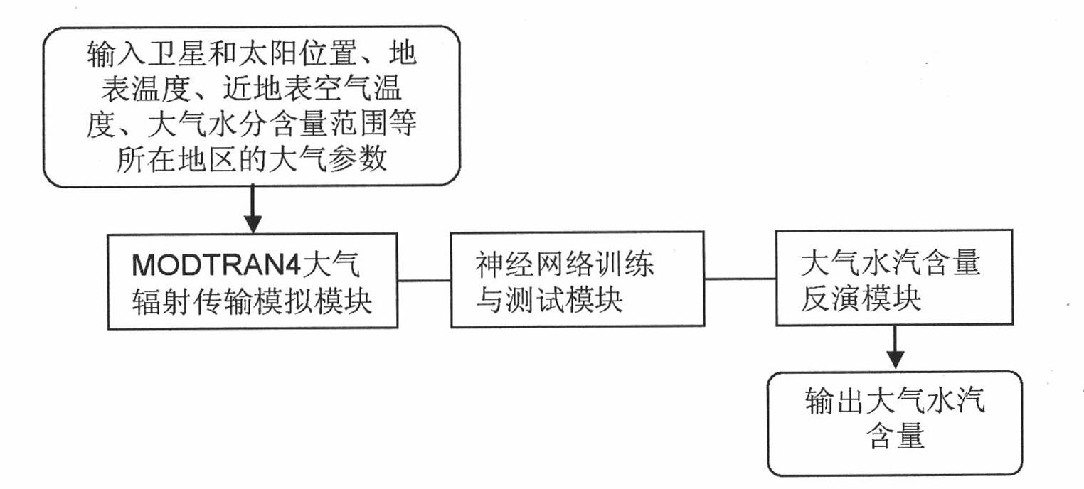
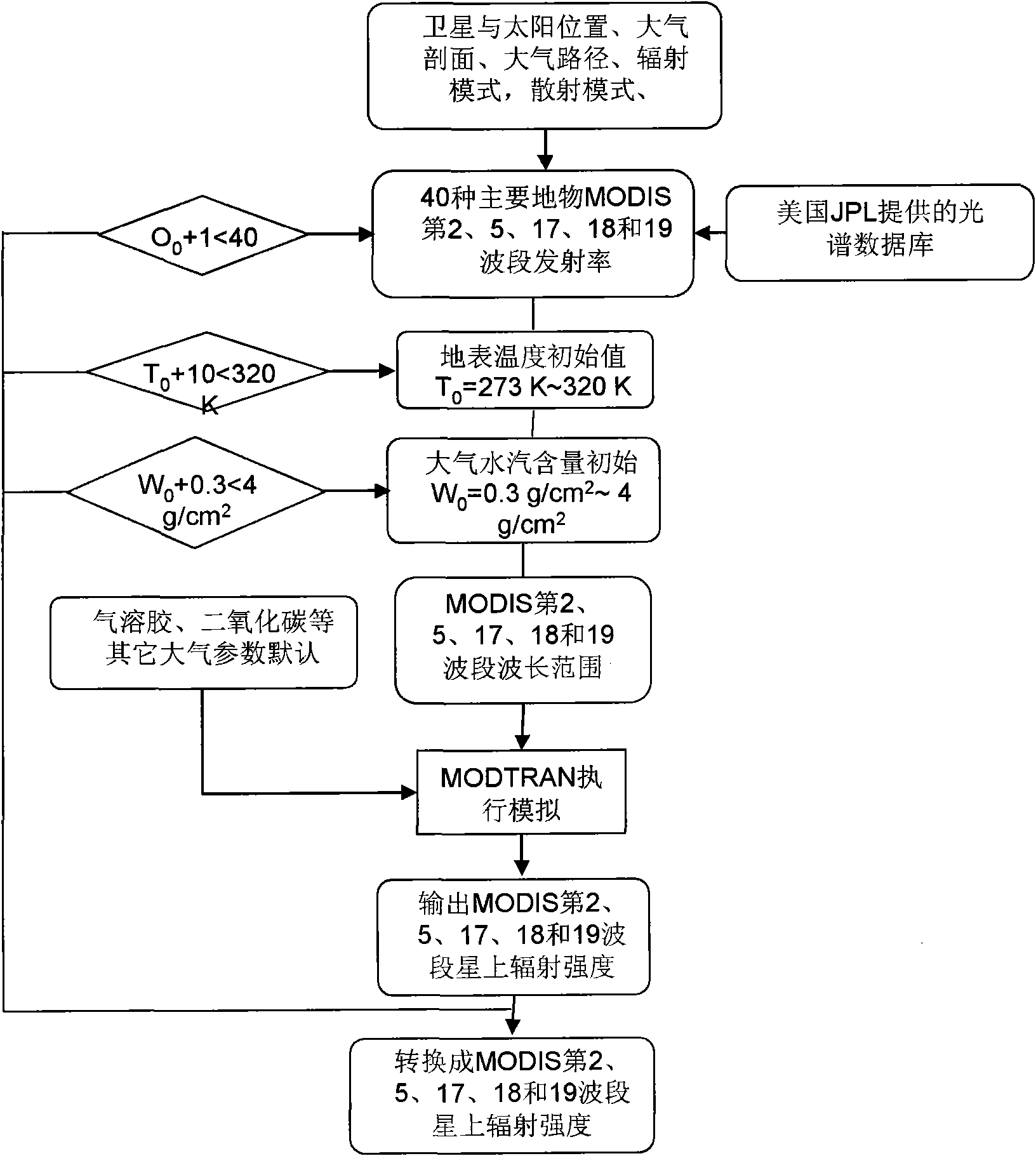
Image

Examples
Embodiment Construction
[0042] The inversion algorithm derivation of atmospheric water vapor content is based on the intensity of solar radiation reflected from the surface received by the sensor. The radiation intensity of the sun is weakened by the atmosphere when it reaches the sensor through the atmosphere. Atmospheric transmittance is a physical quantity used to describe the degree to which solar radiation intensity is weakened. Atmospheric transmittance varies with wavelength and observation angle, usually after simplification, the radiative transfer equation can be described as Equation 1 [Gao B. and Kaufman Y.J., The MODIS Near-IR water vapor algorithm: product ID: MOD05- total pregnant water, algorithm technical background document, Remote Sensing Division, Code 7212, Naval Research Laboratory, 4555 Overlook Avenue, SW, Washington, DC 20375 (1998).]:
[0043] L sensor (λ)=L sun (λ)τ(λ)ρ(λ)+L path (λ) (Equation 1)
[0044] where λ represents the wavelength, L sensor (λ) represents the r...
PUM
 Abstract
Description
Claims
Application Information