Eureka AIR delivers breakthrough ideas for toughest innovation challenges, trusted by R&D personnel around the world.

GIS (Geographic Information System)-based emergency hierarchical pushing method and system and storage medium

A technology for emergencies and emergencies, applied in the field of GIS and emergency event processing, it can solve the problems of inefficiency of technology promotion by grading plans, and achieve the effect of reducing system resource consumption and improving accuracy and timeliness.

Active Publication Date: 2022-06-28
广东孺子牛地理信息科技有限公司
View PDF6 Cites 0 Cited by
  • Summary
  • Abstract
  • Description
  • Claims
  • Application Information

AI Technical Summary

Problems solved by technology

[0004] In response to emergency events such as geographical disasters, in order to deal with emergencies and uncertain situations as much as possible, it is necessary to carry out hierarchical promotion of emergency plans / emergency events, but there are low-efficiency technical problems in the related planning promotion technology

Method used


Image

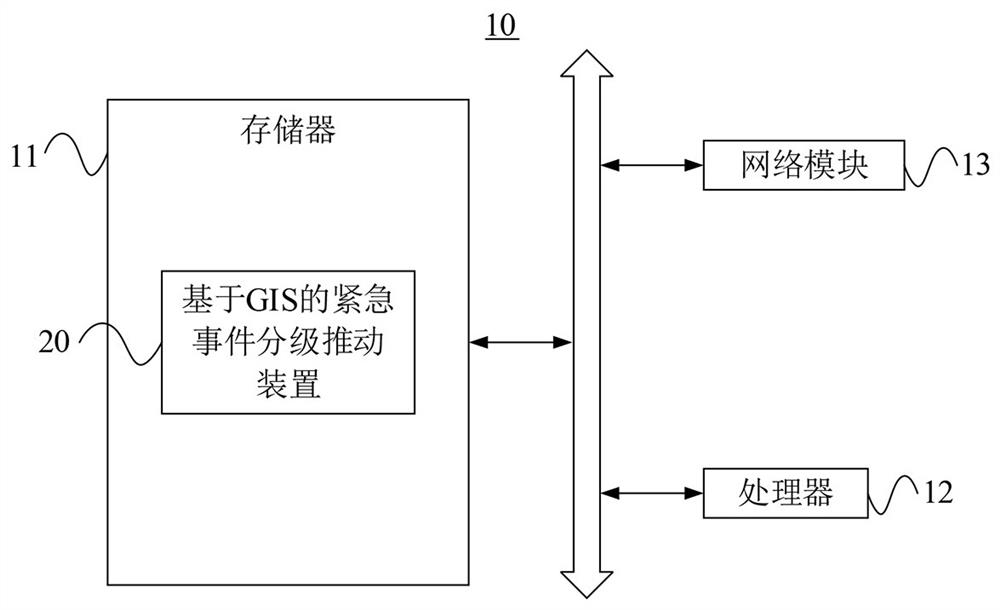
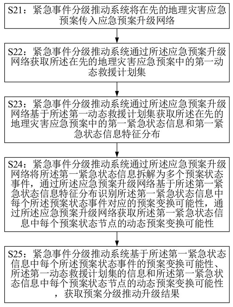
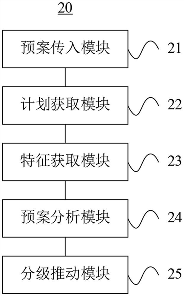
  • GIS (Geographic Information System)-based emergency hierarchical pushing method and system and storage medium
  • GIS (Geographic Information System)-based emergency hierarchical pushing method and system and storage medium
  • GIS (Geographic Information System)-based emergency hierarchical pushing method and system and storage medium

Examples


Embodiment Construction

[0055] In order to make the purposes, technical solutions and advantages of the embodiments of the present application clearer, the technical solutions in the embodiments of the present application will be described clearly and completely below with reference to the drawings in the embodiments of the present application. Obviously, the described embodiments It is only a part of the embodiments of the present application, but not all of the embodiments. The components of the embodiments of the present application generally described and illustrated in the drawings herein may be arranged and designed in a variety of different configurations.

[0056] Thus, the following detailed description of the embodiments of the application provided in the accompanying drawings is not intended to limit the scope of the application as claimed, but is merely representative of selected embodiments of the application. Based on the embodiments in the present application, all other embodiments obt...


PUM


Abstract

The invention relates to the technical field of GIS and geographic disasters, in particular to a GIS-based emergency event grading promotion method and system and a storage medium, which can obtain a plan grading promotion upgrading result by combining a coarse screening result of a dynamic rescue plan in first emergency state information and a dynamic plan transformation possibility of each plan state node. Therefore, it can be understood that compared with a related technology that the first emergency state information feature distribution is subjected to plan grading promotion upgrading through an emergency grading promotion decision tree, the accuracy and timeliness of plan grading promotion upgrading are improved, and system resource consumption of emergency grading promotion is effectively reduced.

Description

technical field [0001] The embodiments of the present application relate to the technical field of GIS and emergency event processing, and specifically relate to a GIS-based emergency event classification promotion method, system, and storage medium. Background technique [0002] Geographic Information System (GIS) is a specific and very important spatial information system. It is a technical system that collects, stores, manages, calculates, analyzes, displays and describes the relevant geographical distribution data in the whole or part of the earth's surface (including the atmosphere) space with the support of computer hardware and software systems. [0003] GIS is a category of information systems, the difference is that it can operate and process geo-referenced data. At present, GIS has been widely used in the field of geological disaster analysis and emergency event processing, which can minimize the personal and property losses caused by geological disasters to peopl...

Claims


Application Information

Patent Timeline
Patent Type & Authority Applications(China)
IPC IPC(8): G06Q10/06G06Q50/26G06F16/2458G06F16/29G06K9/62
CPCG06Q10/0639G06Q50/26G06F16/2465G06F16/29G06F18/23
Inventor 冯美柱余岚邓泳珊蒋磊
Owner 广东孺子牛地理信息科技有限公司
Why Eureka
Eureka Blog
Learn More