
Terrain surveying device for territorial space planning

A technology of space planning and terrain measurement, applied in the field of measurement, can solve problems such as stagnation of measurement work, reduction of measurement efficiency, and antenna loosening and falling off, so as to avoid unnecessary losses, simple and convenient limit work, and improve connection stability Effect

Inactive Publication Date: 2022-08-05
韩亮
View PDF0 Cites 0 Cited by
  • Summary
  • Abstract
  • Description
  • Claims
  • Application Information

AI Technical Summary

Problems solved by technology

[0003] However, as far as the current traditional measurement devices are concerned, the nose of the device and the antenna are mostly detachable. When running in the field for a long time (especially in mountainous jungle terrain), the antenna is vulnerable to large-scale running movements of the measurer. And all kinds of climbing actions loosen and fall off from the nose. It is difficult for the measurer to find the falling off phenomenon when running. It will not be discovered until the next target point is hit and measured. The distance is large, and the weeds in the mountains and jungles are overgrown, and the antenna is not easy to find. This not only brings economic losses to the surveyors, but also causes the measurement work to be stopped forcibly due to the loss of the antenna. The head cannot work, which reduces the measurement efficiency. The device cannot guarantee the antenna and the connection reliability of the machine head

Method used


Image

  • Terrain surveying device for territorial space planning
  • Terrain surveying device for territorial space planning
  • Terrain surveying device for territorial space planning

Examples


Embodiment

[0046] Example: please refer to Figure 1 to Figure 8 :

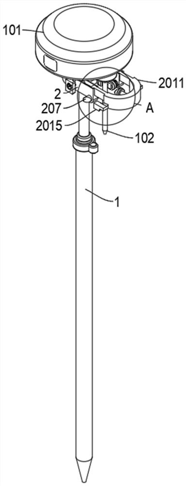
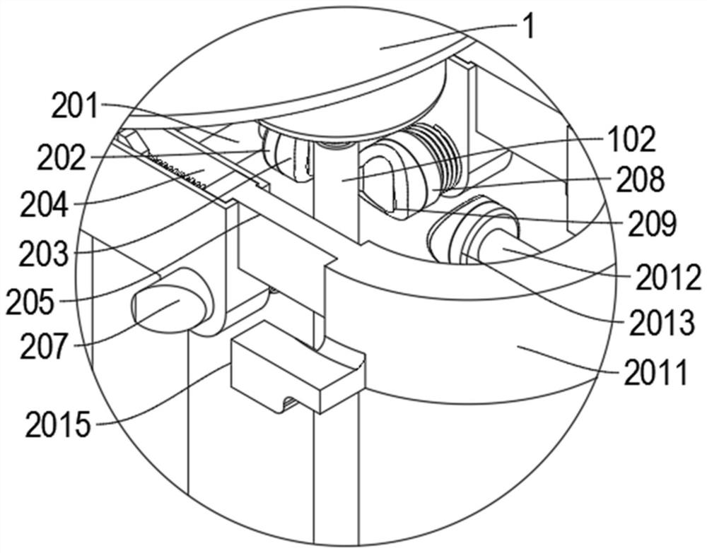
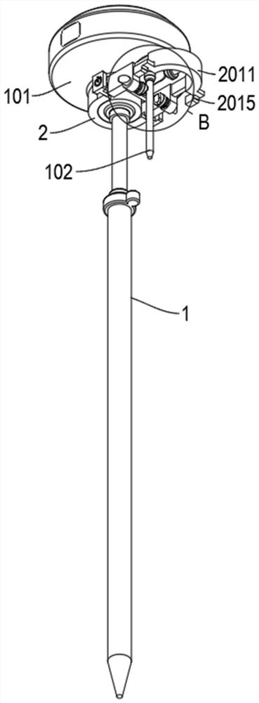
[0047] The present invention proposes a topographic measuring device for land and space planning, comprising: a measuring rod 1, a measuring head 101 is arranged on the top of the measuring rod 1; a measuring antenna 102 is arranged on the right side of the bottom of the measuring head 101; Limiting member 2; the interior of the limiting member 2 is provided with a limiting plate 201, and the limiting plate 201 is a rectangular structure; a limiting head A202 is provided on the right side of the limiting plate 201; a limiting pad is provided on the right side of the limiting head A202 A203, and the limit pad A203 is made of silicone material; the top of the measuring rod 1 is provided with a travel groove 204; the interior of the travel groove 204 is slidably installed with a sliding block 205;

[0048] The measuring staff vertically measures the rod 1, so that the bubbles on the measuring rod 1 are centered, and then ...


PUM


Abstract

The invention provides a topographic survey device for territorial space planning, and relates to the technical field of survey, comprising: a survey rod, the top of which is provided with a survey head; a measuring antenna is arranged on the right side of the bottom of the measuring machine head; a limiting plate is arranged in the limiting piece; a limiting head A is arranged on the right side of the limiting plate; a limiting pad A is arranged on the right side of the limiting head A; a stroke groove is formed in the top of the measuring rod; a sliding block is installed in the stroke groove in a sliding mode. The measuring antenna is limited left and right through cooperation of the limiting pad C and the limiting pad A, the connection stability between the measuring antenna and the measuring machine head is improved, the measuring antenna is prevented from loosening and disengaging from the measuring machine head when topographic survey is carried out in the field, and the problems that the machine head and the antenna of the device are mostly detachable, and the antenna cannot be detached easily are solved. And the antenna is easy to loosen and fall off from the machine head due to large-amplitude running actions and various climbing actions of a measurer, so that the antenna is lost.

Description

technical field [0001] The invention relates to the technical field of measurement, in particular to a topographic measurement device for national land space planning. Background technique [0002] National spatial planning is a guide for national spatial development, a spatial blueprint for sustainable development, and the basic basis for various development, protection and construction activities. National spatial planning requires professional surveyors to use various professional surveying instruments to measure the terrain. , and real-time kinematic GPS (RTK) belongs to a category of topographic measurement devices. [0003] However, as far as the current traditional measurement devices are concerned, the nose of the device and the antenna are mostly detachable. When running for a long time in the field (especially mountain and jungle terrain), the antenna is vulnerable to the large running action of the surveyor. And all kinds of climbing movements come loose from the...

Claims


Application Information

Patent Timeline
Patent Type & Authority Applications(China)
IPC IPC(8): G01C15/00
CPCG01C15/00
Inventor 翟磊韩亮张振华
Owner 韩亮
Learn More