Information collecting, recording and displaying method for land survey

A technology of information collection and display methods, applied in data collection and recording, special data processing applications, instruments, etc., can solve problems such as errors, inconvenience in field operations, and inability to display clearly on the display screen.

Inactive Publication Date: 2005-05-11
SOUTHEAST UNIV
View PDF0 Cites 14 Cited by
  • Summary
  • Abstract
  • Description
  • Claims
  • Application Information

AI Technical Summary

Problems solved by technology

[0007] ① The information obtained from the on-site investigation needs to be manually plotted on the paper map, which is not convenient for field work, but also increases the process of indoor information processing, which is easy to cause human errors
[0008] ②Current notebook computers (including tablet computers) are not suitable for outdoor use (the volume and weight are large, and the display screen cannot clearly display the content to be viewed in the sun)
[0009] ③ The current land use map stored in the form of a database needs to be printed out in order to get it on site, which increases the cost

Method used


Image

  • Information collecting, recording and displaying method for land survey
  • Information collecting, recording and displaying method for land survey
  • Information collecting, recording and displaying method for land survey

Examples


Embodiment Construction

[0069] The information collection, recording and display methods in the land survey of the present invention are:

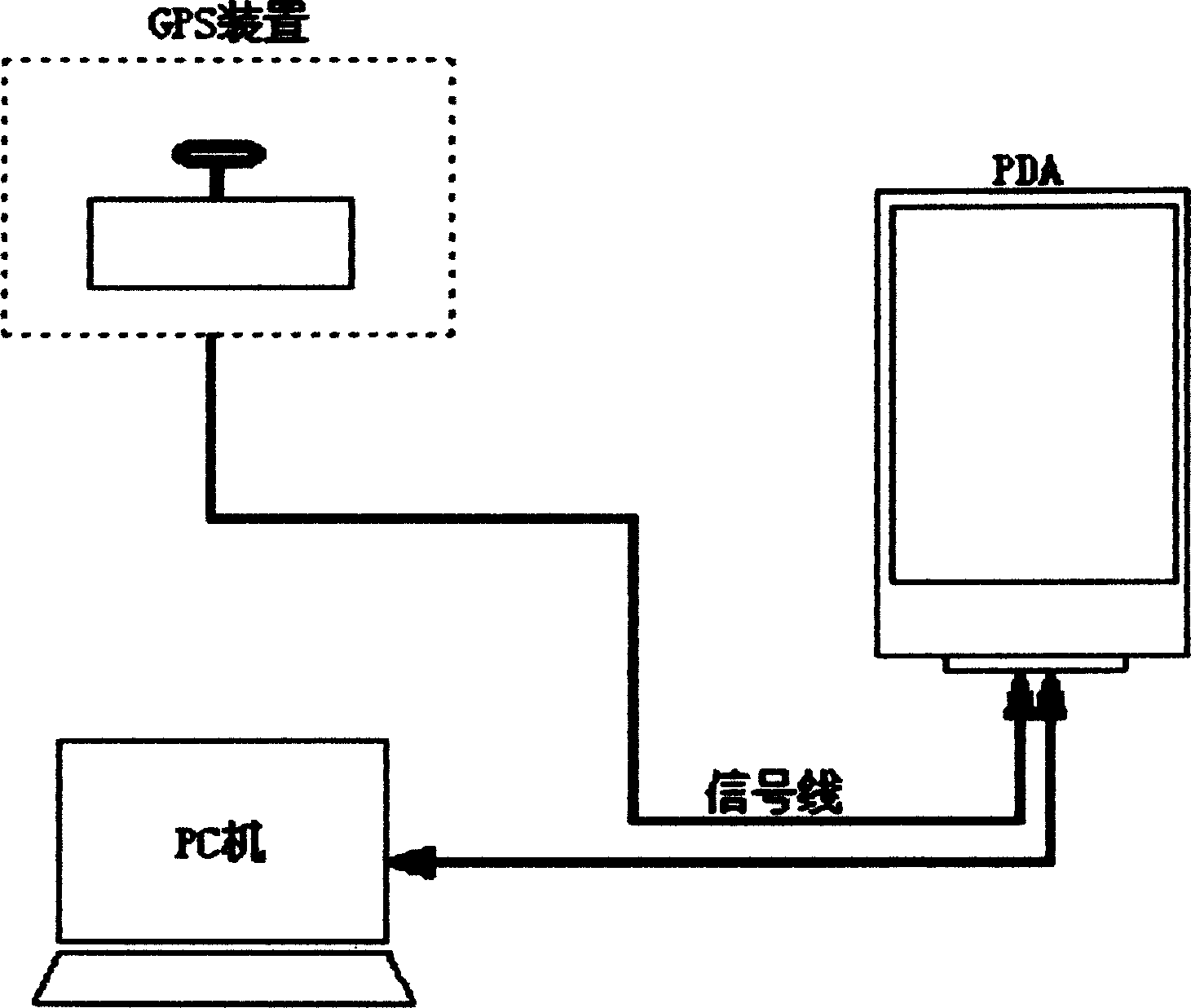
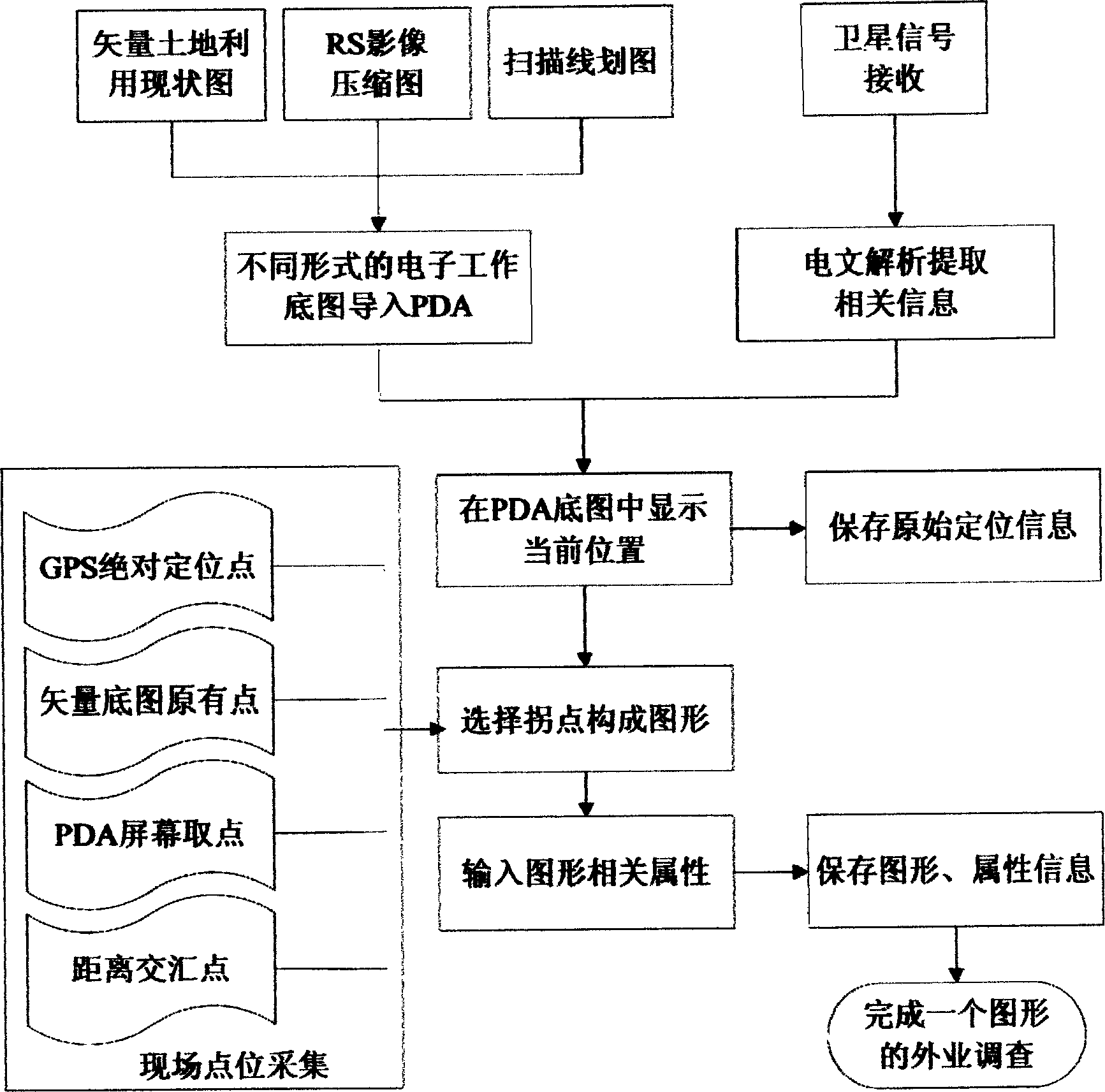
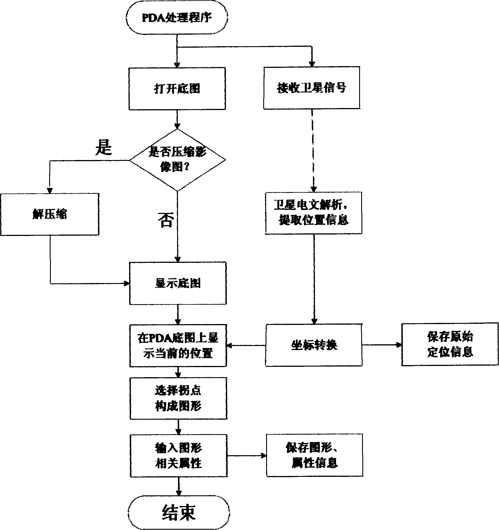
[0070] a. Import the working base map into the PDA: import the vector status map, RS compressed image map, and scan line drawing into the PDA through the software that comes with the PDA.

[0071] b. Use the GPS receiving device to receive satellite data, and analyze and extract relevant information in the PDA through the PDA processing program,

[0072] c. After coordinate conversion and matching with the working base map, the current position is displayed in the PDA base map, and the original positioning information is saved at the same time.

[0073] d. Select the inflection point from the information collected at the site point and the information showing the current position in the PDA base map to form a survey graph,

[0074] e. Input the land survey attribute of the graph, save the graph and attribute information,

[0075] Completed a graphic field surve...


PUM


Abstract

A method of information collection, record and display in land investigation (LI) includes using land current situation vector drawing, compressed remote sensing image and line map as mother map led into PDA; receiving satellite data by GPS device and analysing the picked up information; displaying it on PDA screen after coordinate conversion and mother map matching; forming investigation map by GPS positioning point, existed point in mother map, screen taken point and distance cross point and logging in LI attribute of the map.

Description

technical field [0001] The invention relates to a method for collecting, recording and displaying relevant information in land surveys by using portable equipment, and belongs to the technical field of land management electronic information and corresponding processing methods. Background technique [0002] There are two ways to express the status quo of land use in the land industry: [0003] ①Paper map of land use status; [0004] ② Stored in the computer (personal computer, desktop computer, notebook computer) in the form of database, and displayed on the display screen of the computer in the form of vector. [0005] When carrying out on-site land survey, the above-mentioned computer cannot be moved or is inconvenient to use in the field. And present method all is to take paper map (whether it is the paper map drawn by hand, or the paper map that computer database generates and outputs printing) to the field for on-the-spot investigation. [...

Claims


Application Information

Patent Timeline
Patent Type & Authority Applications(China)
IPC IPC(8): G06F17/00G06F17/40
Inventor 王庆裴凌王慧青
Owner SOUTHEAST UNIV
Why Eureka
Try Eureka