Method and device for image processing in a geodetic measuring device

A technology of geodetic surveying and instruments, applied in the direction of measuring devices, measuring instruments, instruments, etc., can solve the problems of increasing technology and time consumption

Active Publication Date: 2006-04-19
LEICA GEOSYSTEMS AG
View PDF5 Cites 28 Cited by
  • Summary
  • Abstract
  • Description
  • Claims
  • Application Information

AI Technical Summary

Problems solved by technology

Moreover, the automated target search and orientation process requires increased skill and time consumption

Method used


Image

  • Method and device for image processing in a geodetic measuring device
  • Method and device for image processing in a geodetic measuring device
  • Method and device for image processing in a geodetic measuring device

Examples


Embodiment Construction

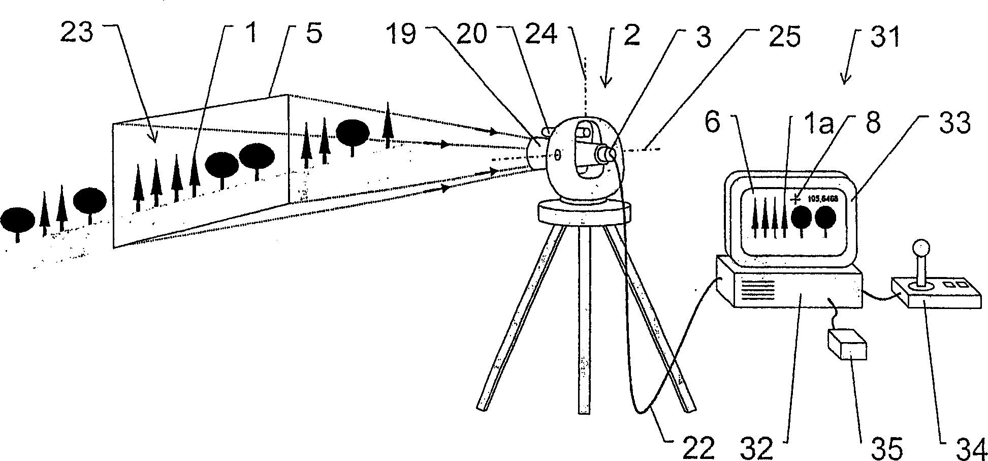
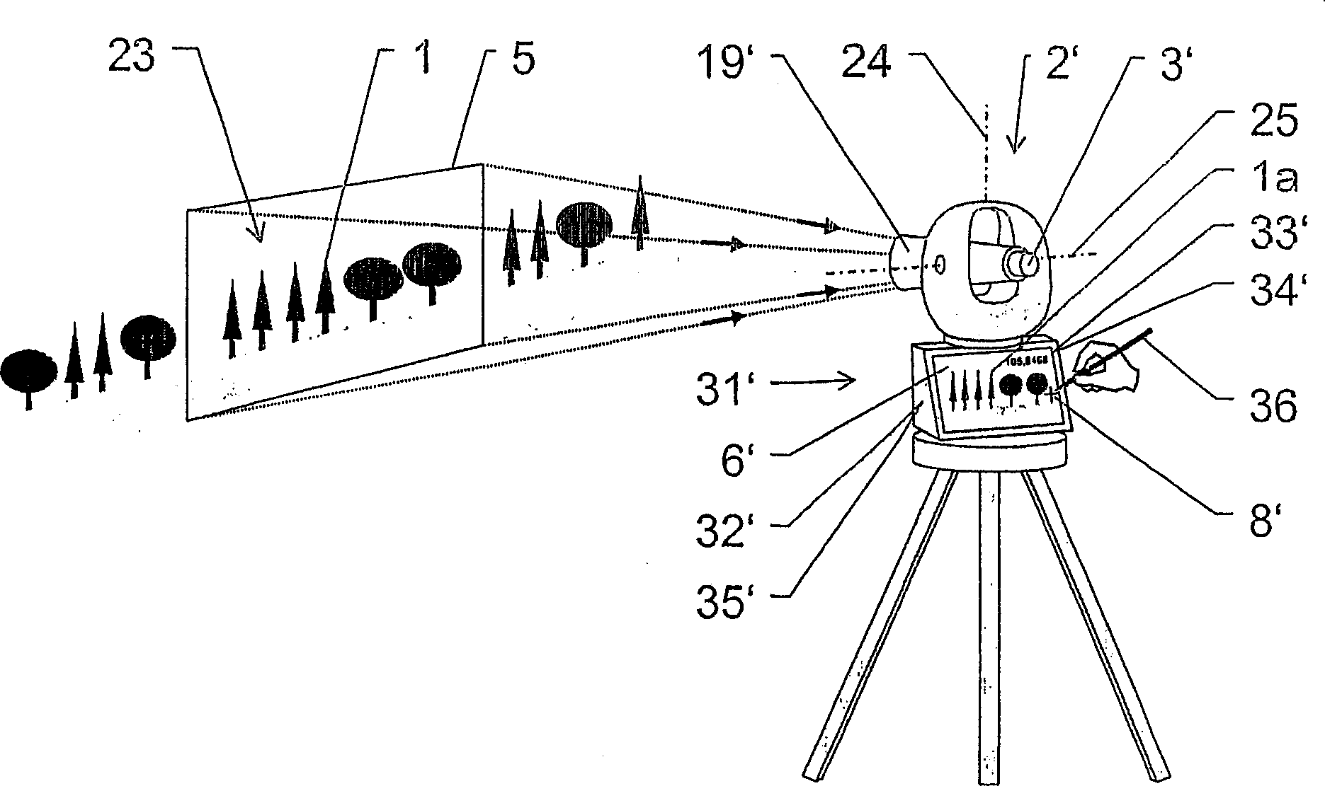
[0039] figure 1 Shown is a diagram of a geodetic instrument 2 having an electronic recording device 3 for capturing recorded images of at least one object 1 to be geodetic; and an electronic display and control device 31 . The geodetic instrument 2 has an optical unit 19 , rotatable about a longitudinal axis 24 and rotatable about a transverse axis 25 , which has a recording device 3 , which here is formed as a CCD or CMOS camera arranged instead of an eyepiece. The geodetic instrument 2 also has an external distance measuring device 20 for distance measurement without a reflector and / or for focusing the optical unit 19 . Alternatively, the rangefinder 20 may be integrated within the optical unit 19 and / or separate from the orientation of the optical unit 19 with respect to its capture range. In the case of an integrated telemeter, the geodetic instrument 2 is a so-called tachymeter. The recording device 3 captures a scene 23 with at least one object 1 to be geodetic in a ce...


PUM


Abstract

The invention relates to a method for the geodesical measurement of an object (1), using a geodesical measuring appliance (2) comprising recording means (3) for acquiring a recorded image (4) at least of the object (1) to be geodesically measured. Once the angular orientation of a coverage strip (5) of the recording means (3) has been determined, the image (4) is captured and represented at least partially in the form of a display image (6). A set of recorded image co-ordinates (7) are determined by establishing at least one set of associated display image co-ordinates (8), and the set of recorded image co-ordinates (7) is transformed into at least one geodesical measuring variable, especially a solid angle. Templates (10) which are in the form of models that can be placed on the display image and at least partially describe the object (1) are used to support the user during the fixing of the target point. Once the template (10) has been selected and positioned, it is adapted to the recorded object (la) and determines the set of recorded image co-ordinates (7) by means of a characteristic point (11) of the template (10). The invention also relates to an electronic display and control device (31), a geodesical measuring appliance (2), and a computer program product for carrying out the method.

Description

technical field [0001] The invention relates to a method and a device for geodetic surveying of objects by means of image processing using geodetic instruments. Background technique [0002] In order to record properties, in particular spatially related data, of defined points in the measurement environment, many measuring devices are known from the past. As spatial standard data, the position of the measuring instrument, including possibly existing reference points, as well as the direction, distance and angle to the measuring point are recorded here. Improvements in the past often involved the use of new technology methods with increased accuracy and speed. [0003] However, such prior art arrangements still require that the measuring instrument be directed directly to the point to be measured. This is usually done with the aid of special orientation devices such as optical telescopes. A well-known example of such a measuring instrument is the theodolite. For an overvi...

Claims


Application Information

Patent Timeline
Patent Type & Authority Applications(China)
IPC IPC(8): G01C15/00G01C1/04G01C11/02
CPCG01C11/02G01C1/04G01C15/00G01C15/02
Inventor 贝恩德·瓦尔泽
Owner LEICA GEOSYSTEMS AG
Why Eureka
Try Eureka