Method for publishing vector map based on interconnection network

A vector map and Internet technology, applied in the direction of data exchange network, branch offices providing special service devices, data exchange details, etc., can solve the problems of network bandwidth occupation, narrow network bandwidth, and inability to meet timely release requirements, etc., to reduce pressure Effect

Inactive Publication Date: 2007-03-21
TIANZE INFORMATION IND
View PDF1 Cites 15 Cited by
  • Summary
  • Abstract
  • Description
  • Claims
  • Application Information

AI Technical Summary

Problems solved by technology

[0013] Moreover, the spatial geographic data lies in the huge amount of data and the network bandwidth is too narrow, which brings great difficulties to the transmission and release of data. It is manifested in the fact that the network bandwidth is too occupied, the user waits for a long time, the map data cannot be displayed, and it cannot be reached. Release requirements in time

Method used


Image

  • Method for publishing vector map based on interconnection network
  • Method for publishing vector map based on interconnection network

Examples


Embodiment Construction

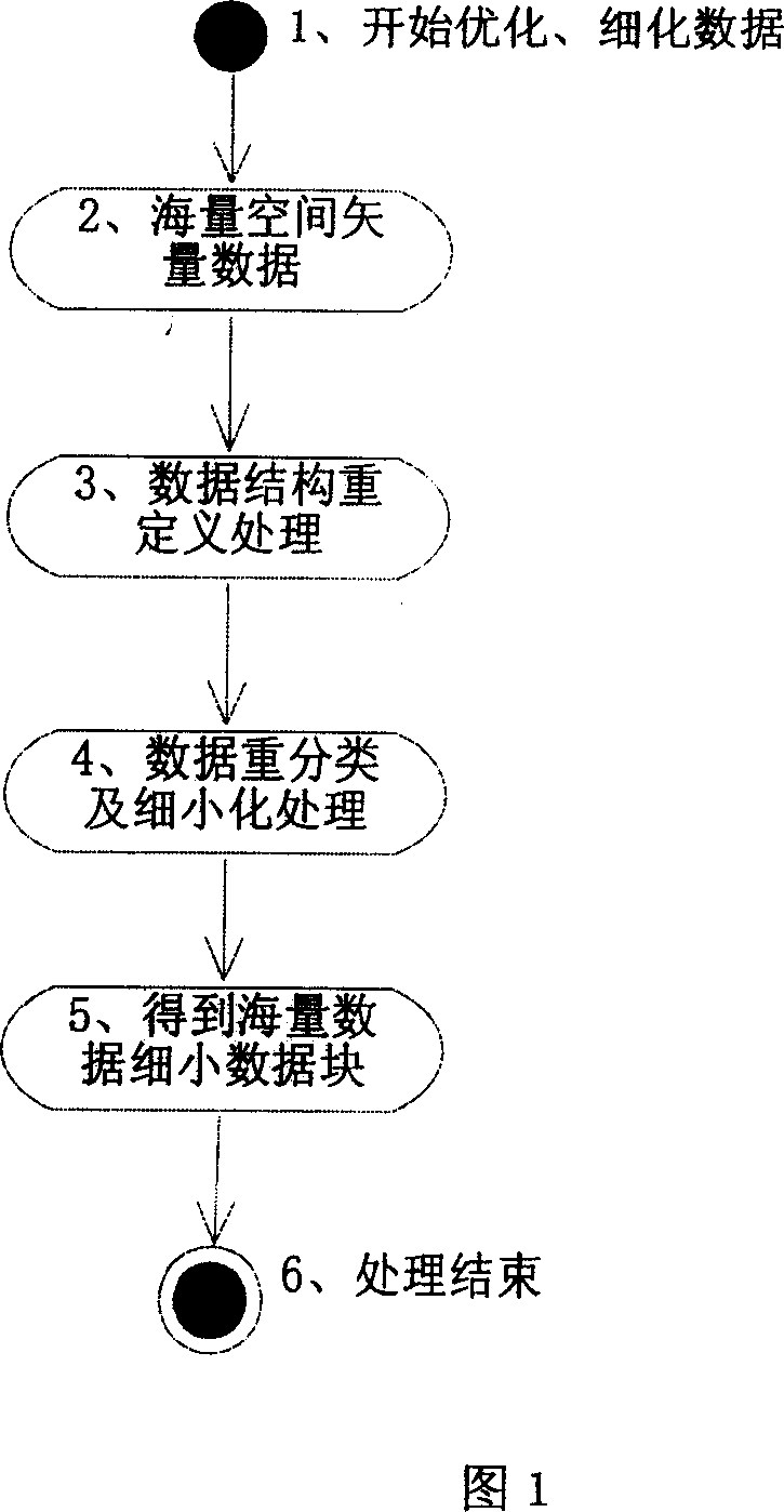
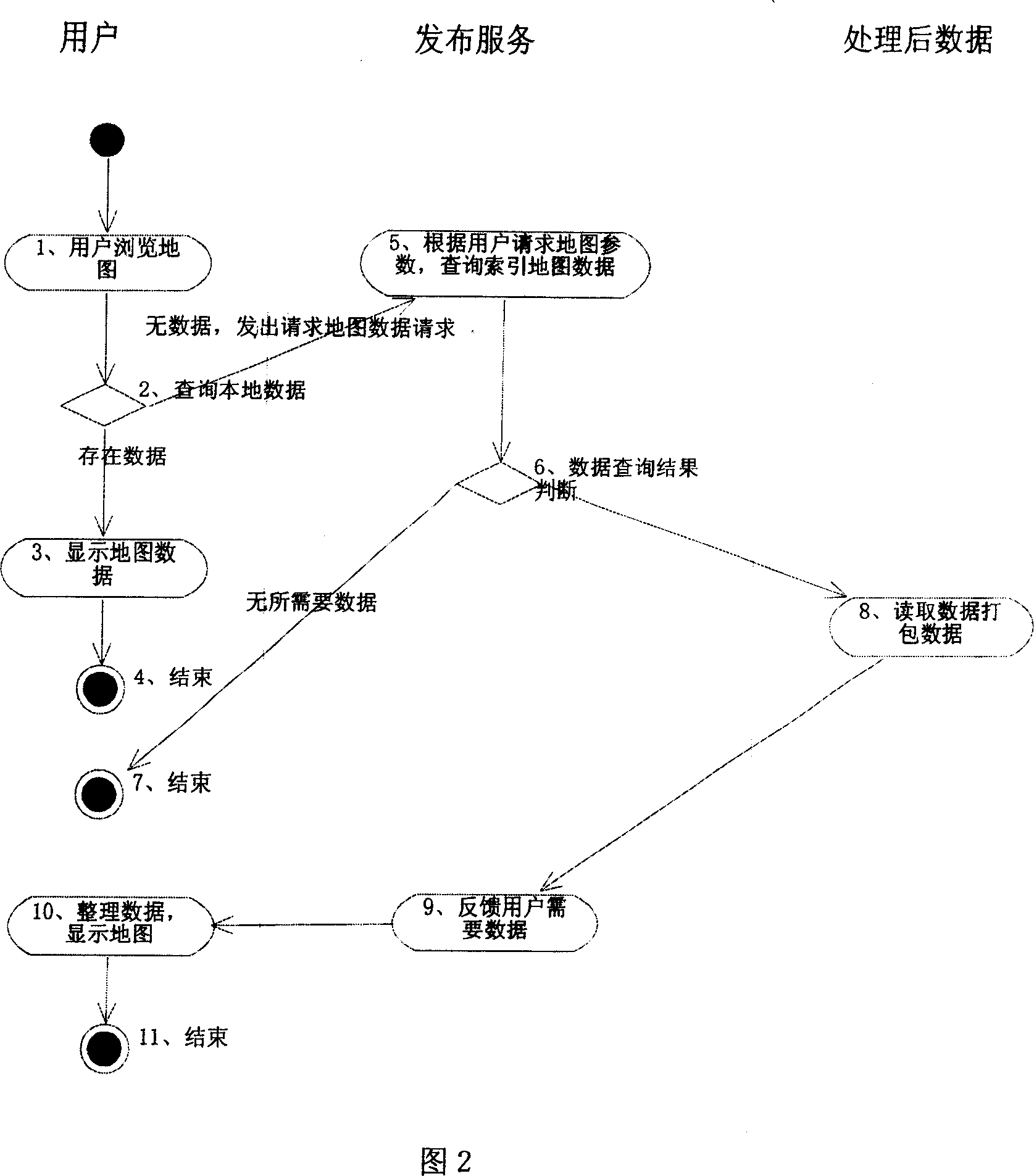
[0025] As shown in Figure 1, as the network release manager, first optimize the data structure of the massive spatial data (the new data structure adds the type of feature, industry of feature, important level of feature, spatial index of feature on the basis of the original data structure) , spatial density around features, etc.), and then the optimized data is processed and stored into many small data blocks according to parameters such as region, industry, and importance (according to the type of map, feature type, and Factors such as the important level of objects, the longitude and latitude of objects, the scale of map enlargement, the detailed procedures of surface objects in a unit area, etc. After detailed calculations, the map is divided into N small maps, so as to ensure that each small map is small enough for fast network transmission. In addition On the one hand, according to the longitude and latitude of the earth, the map zoom ratio, and index storage N small maps...


PUM


Abstract

A method for publishing vector map based on Internet includes redefining data structure of mass vector space data and adding type, profession, important stratification, space index and/or peripheral space density of culture features on mass space data structure; unblocking said data structure according to said relevant parameters then setting up a networked mathematical matrix based on longitude and latitude and calculating geographic data for each space as well as indexing space data to corresponding matrix for being stored.

Description

technical field [0001] The invention belongs to the computer application of distributing spatial geographic data based on the Internet. The invention relates to publishing and displaying massive spatial geographic data in the network, and relates to a complete set of data publishing methods for data structure, classified storage and data display of spatial geographic data. Background technique [0002] The successful release of the spatial geographic data network is of great significance in the release of massive spatial data networks. It can be widely used in the application fields of politics, national defense, commerce, culture, etc. to make information systems graphical, intuitive, and easy to maintain. It plays an important role in improving information and data sharing. However, the release of massive spatial and geographical data based on the Internet is due to large data, slow network transmission speed, and long waiting time for users; i...

Claims


Application Information

Patent Timeline
Patent Type & Authority Applications(China)
IPC IPC(8): H04L12/16H04L12/56
Inventor 陈进薛扬周强翟省
Owner TIANZE INFORMATION IND
Why Eureka
Try Eureka