Spacecraft position monitoring and control

a spacecraft and position technology, applied in the field of spacecraft management, can solve the problems of only updating a satellite, the integration indication would represent a potential increase in error, and the ground control station could only update a satellite, so as to improve the reliability of a predicted state of a spacecraft position, improve the maintenance and accuracy of spacecraft position data, and improve the effect of spacecraft management and control

a spacecraft and position technology, applied in the field of spacecraft management, can solve the problems of only updating a satellite, the integration indication would represent a potential increase in error, and the ground control station could only update a satellite, so as to improve the reliability of a predicted state of a spacecraft position, improve the maintenance and accuracy of spacecraft position data, and improve the effect of spacecraft management and control

US20070085735A1Inactive Publication Date: 2007-04-19LOCKHEED MARTIN CORP

Image

  • Spacecraft position monitoring and control
  • Spacecraft position monitoring and control
  • Spacecraft position monitoring and control

Examples


Embodiment Construction

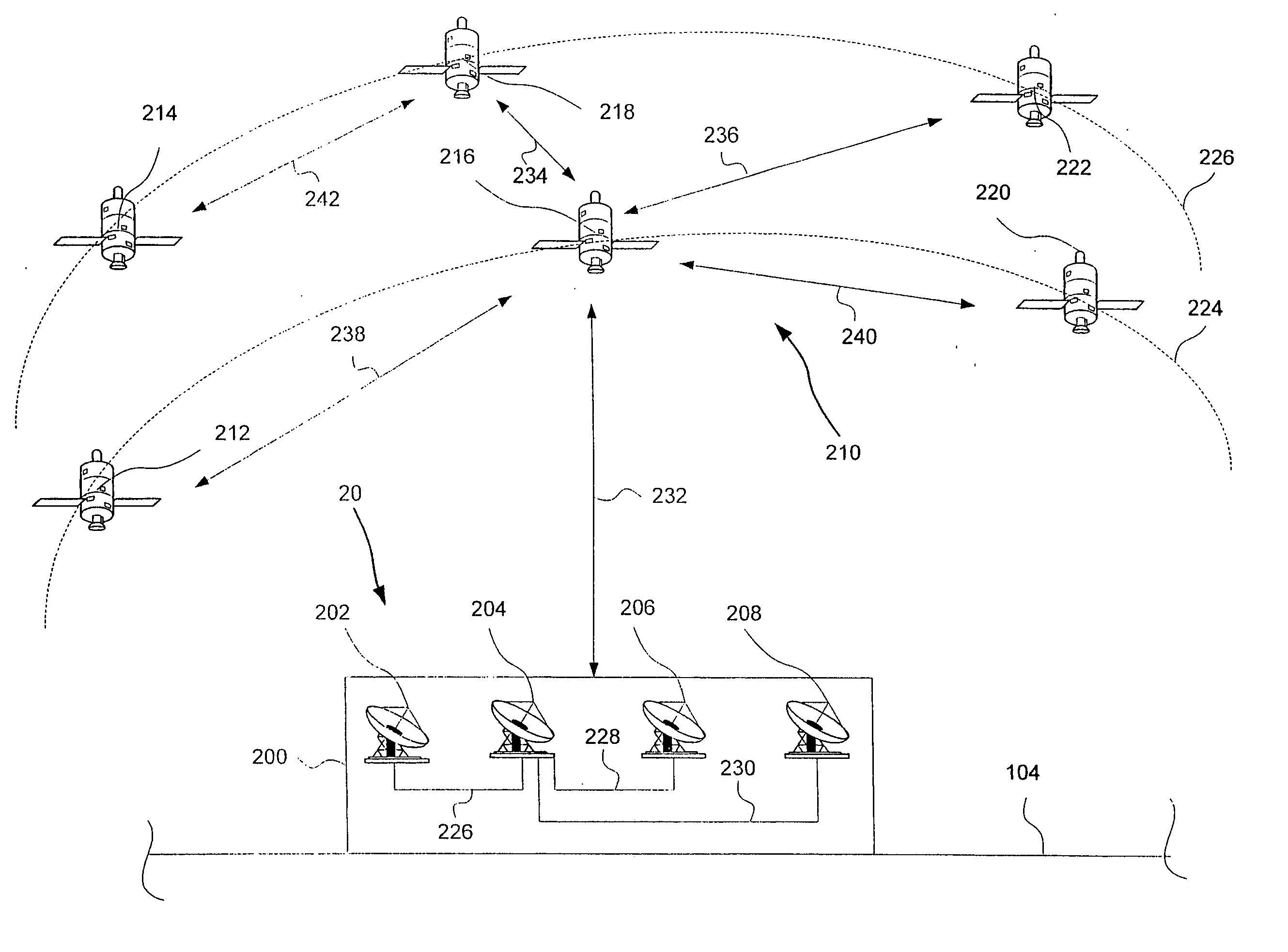
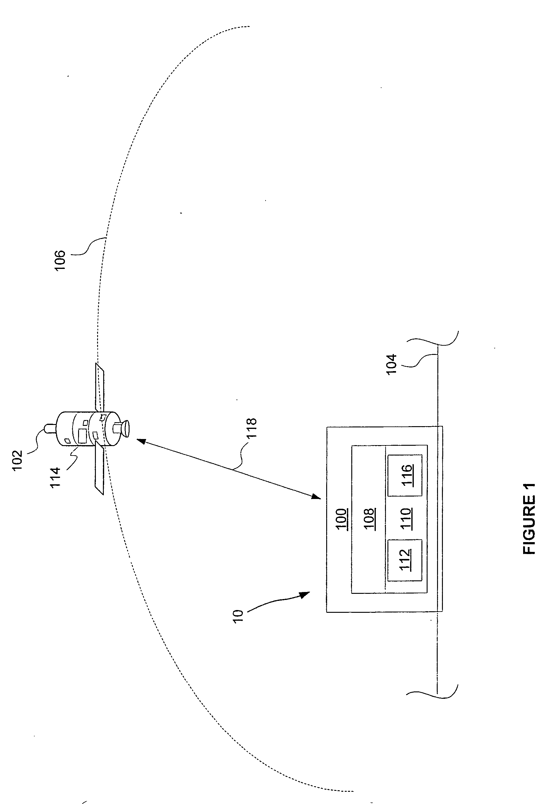
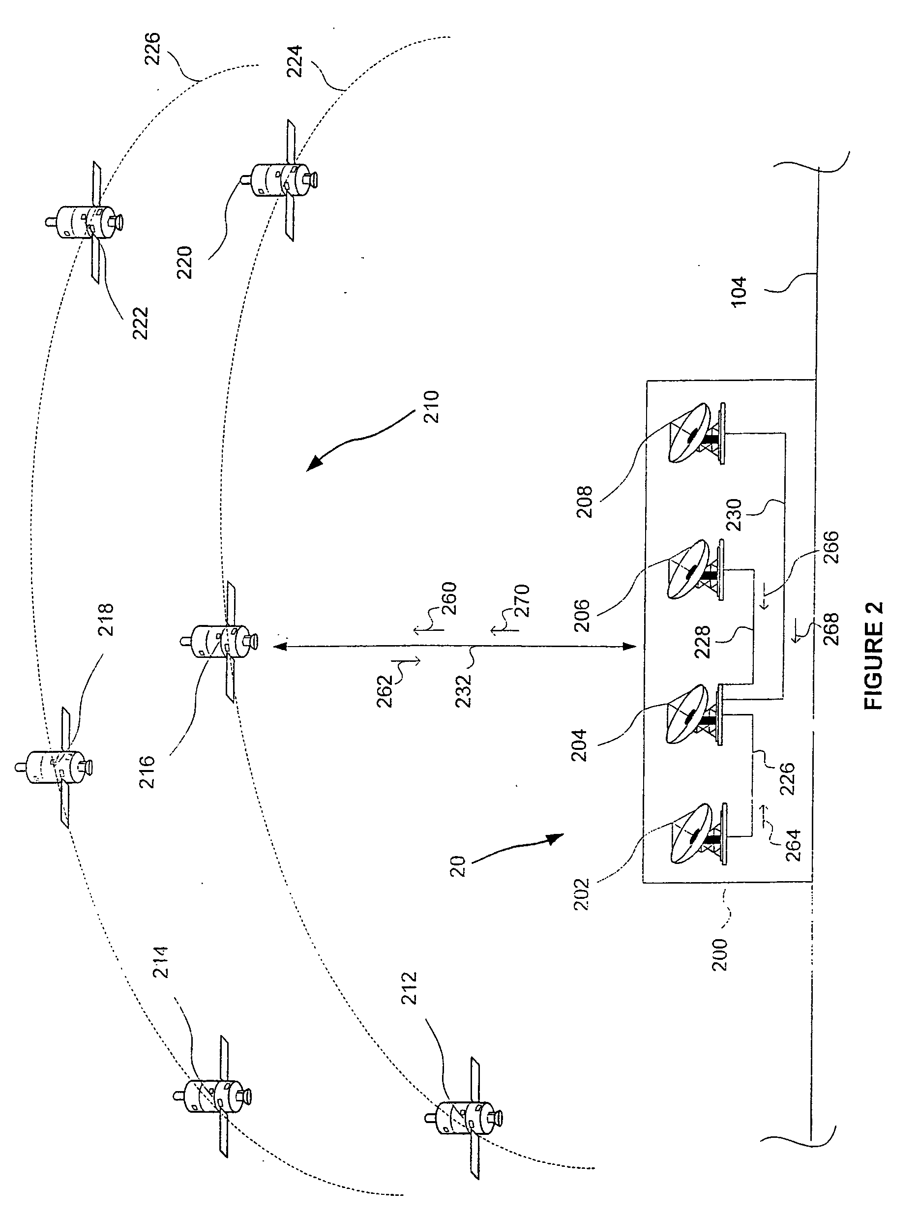
[0023] Reference will now be made to the accompanying drawings, which at least assist in illustrating the various pertinent features of the present invention. In this regard, the following description is presented for purposes of illustration and description and is not intended to limit the invention to the form disclosed herein. Consequently, variations and modifications commensurate with the following teachings, and skill and knowledge of the relevant art, are within the scope of the present invention. The embodiments described herein are further intended to enable others skilled in the art to utilize the invention in such, or other embodiments, and with various modifications required by the particular application(s) or use(s) of the present invention.

[0024] While the principles of the present invention are applicable to any environment wherein it is desirable to maintain accurate position data with respect to one or more spacecraft or airborne vehicles, at least one application ...


PUM


Abstract

A method and system for providing integrity information from a spacecraft in a non-geostationary constellation of spacecraft. According to one aspect of the present invention, a terrestrial source is provided for generating and providing a position message to a spacecraft in the non-geostationary constellation. The position message causes the spacecraft to generate and provide a response message to the terrestrial source. The response message is processed in the terrestrial source to determine spacecraft position data. The spacecraft position data is then provided to the spacecraft and utilized by the spacecraft and other spacecraft in the constellation to provided integrity information to a navigational aid.

Description

FIELD OF THE INVENTION [0001] The present invention relates to spacecraft management, and in particular, to spacecraft position monitoring and correction. BACKGROUND OF THE INVENTION [0002] In the art of spacecraft management, communication links between a spacecraft and a terrestrial monitoring and control station (e.g. a ground control station located on the surface of the earth) may be used for exchanging information related to monitoring of the spacecraft's performance and / or for providing commands necessary for the proper operation of the spacecraft. [0003] One example of where such a communication link is utilized, is satellite constellation position monitoring and correction in the Global Positioning System (GPS) satellite constellation. GPS is composed of a plurality of satellites orbiting the earth. Using a GPS receiver, a user of the GPS system is provided with location information relative to the earth's surface, e.g. typically in the form of latitude, longitude, and / or a...

Claims


Application Information

Patent Timeline
19 Apr 2007
Publication
US20070085735A1
IPC
G01S5/14; G01S19/51; G01S19/20; G01S19/50
CPC
G01S5/14; G01S19/20; G01S19/50
Inventors
BAY, FM