Digital Watermarking for Geospatial Images

a geospatial image and digital watermarking technology, applied in the field of digital watermarking of digital images, can solve problems such as inability to detect digital watermarks

Inactive Publication Date: 2008-02-14
GCS RES
View PDF12 Cites 48 Cited by
  • Summary
  • Abstract
  • Description
  • Claims
  • Application Information

AI Technical Summary

Benefits of technology

[0007] In accordance with the present invention, shortcomings and problems in prior systems are solved by a system and process that digitally watermarks images by modifying pixels from the source image and embedding a payload in the image that includes pertinent geospatial image data. The payload can later be extracted from the digitally watermarked image and converted into meaningful data. The payload can be divided into a number of meaningful values and in some examples will include unique identifiers. The unique identifiers are arranged to link the image to additional information such as copyright information, geospatial reference information, associated data, and related applications and services. Since the payload is embedded within the pixels of the image, no additional storage space is required, and the information is arranged to survive various image manipulations that might be employed by a user such as: translation of image formats, rotation, scaling, cropping, printing and scanning, and many other image processes.

Problems solved by technology

Digital watermarks are imperceptible to the human eye and are often hidden in image noise to obscure the data shift.

Method used


Image

  • Digital Watermarking for Geospatial Images
  • Digital Watermarking for Geospatial Images
  • Digital Watermarking for Geospatial Images

Examples


example geographic

Information System

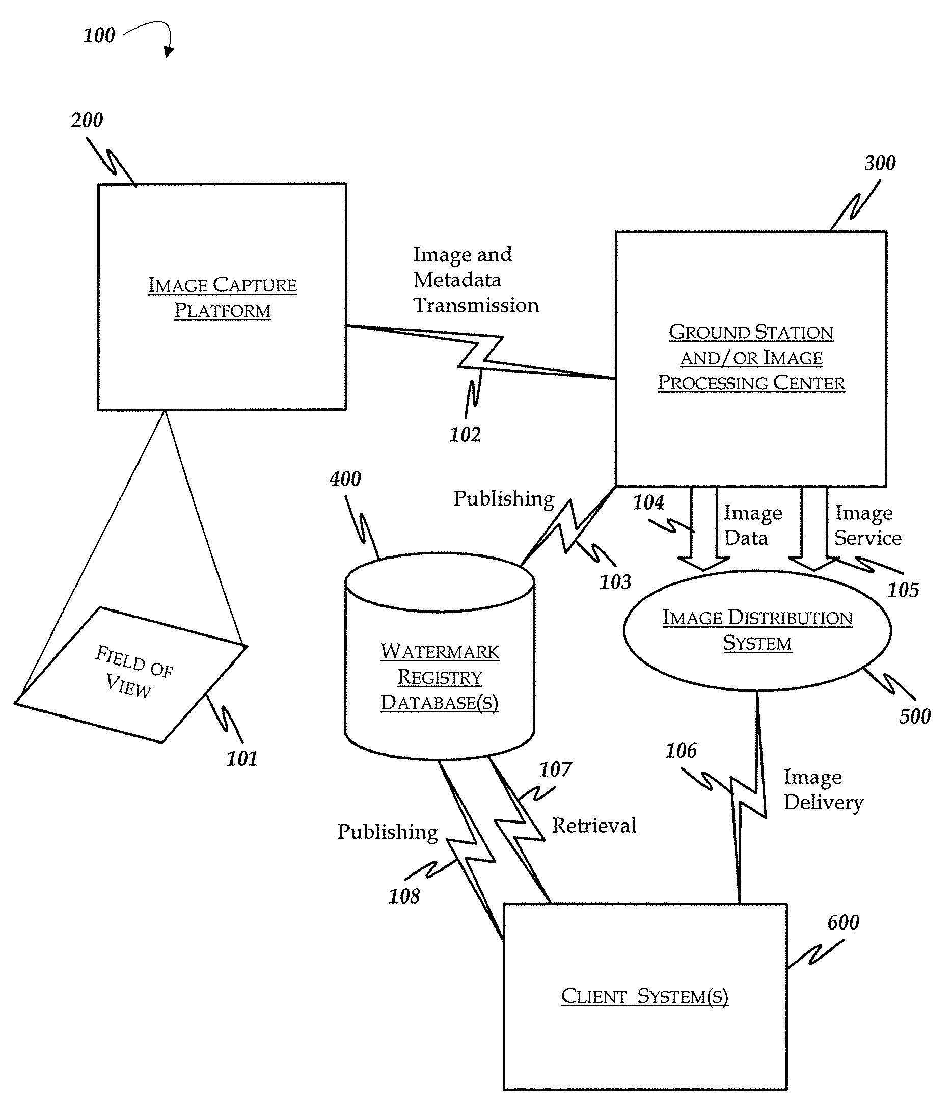
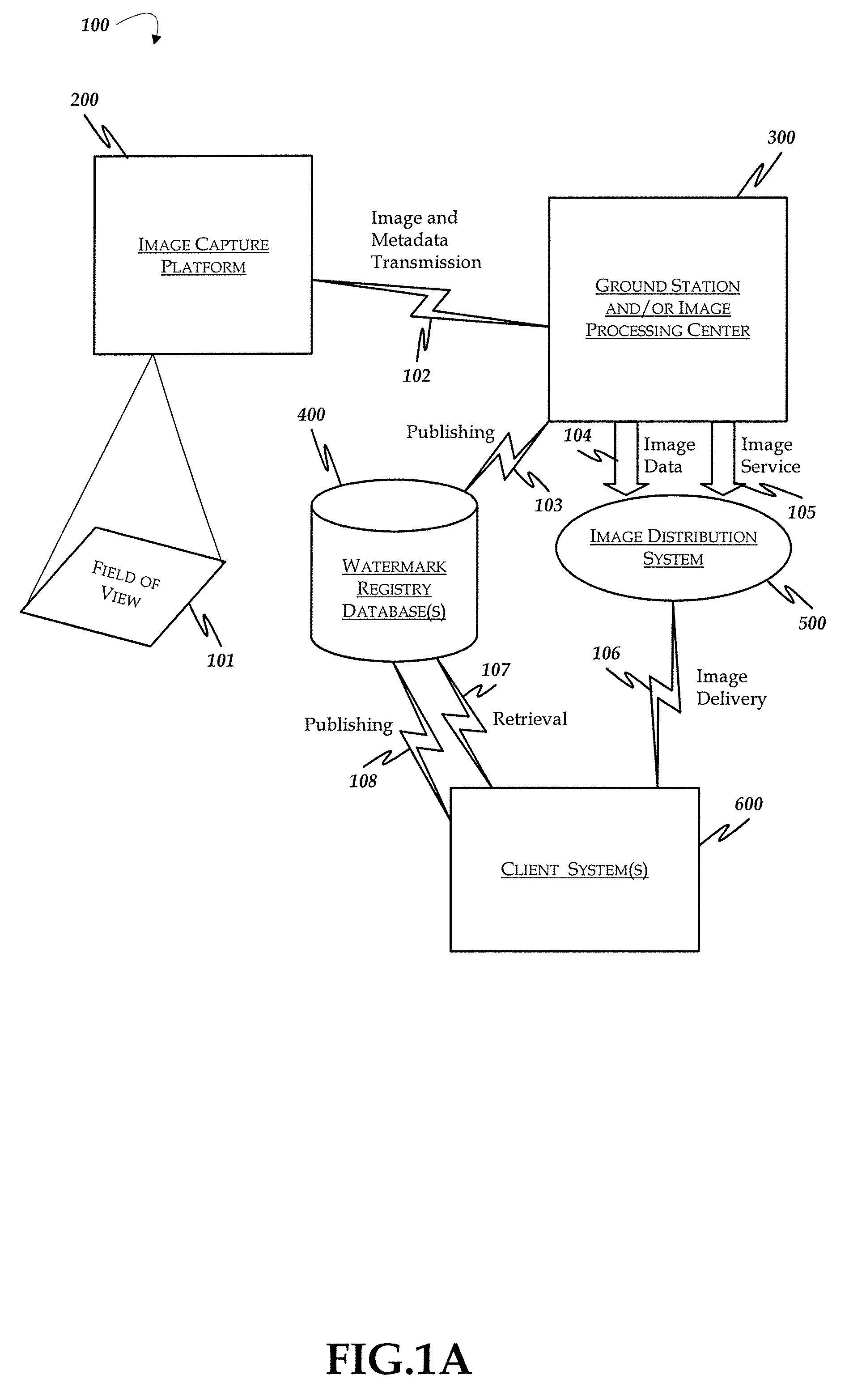
[0044]FIG. 1A is a system diagram illustrating an example geographic information system (100) that is arranged in accordance with at least some aspects of the present disclosure. The geographic information system (100) includes an image capture platform (200), a ground station and / or image processing center (300), watermark registry database(s) (400), an image distribution system (500) and client system(s) (600).

[0045] The image capture platform (200) includes an output that is coupled to an input of the image ground station and / or processing center (300). The image processing center (300) is arranged in communication with the watermark registry database (400) and the image distribution system (500). Both the watermark registry database(s) (400) and the image distribution system (500) are also in communication with one or more client systems (600).

[0046] In operation, the image capture device (600) is arranged to capture an image from a scene that is located with...

example signal

Flow

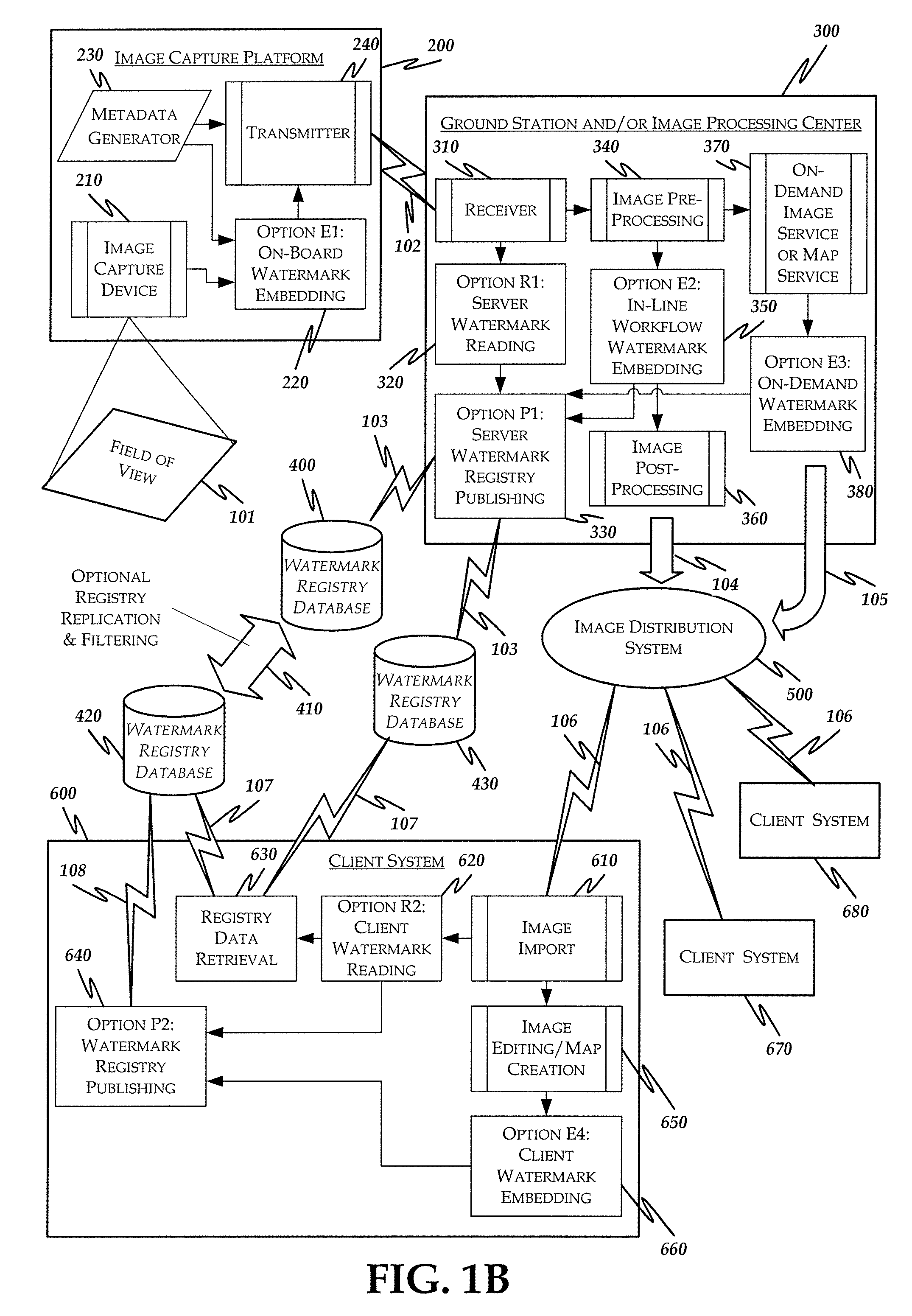
[0052]FIG. 2A diagrams an example signal flow for the image capture platform (200) where images are captured and an on-board watermark is added to the image. Within this block, the image signal (101) is captured by the digital imaging device (210) and passed (201) to the on-board watermark embed process (220). Meanwhile, on-board sensors (231) are collecting real-time metadata related to the imaging platform such as date, time, location, direction and speed of travel, field of view, type of image data collected, height, and width. The sensor data (233) is formatted (232) and passed to both the on-board embed process (220) and the transmitter (240). Within the on-board watermark embed process (220), the payload data (202) from the metadata generator (230) is combined with source and image identifiers in a variable payload formatting process (221). This process determines the type of payload to embed based on system configurations and the amount of data available. The formatted pa...

example process

Flow

[0064]FIG. 7 is a process flow diagram (700) illustrating a geospatial digital watermarking workflow that is arranged in accordance with at least some aspects of the present disclosure. Process flow diagram 700 includes processing blocks 701-713.

[0065] At processing block 701, a source image frame is captured such as from an image capture device illustrated in FIG. 2B. Proceeding to block 702, the source image is pre-processed as illustrated in FIG. 3B to prepare the image for downstream processes like mosaicing. In other cases, the image could be retrieved from internal storage at an image processing center. These processes could include orthorectification, radiometric balancing, or other processes. Continuing to block 703, a process is applied to determine the type and format of payload to use in the image (also called the payload definition). This process can be dependent on system configuration settings, environmental settings, the amount of metadata available and other par...


PUM


Abstract

A geographic information system digitally watermarks by modifying pixels from a source image with additional spatial and non-spatial information for a destination image. When an image is digitally watermarked, the pixels of the image are modified to include an embedded redundant pattern that is imperceptible to viewers of the image. The redundant pattern of changes from the “digital watermark” can be converted back into a payload containing meaningful data, and in some examples into unique identifiers. The payload is arranged to link the image to additional information such as copyright information, geospatial data, and related applications and services. Since the payload is embedded within the pixels of the image, no additional storage space is required, and the information is arranged to survive various image manipulations that might be employed by a user such as: translation of image formats, rotation, scaling, cropping, printing and scanning, and many other image processes.

Description

RELATED APPLICATION [0001] This utility patent application claims the benefit under 35 United States Code § 119(e) of U.S. Provisional Patent Application No. 60 / 836,466 filed on Aug. 8, 2006, which is hereby incorporated by reference in its entirety.FIELD OF THE INVENTION [0002] The present disclosure generally relates to digital watermarking of digital images for use in geospatial applications. More particularly, the described digital watermarking methods modify pixels from the source image to provide a redundant pattern that is embedded in the destination image while remaining imperceptible to the viewer of the destination image. Digital watermarking embedding and reading processes are integrated at key points of the system depending on workflow to enable a variety of enhancements to the applications and uses of geospatial imagery. These applications range from synchronization of metadata on airborne platforms to in-line process management and tracking of data from on-demand image...

Claims


Application Information

Patent Timeline
Patent Type & Authority Applications(United States)
IPC IPC(8): G06K9/00
CPCG06F17/30241G06T1/0064G06F17/30265G06F16/29G06F16/58
Inventor LOFGREN, NEIL E.PHILP, JAMES ALEXANDERSPATARO, FREDERICK LEONARDBELTZ, MICHAEL WILLIAMMACHOLZ, CRAIG WILLIAM
Owner GCS RES
Why Eureka
Try Eureka