
Method of seismic data interpolation by projection on convex sets

a technology of convex sets and seismic data, applied in the field of seismic exploration, can solve the problems of gaps in seismic coverage and/or fold, impractical or impossible to acquire data in some limited parts, and inability to regularly space traces in some parts of the survey area

Active Publication Date: 2009-11-26
BP CORP NORTH AMERICA INC
View PDF3 Cites 23 Cited by
  • Summary
  • Abstract
  • Description
  • Claims
  • Application Information

AI Technical Summary

Benefits of technology

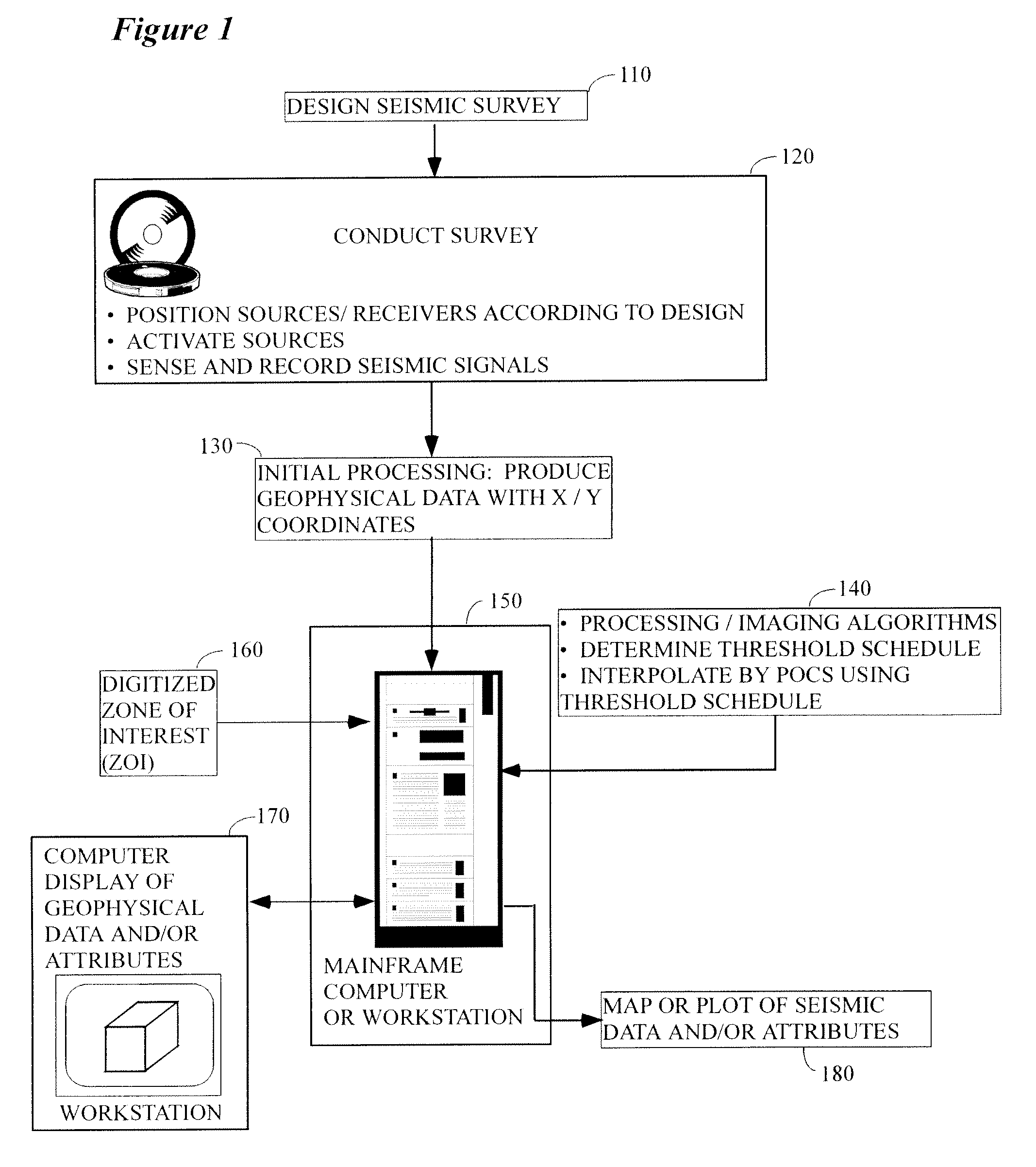
[0014]According to a preferred aspect of the instant invention, there is provided herein a system and method for interpolating 2D, 3D, or higher dimension seismic data to create datasets that are regular in coverage and / or fold which substantially reduces the amount of computation that would have been required heretofore. In brief, the instant invention reduces the number of iterations that would otherwise be required by a factor three to five by thresholding the data according to the method disclosed herein. In particular, according to a preferred embodiment, the instant invention will preferably be implemented in connection with, for example, a 3D seismic dataset as follows:
[0021]According to still another preferred embodiment, a robust interpolation of aliased data may be performed by restricting the calculations during the initial iterations to the lowest temporal and spatial frequencies found in the data, and then gradually allowing higher temporal and spatial frequencies into the following iterations.

Problems solved by technology

One well known problem with seismic data, though, is that in many cases it is impractical or impossible to acquire data in some limited parts of a planned survey, i.e., there may be skips, gaps, or localized regions of overwhelming noise that result in gaps in the seismic coverage and / or fold.
Additionally, in some cases it is impractical or impossible to acquire regularly spaced traces in some parts of the survey area.
That is, rather than obtaining uniformly and equally spaced shot / receiver spacings that are collected exactly as they were planned in the office of the explorationist, the actual collection of data in the field may result in irregular spacing of shots, receivers or both.
This results in a wavefield that is sampled irregularly.
This irregular sampling can cause artifacts in seismic images that were produced by using processing algorithms that presuppose a regularly sampled wavefield.
However, as useful as POCS has proven to be, its application in practice has added a significant amount of time and cost to the processing of the seismic data because of the computer resources that are required to calculate it.
That is, this method of interpolation is computationally intensive and, although many datasets that could benefit from an application of this technique, its application has occasionally been avoided to save time and computer resources in the processing of the data.

Method used


Image

  • Method of seismic data interpolation by projection on convex sets
  • Method of seismic data interpolation by projection on convex sets
  • Method of seismic data interpolation by projection on convex sets

Examples


Embodiment Construction

[0035]While this invention is susceptible of embodiment in many different forms, there is shown in the drawings, and will herein be described hereinafter in detail, some specific embodiments of the instant invention. It should be understood, however, that the present disclosure is to be considered an exemplification of the principles of the invention and is not intended to limit the invention to the specific embodiments or algorithms so described.

General Environment of the Invention

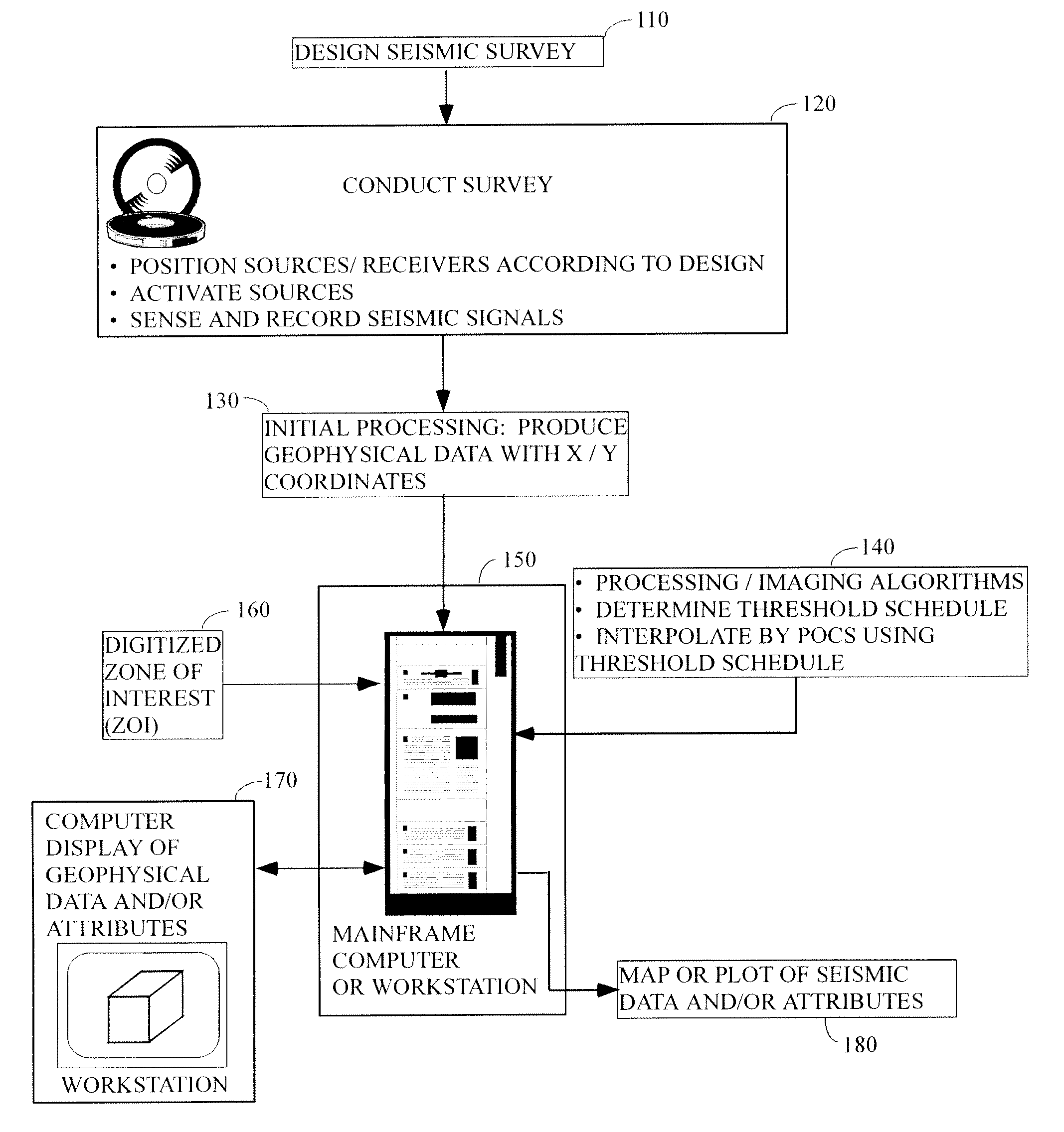
[0036]FIG. 1 illustrates the general environment in which the instant invention would typically be used. A seismic survey is designed 110 by the explorationist to cover an area of economic interest. Field acquisition parameters (e.g., shot spacing, line spacing, fold, etc.) are typically selected in conjunction with this step, although it is common to modify the ideal design parameters slightly (or substantially) in the field to accommodate the realities of conducting the survey.

[0037]Seismic data are col...


PUM


Abstract

According to a preferred aspect of the instant invention, there is provided herein a system and method for Interpolation of seismic data with a POCS (projection onto convex sets) algorithm that can produce high quality interpolation results, at a reduced computational cost. In particular, optimizing the threshold calculations, allowing for aliased data, allowing the algorithm to skip unneeded Fourier transforms, and parallelization makes the method more practical and robust. Robust interpolation of aliased data may be done by limiting the calculations of the beginning iterations to the lowest temporal and spatial frequencies included in the data, then gradually allowing higher temporal and spatial frequencies into the following iterations.

Description

RELATED CASE[0001]This application claims the benefit of U.S. Provisional Patent Application Ser. No. 61 / 054,878 filed on May 21, 2008, and incorporates said provisional application by reference into this disclosure as if fully set out at this point.TECHNICAL FIELD[0002]This invention relates to the general subject of seismic exploration and, in particular, to methods for estimating seismic and other signals that are representative of the subsurface.BACKGROUND OF THE INVENTION[0003]A seismic survey represents an attempt to image or map the subsurface of the earth by sending sound energy down into the ground and recording the “echoes” that return from the rock layers below. The source of the down-going sound energy might come, for example, from explosions or seismic vibrators on land, or air guns in marine environments. During a seismic survey, the energy source is placed at various locations near the surface of the earth above a geologic structure of interest. Each time the source i...

Claims


Application Information

Patent Timeline
IPC IPC(8): G01V1/28G06F19/00
CPCG01V2210/57G01V1/36G01V1/28
Inventor ABMA, RAYMOND L.
Owner BP CORP NORTH AMERICA INC
Learn More