Positioning system and method

a positioning system and positioning method technology, applied in surveying and navigation, navigation instruments, instruments, etc., can solve the problems of degrading the accuracy of position determination and the inability to provide continuously available positioning

Active Publication Date: 2011-03-03
LEICA GEOSYSTEMS AG
View PDF8 Cites 3 Cited by
  • Summary
  • Abstract
  • Description
  • Claims
  • Application Information

AI Technical Summary

Benefits of technology

[0067]A particular advantage of this embodiment of the invention is that the virtual satellites may be placed in an orbit that minimizes the dilution of precision of the GPS satellite and virtual satellite constellation.

Problems solved by technology

However, the ability to provide continuously available positioning is impaired when there is poor satellite “visibility” or one or more of the satellites are inoperative, which results in the accuracy of the position determination being degraded.

Method used


Image

  • Positioning system and method
  • Positioning system and method
  • Positioning system and method

Examples


Embodiment Construction

[0021]The invention will be described with reference to a GPS GNSS for guidance of an agricultural vehicle. However, a skilled person will appreciate that the system is applicable utilizing any known GNSS for any known guidance application.

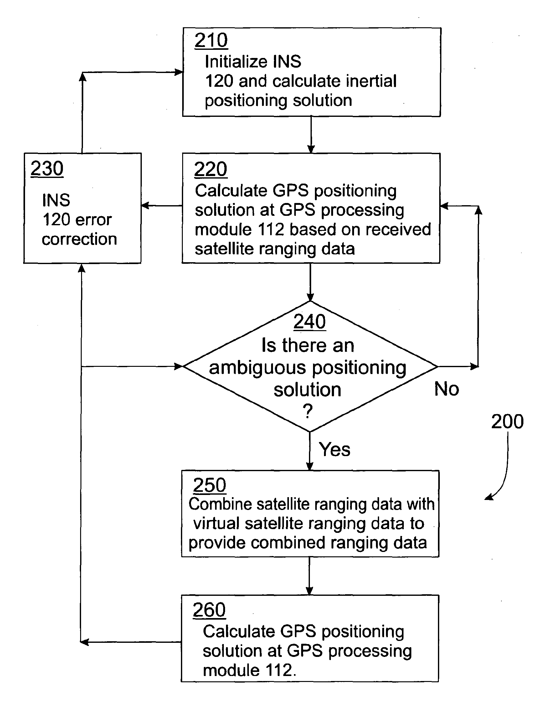
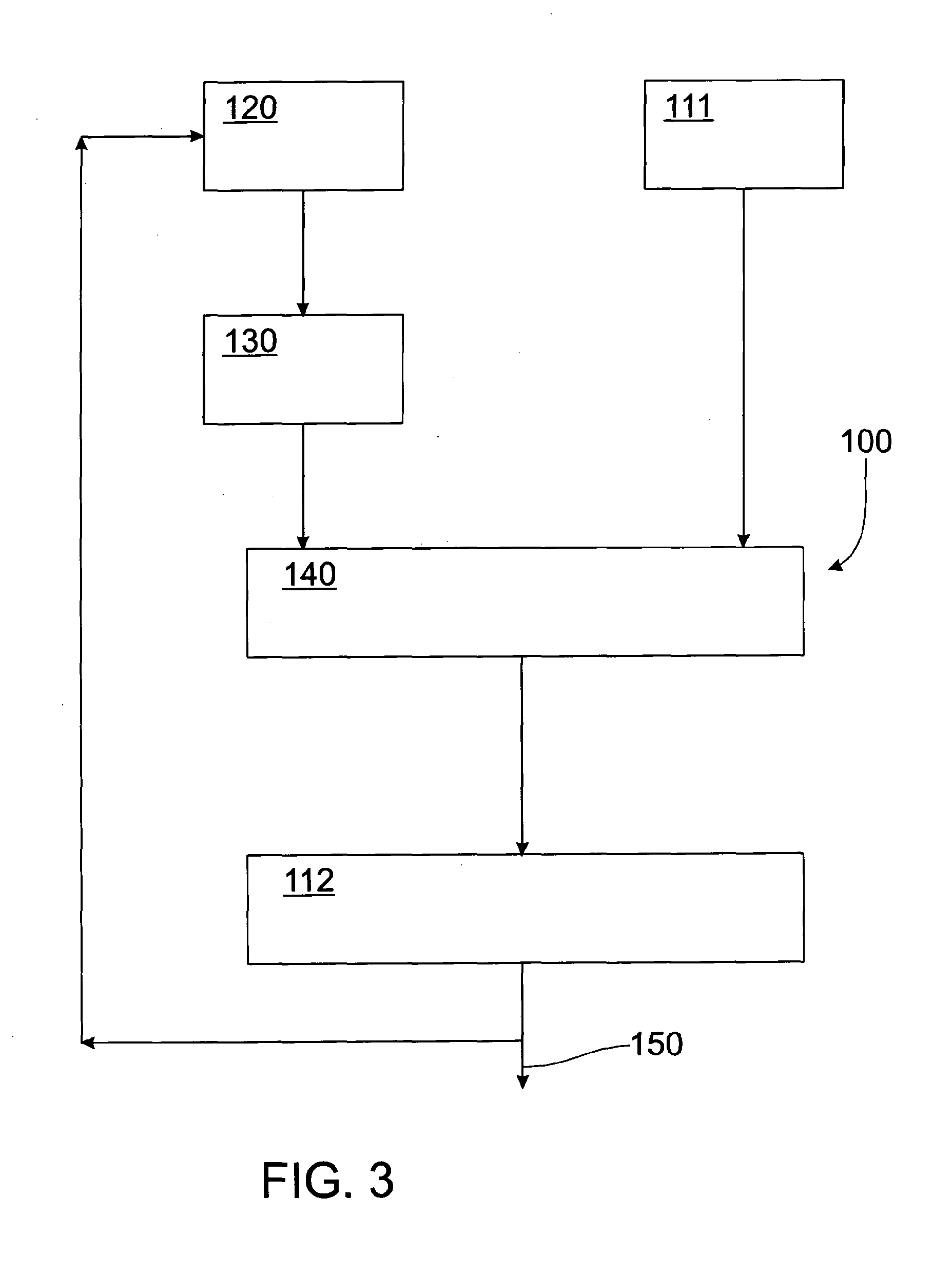
[0022]The positioning system and method of the invention converts INS positioning data into a data form that is able to be input into a processing module of a GPS receiver such that the GPS receiver is able to process the converted INS positioning data as GPS ranging data. By transforming the INS data to represent that data as GPS ranging data, the GPS processing module is able to seamlessly provide positioning data that utilizes traditional GPS range processing techniques augmented with INS positioning data.

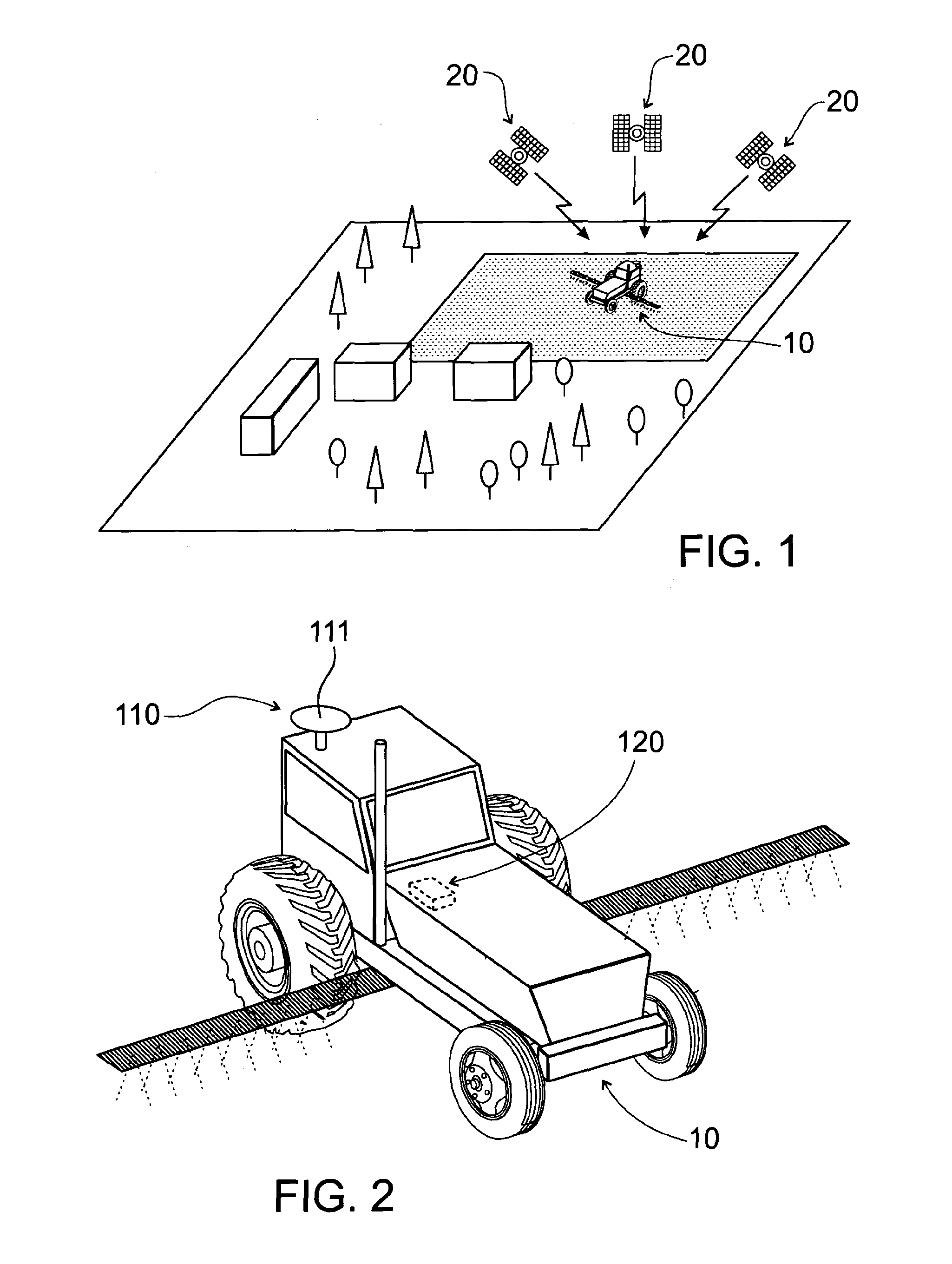
[0023]FIG. 1 shows a schematic view of a vehicle 10 utilizing a GNSS to navigate and FIG. 2 shows a schematic view of vehicle 10. In the embodiment, the vehicle 10 is used for cultivation of soil on farmland. In order that cultivation occurs i...


PUM


Abstract

A positioning method whereby inertial positioning data is calculated based upon measurements of an Inertial Navigation System. Virtual satellite ranging data is then generated based upon the inertial positioning data. The virtual satellite ranging data is then combined with received satellite ranging data from one or more satellites forming part of a Global Navigation Satellite System (GNSS). A GNSS positioning solution is then calculated based upon the combined received satellite ranging data and the virtual satellite ranging data.

Description

FIELD OF THE INVENTION[0001]The present invention relates to a positioning system and method. In particular, the invention relates to a positioning method and system integrating measurements from Global Navigation Satellite Systems (GNSS) and Inertial Navigation Systems (INS).BACKGROUND TO THE INVENTION[0002]Many applications use methods and systems for position determination, e.g. of a geodetic instrument, a vehicle or the like, which are based on global positioning systems, such as, for example, GPS, GLONASS or the European Galileo system. These Global Navigation Satellite Systems (GNSS) are based on the reception of satellite signals.[0003]The requirements of vehicle guidance or navigation, e.g. in agricultural, mining, trucking or railroad applications, have subtle differences to those of surveying, including a much stronger requirement for continuously available positioning. However, the ability to provide continuously available positioning is impaired when there is poor satell...

Claims


Application Information

Patent Timeline
Patent Type & Authority Applications(United States)
IPC IPC(8): G01S19/47G01S19/27G01S5/14
CPCG01C21/165G01S19/45G01S19/47
Inventor COLE, ANTHONYKELLAR, WILLIAM
Owner LEICA GEOSYSTEMS AG
Why Eureka
Try Eureka