Validating map data corrections

Active Publication Date: 2011-05-12
TOMTOM INT BV
View PDF9 Cites 87 Cited by
  • Summary
  • Abstract
  • Description
  • Claims
  • Application Information

AI Technical Summary

Benefits of technology

[0049]It is thus possible to provide a powerful means for validating requested corrections to map data in a navigation system. The arrangements disclosed avoid much of the expense associated with traditional methods of validating

Problems solved by technology

The real road network that is embodied in the map database changes over time, and whilst it is conventional for map providers to provide updates for application to map databases, the rate of change inevitably means that even the most up to date databases include errors that require correction.
Furthermore, as the type of information included in these map databases increases, for example to include information regarding points of interest (such as theme parks, museums, banks or filling stations), so the problem of map data accuracy is compounded as new points of interest appear and old points of interest disappear.
This verification process necessarily takes time to complete, and as such if a user wishes to have the most up to date map data available they necessarily need to choose to include map data that has not yet been officially verified.
Whilst most users of functionality such as Map Share™ are seeking to i

Method used


Image

  • Validating map data corrections
  • Validating map data corrections
  • Validating map data corrections

Examples


Example

[0063]Throughout the following description identical reference numerals will be used to identify like parts.

[0064]Embodiments of the present invention will now be described with particular reference to a PND. It should be remembered, however, that the teachings of the present invention are not limited to PNDs but are instead universally applicable to any type of processing device that is configured to execute navigation software so as to provide route planning and / or navigation functionality. It follows therefore that in the context of the present application, a navigation device is intended to include (without limitation) any type of route planning and navigation device, irrespective of whether that device comprises a PND, a device in a vehicle such as an automobile, or indeed a computing resource, for example a personal computer (PC) (portable or otherwise), a mobile telephone or a Personal Digital Assistant (PDA) executing route planning and navigation software.

[0065]It will also...


PUM


Abstract

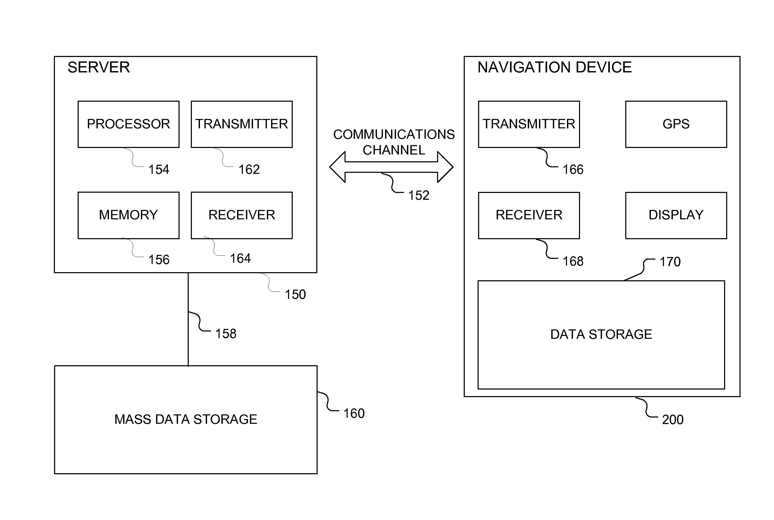
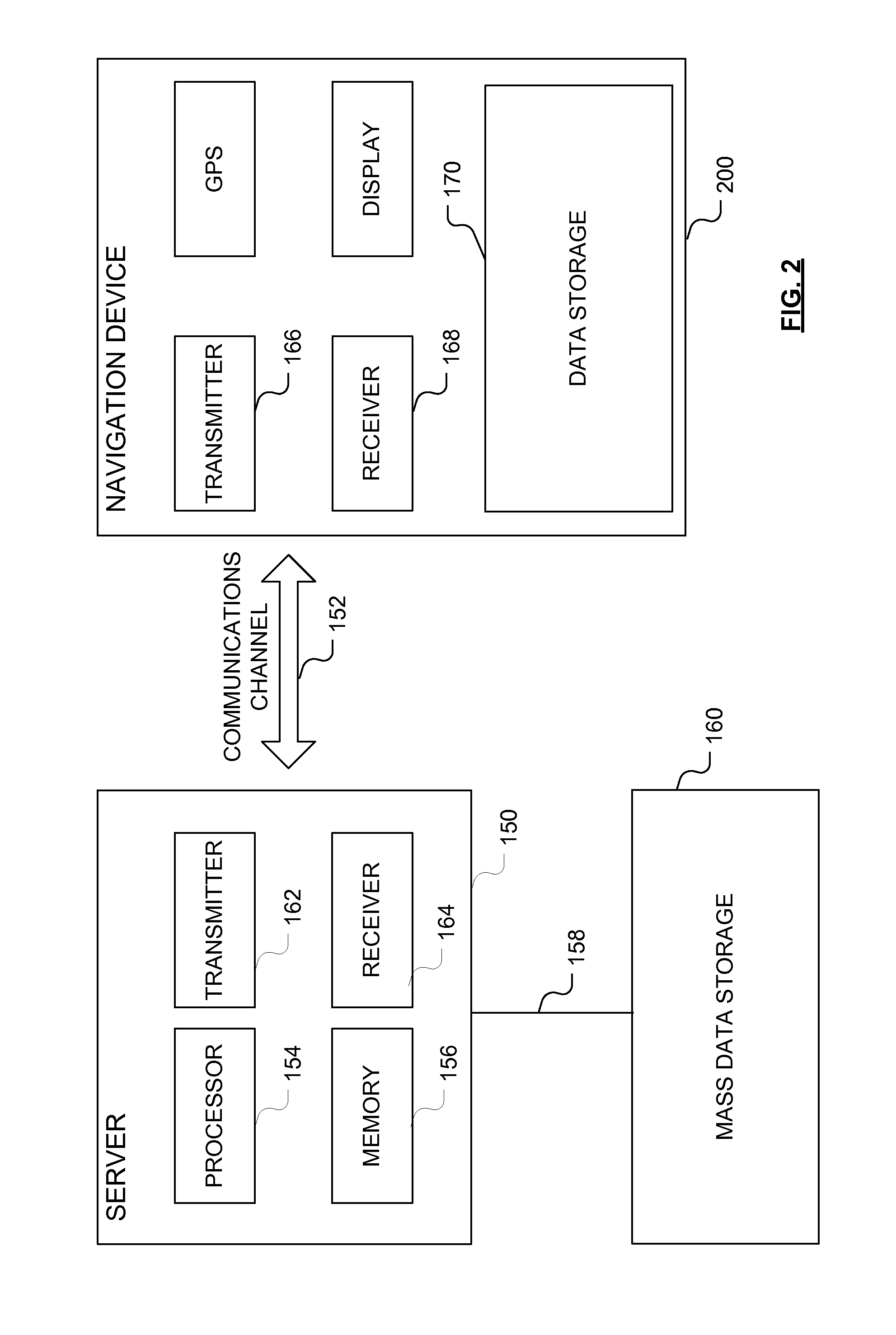
A system is disclosed for validating a correction to map data for a geographic location, the system including: a processing resource; and a navigation device. In at least one embodiment, the processing resource includes: a user request generator that is configured to generate a user request for transmission to the navigation device; a transmitter for transmitting the generated user request to the navigation device; and a receiver for receiving a user response from the navigation device; and the navigation device includes: a receiver for receiving the user request transmitted from the processing resource; a user request module configured to present the received user request to a user of the navigation device; a user response module for capturing a user response to the presented user request, and a transmitter for transmitting the captured user response to the processing resource.

Description

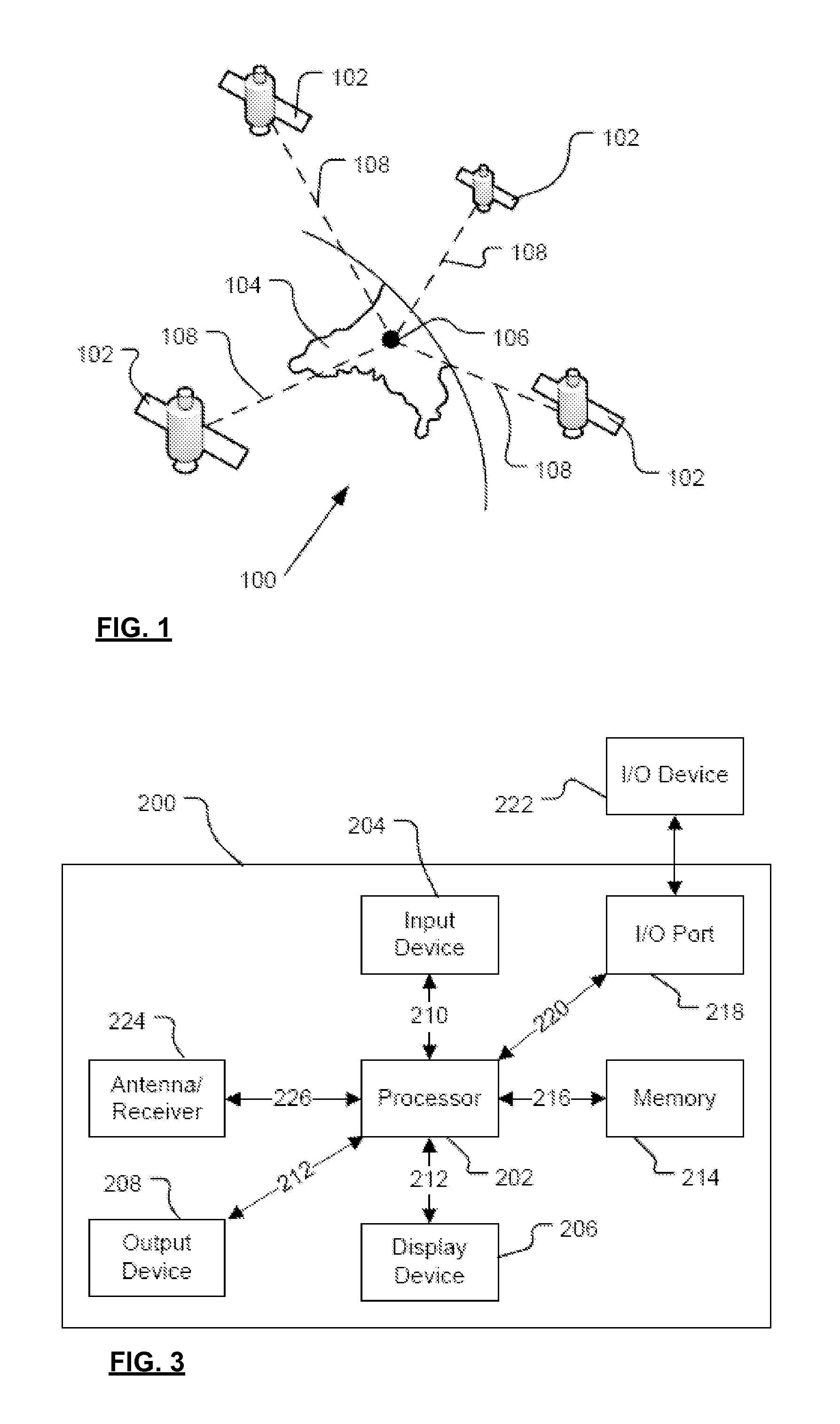
FIELD OF THE INVENTION[0001]The present invention relates, in general, to validating map data corrections. Embodiments of the invention relate to a method for use in the validation of a correction to map data for a geographic location, and to a system for use in the validation of a correction to map data for a geographic location. Other embodiments relate to a navigation device and a processing resource for use in the system, and to a computer program.BACKGROUND TO THE INVENTION[0002]Portable computing devices, for example Portable Navigation Devices (PNDs) that include GPS (Global Positioning System) signal reception and processing functionality are well known and are widely employed as in-car or other vehicle navigation systems, either as devices that are permanently mounted in the vehicle or as devices that can be removed from the vehicle.[0003]In general terms, a modern PND comprises a processor, memory (at least one of volatile and non-volatile, and commonly both), and map data...

Claims


Application Information

Patent Timeline
IPC IPC(8): G01C21/00
CPCG01C21/32G06F17/30241G01C21/00G06F16/29G01C21/3856G01C21/3885G01C21/3859G01C21/36
Inventor GRUIJTERS, PAULUSLUKASSEN, ROBERT
Owner TOMTOM INT BV
Why Eureka
Try Eureka