Methods for identifying rooftops using elevation data sets

a technology of elevation data and methods, applied in the field of elevation data analysis, can solve the problems of difficult to obtain information, inability to reliably determine the height and location of the roof, etc., and achieve the effect of avoiding obscuring the purpos

Inactive Publication Date: 2012-12-20
CSC HLDG
View PDF2 Cites 15 Cited by
  • Summary
  • Abstract
  • Description
  • Claims
  • Application Information

AI Technical Summary

Benefits of technology

[0006]This section is for the purpose of summarizing some aspects of the present invention and to briefly introduce some preferred embodiments. Simplifications or omissions may be made to avoid obscuring the purpose of the section. Such simplifications or omissions are not intended to limit the scope of the present invention.

Problems solved by technology

Unfortunately, the resulting information is often difficult to obtain, and roof heights and locations cannot be reliably determined from aerial photography.

Method used


Image

  • Methods for identifying rooftops using elevation data sets
  • Methods for identifying rooftops using elevation data sets
  • Methods for identifying rooftops using elevation data sets

Examples


Embodiment Construction

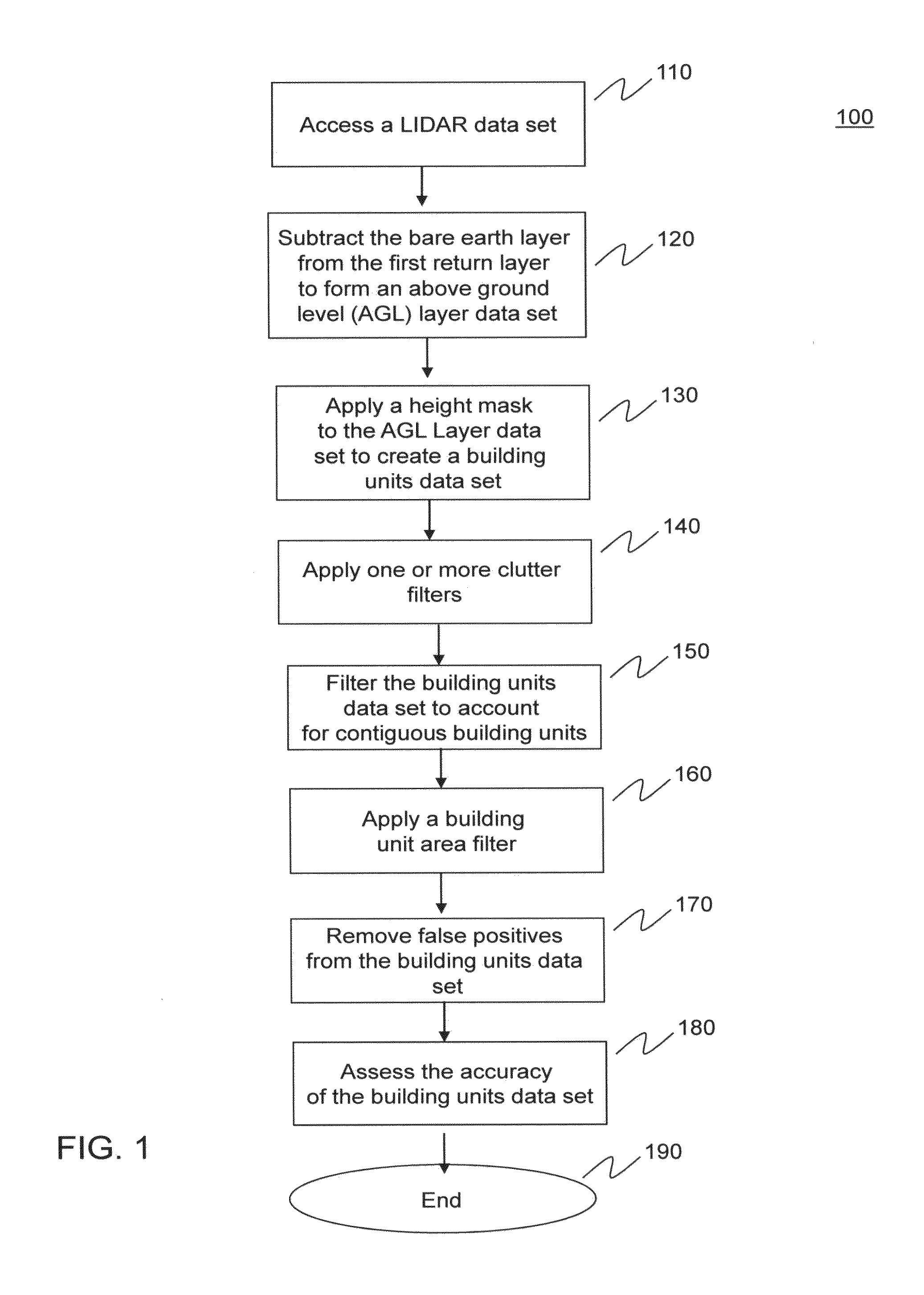
[0029]FIG. 1 provides a method 100 for identifying building unit rooftops, according to an embodiment of the invention. Method 100 begins in step 110. In step 110, a light detection and ranging (LIDAR) data set for a geographic area of interest is accessed. The LIDAR data set is gridded into a bare earth layer and a first return layer, which may be referred to generally as a surface layer. The example embodiments throughout the specification refer to LIDAR data sets. The invention is not limited to the use of LIDAR data. Rather, other types of elevation data can be used, such as, for example, data collected by RADAR or a variant of three-dimensional photography. Additionally, in embodiments the bare earth layer and first return layer (or surface layer) data may be obtained through different measurement techniques.

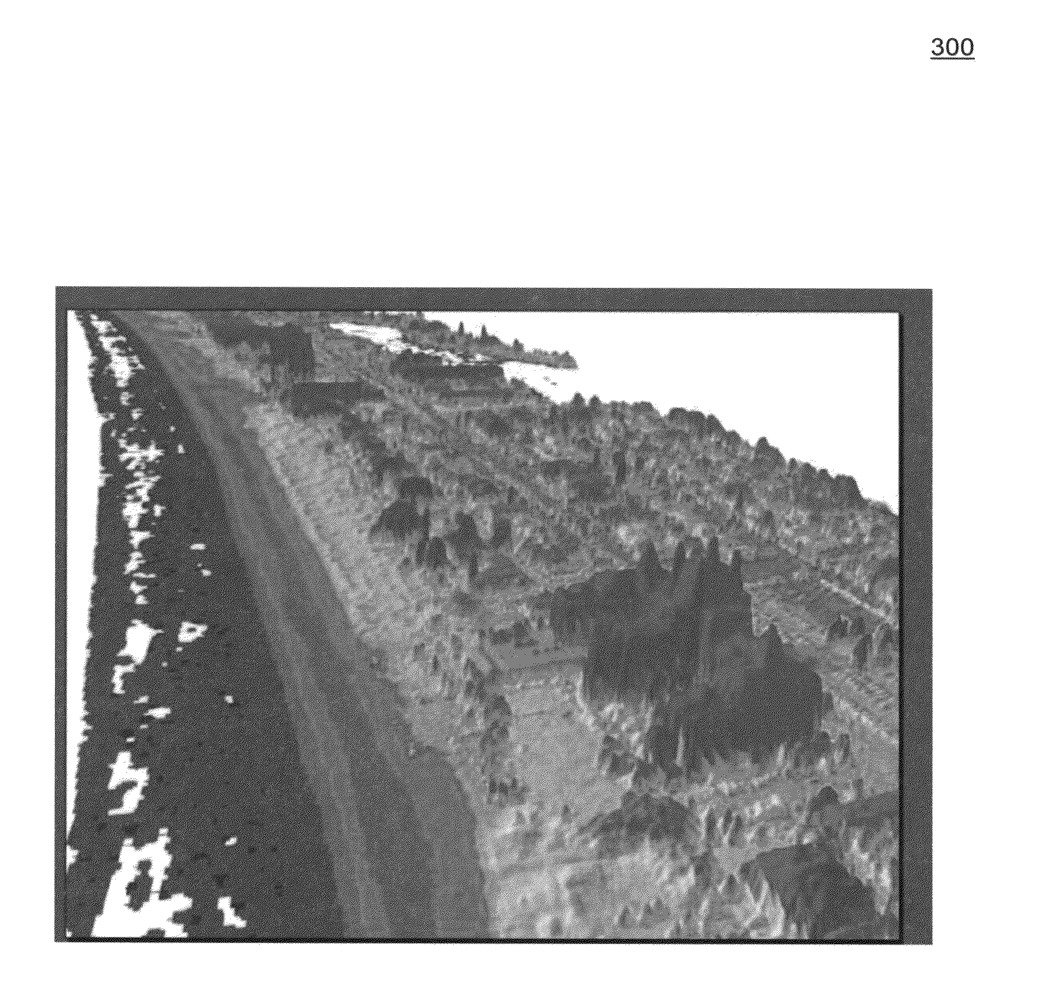
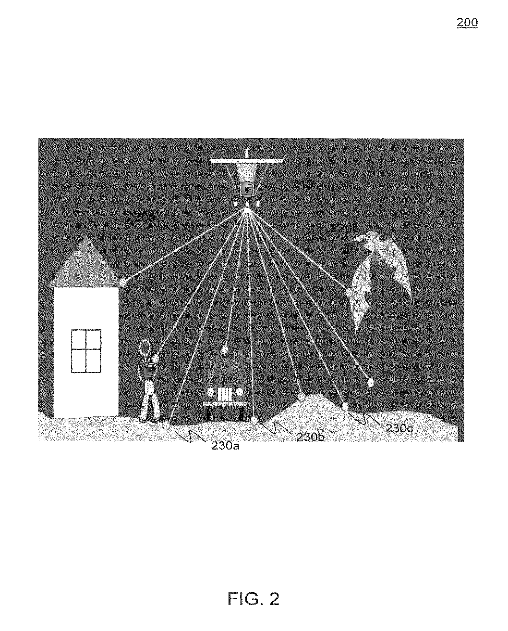
[0030]LIDAR describes a profiling system that produces location and elevation data to define the surface of a geographic area and the heights of above ground features. LIDA...


PUM


Abstract

In an embodiment, a method for identifying building unit rooftops, and their associated heights and locations is provided. The method includes subtracting a bare earth layer from a first return layer within a LIDAR data set for a geographic area of interest to form an above ground level (AGL) layer data set. A height mask is then applied to the AGL layer data set to form a building units data set. The building units data set includes data representative of potential building unit rooftops. This data set is refined through the application of a series of filters and masks to remove clutter (e.g., trees, bushes and other non-building unit structures) to refine the data set.

Description

BACKGROUND OF THE INVENTION [0001]1. Field of the Invention[0002]This invention relates generally to elevation data analysis, and more specifically to the use of elevation data to identify building unit rooftops.[0003]2. Background Art[0004]Being able to efficiently identify building unit rooftops, including their height and location, is a critical determination for the deployment of wireless communications services. For large geographical regions, rooftops are typically manually / visually located using geo-coded aerial photography. Street addresses are normally estimated from location using conventional GPS-style interpolations. Unfortunately, the resulting information is often difficult to obtain, and roof heights and locations cannot be reliably determined from aerial photography.[0005]What is needed therefore are systems, methods, and computer program products that enable efficient processing of elevation data sets to identify building unit rooftops and their corresponding height...

Claims


Application Information

Patent Timeline
Patent Type & Authority Applications(United States)
IPC IPC(8): G06K9/00
CPCG06K9/00637G06V20/176
Inventor MCLAUGHLIN, EDGAR J.PATE, ALANSPANBAUER, RICHARD J.GUADINO, MARK
Owner CSC HLDG
Why Eureka
Try Eureka