

System and method for mapping an indoor environment
a mapping system and indoor environment technology, applied in the direction of navigation instruments, location information based services, instruments, etc., can solve the problems of unsuitable indoor navigation systems such as gps, and lack of global accessibility provided by satellite networks
- Summary
- Abstract
- Description
- Claims
- Application Information
AI Technical Summary
Benefits of technology
Problems solved by technology
Method used
Image

Examples
Embodiment Construction
[0015]The aspects, features and advantages of the present disclosure will be appreciated when considered with reference to the following description of preferred embodiments and accompanying figures. The following description does not limit the disclosure; rather, the scope is defined by the appended claims and equivalents. While certain processes in accordance with example embodiments are shown in the figures as occurring in a linear fashion, this is not a requirement unless expressly stated herein. Different processes may be performed in a different order or concurrently.
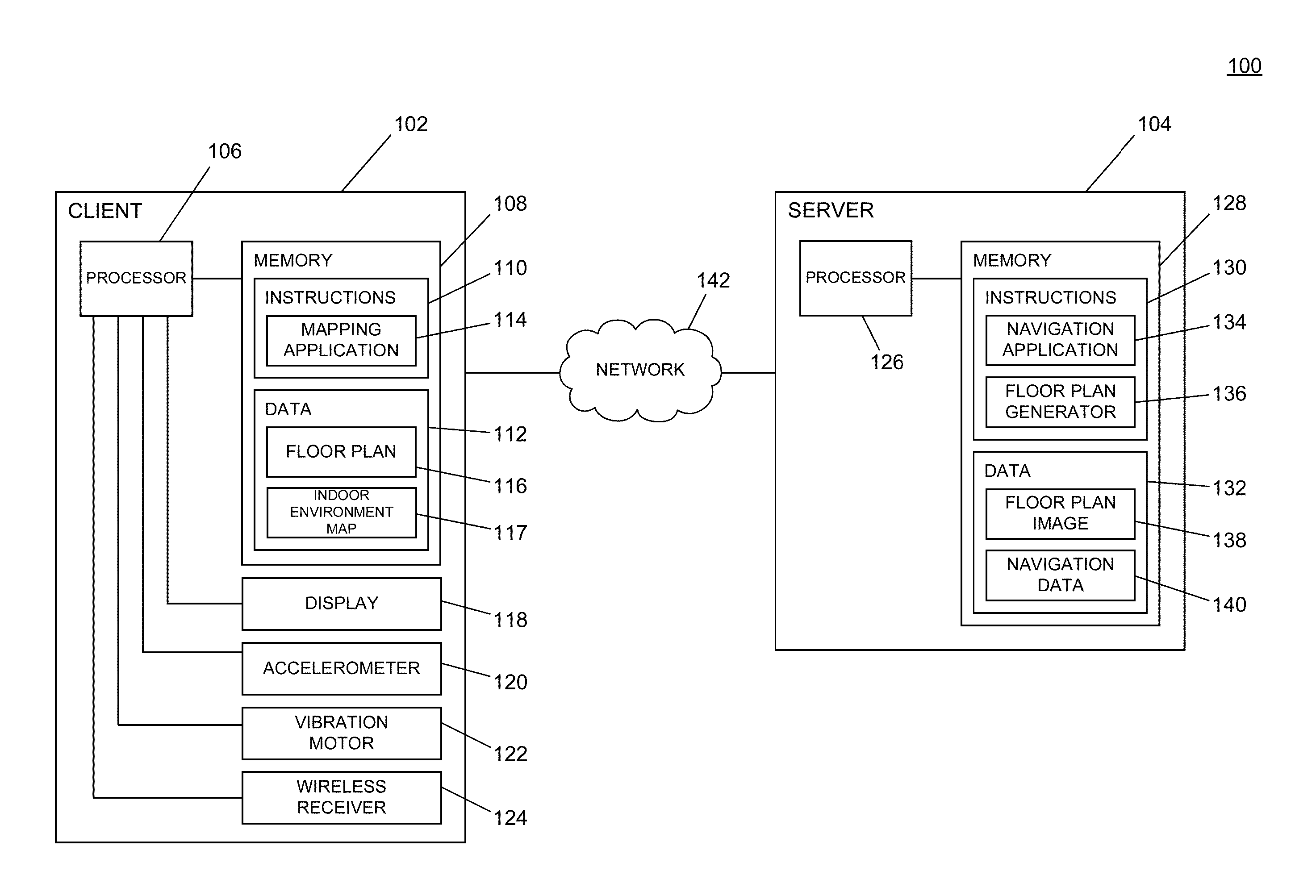
[0016]The disclosure describes systems and methods for mapping an indoor environment. Aspects of the disclosure provide a flexible, portable, user-friendly system for gathering location data in indoor environments such that the location data may be used to enable indoor navigation operations. Elements of the system relate to gathering location information and associating the gathered location information with part...
PUM
 Abstract
Description
Claims
Application Information