Lidar-based shipboard tracking and state estimation for autonomous landing

a technology of autonomous landing and tracking system, applied in the field of rotorcraft, can solve the problems of unequipped ships, high cost of tracking system, and multitude of challenges of autonomous uavs

Active Publication Date: 2016-01-14
SIKORSKY AIRCRAFT CORP
View PDF4 Cites 31 Cited by
  • Summary
  • Abstract
  • Description
  • Claims
  • Application Information

AI Technical Summary

Benefits of technology

[0013]According to another aspect of the invention, a system for state estimation of a surface of a platform at sea includes a sensor system; a processor; and memory having instructions stored thereon that, when executed by the processor, cause the system to: receive sensor signals indicative of LIDAR data for the platform; apply a Bayesian filter to the LIDAR data for a plurality of hypotheses; determine vertical planes representing azimuth and elevation angles for the LIDAR data; apply a robust linear estimation algorithm to the vertical planes; and determine candidate points in response to the applying of the robust linear estimation algorithm.

Problems solved by technology

Sea-based operation of autonomous UAV's presents a multitude of challenges.
Further, significant deck motion from high sea-state conditions causes an autonomous UAV landing target to move constantly with the ship's heaving, pitching, and rolling motion.
However, this tracking system is not only expensive but renders an unequipped ship unlandable.

Method used


Image

  • Lidar-based shipboard tracking and state estimation for autonomous landing
  • Lidar-based shipboard tracking and state estimation for autonomous landing
  • Lidar-based shipboard tracking and state estimation for autonomous landing

Examples


Embodiment Construction

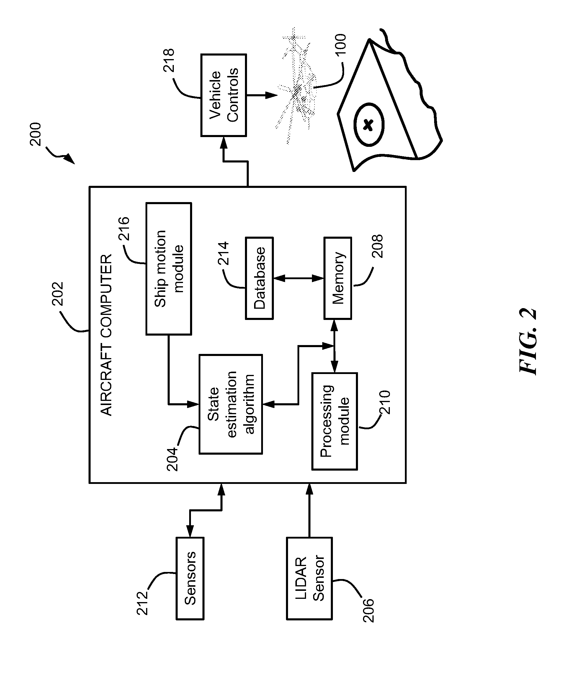
[0028]Embodiments describe a system and method for online tracking and state estimation of a platform or ship deck at various sea states using LIDAR data to enable safe landing of an autonomous unmanned aerial vehicles (“UAV”). The embodiments utilize one or more algorithms that utilize a multi-hypothesis Bayesian filter which leverages real-time LIDAR scanner data of ship deck measurements from potentially dense point cloud data.

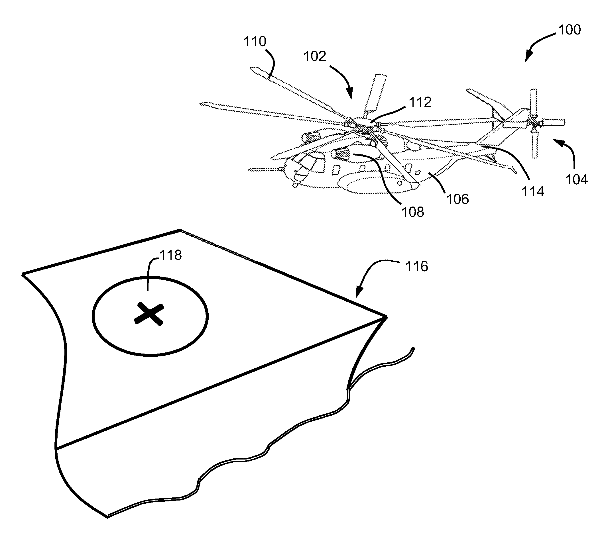
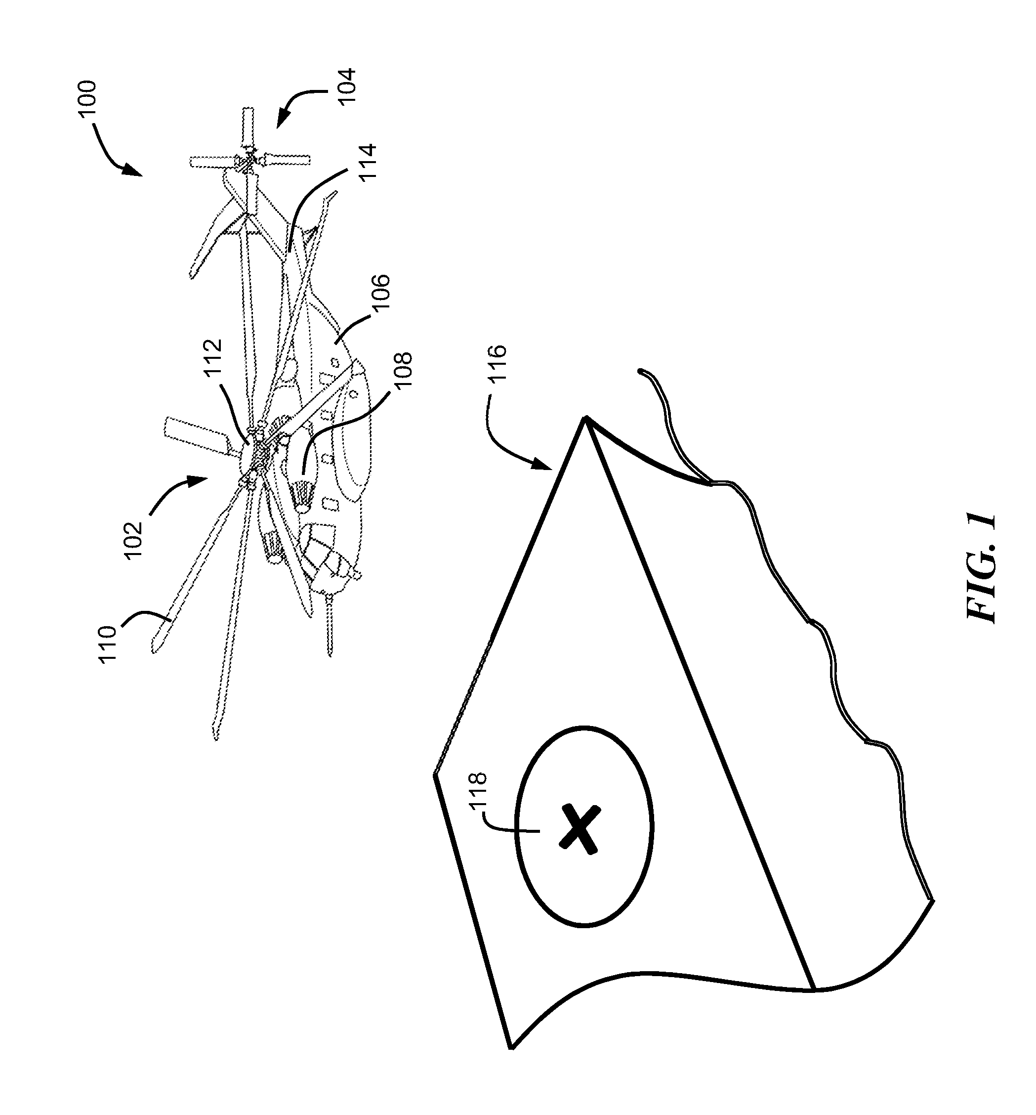
[0029]Referring now to the drawings, FIG. 1 illustrates an autonomous UAV rotary wing aircraft or helicopter 100 (hereinafter “autonomous UAV 100”) which is moving into a position above a ship deck 118 on a ship 116 in accordance with an embodiment of the invention. In other embodiments, autonomous UAV 100 can be approaching a ship deck (or platform) or other surface of a sea-based structure at sea. Aircraft 100 has a main rotor assembly 102, which is driven about an axis of rotation, via a main gearbox, by one or more engines 108. Main rotor assembly 102 i...


PUM


Abstract

A system and method for state estimation of a surface of a platform at sea, includes receiving sensor signals indicative of LIDAR data for the platform; applying a Bayesian filter to the LIDAR data for a plurality of hypotheses; determining vertical planes representing azimuth and elevation angles for the LIDAR data; applying a robust linear estimation algorithm to the vertical planes; and determining candidate points in response to the applying of the robust linear estimation algorithm.

Description

CROSS-REFERENCE TO RELATED APPLICATIONS[0001]This application claims the benefit of U.S. provisional patent application Ser. No. 62 / 021,885, filed Jul. 8, 2014, the entire contents of which are incorporated herein by reference.BACKGROUND[0002]The subject matter disclosed herein relates generally to the field of rotorcraft and, in particular, to a shipboard tracking and state estimation system of a ship deck in order to enable sea-based landing of a helicopter at various sea states.DESCRIPTION OF RELATED ART[0003]Unmanned aerial vehicles (UAV's), for example, fixed-wing or rotorcraft vehicles are powered aircraft without a human operator. As such, UAV's provide advantages over manned aircraft by removing humans from situations which may be deemed dangerous, for example, during reconnaissance or during search and rescue operations during a natural disaster. Autonomous UAV's are a natural extension of UAV's and do not require real-time control by a human operator. Autonomous UAV's may ...

Claims


Application Information

Patent Timeline
Patent Type & Authority Applications(United States)
IPC IPC(8): B64D45/08G01S7/48G01S17/933
CPCG01S7/4808B64D45/08G05D1/0684G05D1/0858G01S17/933G08G5/025G08G5/0069
Inventor DERENICK, JASON C.CHEREPINSKY, IGORSTATHIS, CHRISTOPHER
Owner SIKORSKY AIRCRAFT CORP
Why Eureka
Try Eureka