Resource-aware large-scale cooperative 3D mapping using multiple mobile devices

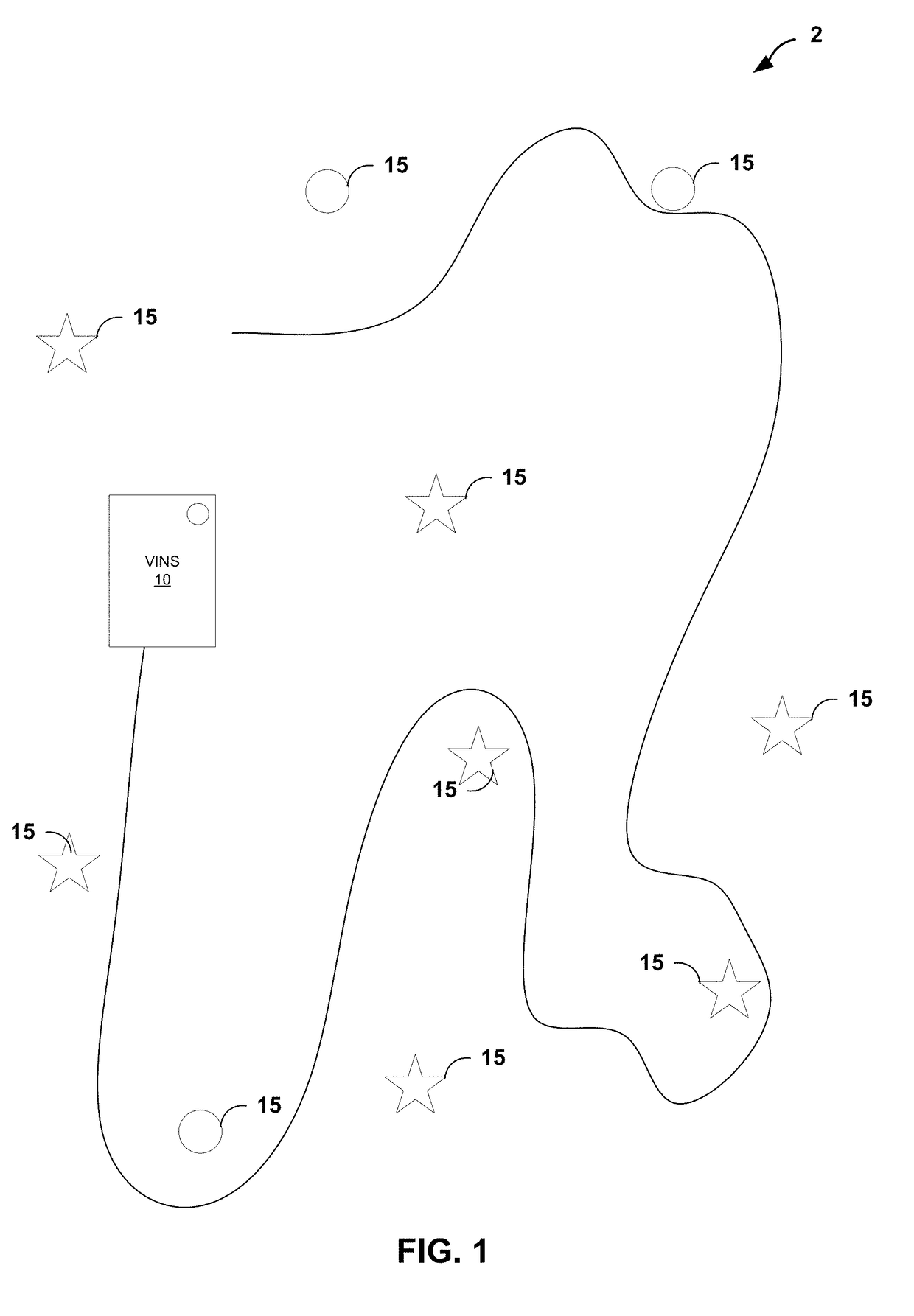
a cooperative, resource-aware technology, applied in the field of navigation, can solve the problems of not having enough storage space or battery for recording data, not being convenient for a single user to navigate the whole building at once, and a single mobile device can create a complex map with a single mobile device, so as to reduce the processing cost, reduce the complexity of the map, and solve the problem of memory demands

Active Publication Date: 2017-11-30
GOOGLE LLC +1
View PDF0 Cites 58 Cited by
  • Summary
  • Abstract
  • Description
  • Claims
  • Application Information

AI Technical Summary

Benefits of technology

[0006]In other words, the example technical solutions described herein may address the problem of cooperative mapping (CM) using datasets collected by multiple users at different times, when the transformation between the users' starting poses is unknown. As examples, CM solutions are described that formulate CM as a constrained optimization problem, where each user's independently estimated trajectory and map are merged together by imposing geometric constraints between commonly-observed point and line features. Additionally, the solutions may efficiently solve the CM problem, by takin

Problems solved by technology

However, creating a complex map with a single mobile device, such as a mobile phone, tablet or wearable computer, presents certain challenges.
For example, the device used for recording data may not have sufficient resources (e.g., storage space or battery) to collect data covering a large area.

Method used


Image

  • Resource-aware large-scale cooperative 3D mapping using multiple mobile devices
  • Resource-aware large-scale cooperative 3D mapping using multiple mobile devices
  • Resource-aware large-scale cooperative 3D mapping using multiple mobile devices

Examples


example algorithm

Description

[0070]In what follows, we first briefly review the BLS method for determining the trajectory and map of each user based on only its own measurements, and then describe in detail an approach to find an initial estimate for the relative poses between users. Subsequently, we introduce our example CM algorithm and present a method for “sparsifying” (i.e., reducing their number and thus spatial density) the commonly-observed-feature constraints.

Single-User Batch Least-Squares

[0071]For a user j, computing the BLS estimate requires minimizing the following non-linear cost function:

j=∥j{hacek over (p)}−g(j{hacek over (p)}, ju)∥jQ2+∥jz−h(jxu)∥jR2  (18)

where the first term corresponds to the cost function arising from IMU measurements (4), while the second term is due to visual observations of point (5), free-line (7), and Manhattan-line (9) features. Also, in (18) j{hacek over (p)} and jxu denote the user' poses and entire state [see (1)], respectively, ju includes all IMU measure...


PUM


Abstract

A method includes: receiving, with a computing platform, respective trajectory data and map data independently generated by each of a plurality of vision-aided inertial navigation devices (VINS devices) traversing an environment, wherein the trajectory data specifies poses along a path through the environment for the respective VINS device and the map data specifies positions of observed features within the environment as determined by an estimator executed by the respective VINS device; determining, with the computing platform and based on the respective trajectory data and map data from each of the VINS devices, estimates for relative poses within the environment by determining transformations that geometrically relate the trajectory data and the map data between one or more pairs of the VINS devices; and generating, with the computing platform and based on the transformations, a composite map specifying positions within the environment for the features observed by the VINS devices.

Description

[0001]This application claims the benefit of U.S. Provisional Application No. 62 / 341,237 by Roumeliotis, entitled, “RESOURCE-AWARE LARGE-SCALE COOPERATIVE 3D MAPPING USING MULTIPLE MOBILE DEVICES” and filed on May 25, 2016, the entire content of which is incorporated herein by reference.TECHNICAL FIELD[0002]This disclosure relates to navigation and, more particularly, to vision-aided inertial navigation.BACKGROUND[0003]In general, a Vision-aided Inertial Navigation System (VINS) fuses data from a camera and an Inertial Measurement Unit (IMU) to track the six-degrees-of-freedom (d.o.f) position and orientation (pose) of a sensing platform through an environment. In this way, the VINS combines complementary sensing capabilities. For example, an IMU can accurately track dynamic motions over short time durations, while visual data can be used to estimate the pose displacement (up to scale) between consecutive views. For several reasons, VINS has gained popularity to address GPS-denied n...

Claims


Application Information

Patent Timeline
IPC IPC(8): G01C21/16G06T17/00G06T17/05G06T19/00
CPCG01C21/165G06T17/005G06T19/003G06T17/05H04W4/026H04W4/027G06T2207/30241G06T2207/30244G06T7/73G06T7/246G06T7/277G01C21/3848G01C21/1656G01C21/3841G06T7/00
Inventor ROUMELIOTIS, STERGIOS I.NERURKAR, ESHA D.HESCH, JOELGUO, CHAODUTOIT, RYAN C.SARTIPI, KOUROSHGEORGIOU, GEORGIOS
Owner GOOGLE LLC
Why Eureka
Try Eureka