
Apparatus and Method For Image Navigation and Registration of Geostationary Remote Sensing Satellites

a image navigation technology, applied in the field of apparatus and method for image navigation and registration of geostationary remote sensing satellites, can solve the problem of a certain limit in choosing and using the inr system

Active Publication Date: 2018-10-25
KOREA AEROSPACE RES INST
View PDF2 Cites 12 Cited by
  • Summary
  • Abstract
  • Description
  • Claims
  • Application Information

AI Technical Summary

Benefits of technology

The patent is describing a new method for making sure that computer networks are secure. The method involves using a special cryptographic code to verify the identity of devices in the network. This helps to prevent unauthorized devices from joining the network and helps to ensure that information is shared only with the intended audience. Overall, the method improves the security of computer networks.

Problems solved by technology

Therefore, there exists a certain limit in choosing and using the INR system that adopts only the star sensing for most geostationary remote sensing satellites.

Method used


Image

  • Apparatus and Method For Image Navigation and Registration of Geostationary Remote Sensing Satellites
  • Apparatus and Method For Image Navigation and Registration of Geostationary Remote Sensing Satellites
  • Apparatus and Method For Image Navigation and Registration of Geostationary Remote Sensing Satellites

Examples


Embodiment Construction

[0025]The features described herein may be embodied in different forms, and are not to be construed as being limited to the examples described herein. Rather, the examples described herein have been provided so that this disclosure will be thorough and complete, and will convey the full scope of the disclosure to one of ordinary skill in the art.

[0026]The following specific structural or functional descriptions are examples to merely describe embodiments, and various alterations and modifications may be made to the examples. Here, the examples are not construed as limited to the disclosure and should be understood to include all changes, equivalents, and replacements within the idea and the technical scope of the disclosure.

[0027]Terms such as first, second, A, B, (a), (b), and the like may be used herein to describe components. Each of these terminologies is not used to define an essence, order or sequence of a corresponding component but used merely to distinguish the correspondin...


PUM


Abstract

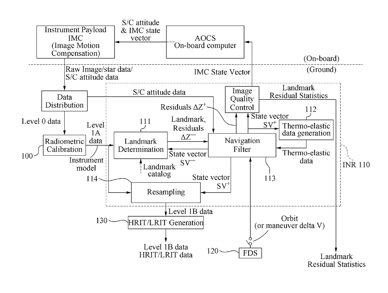
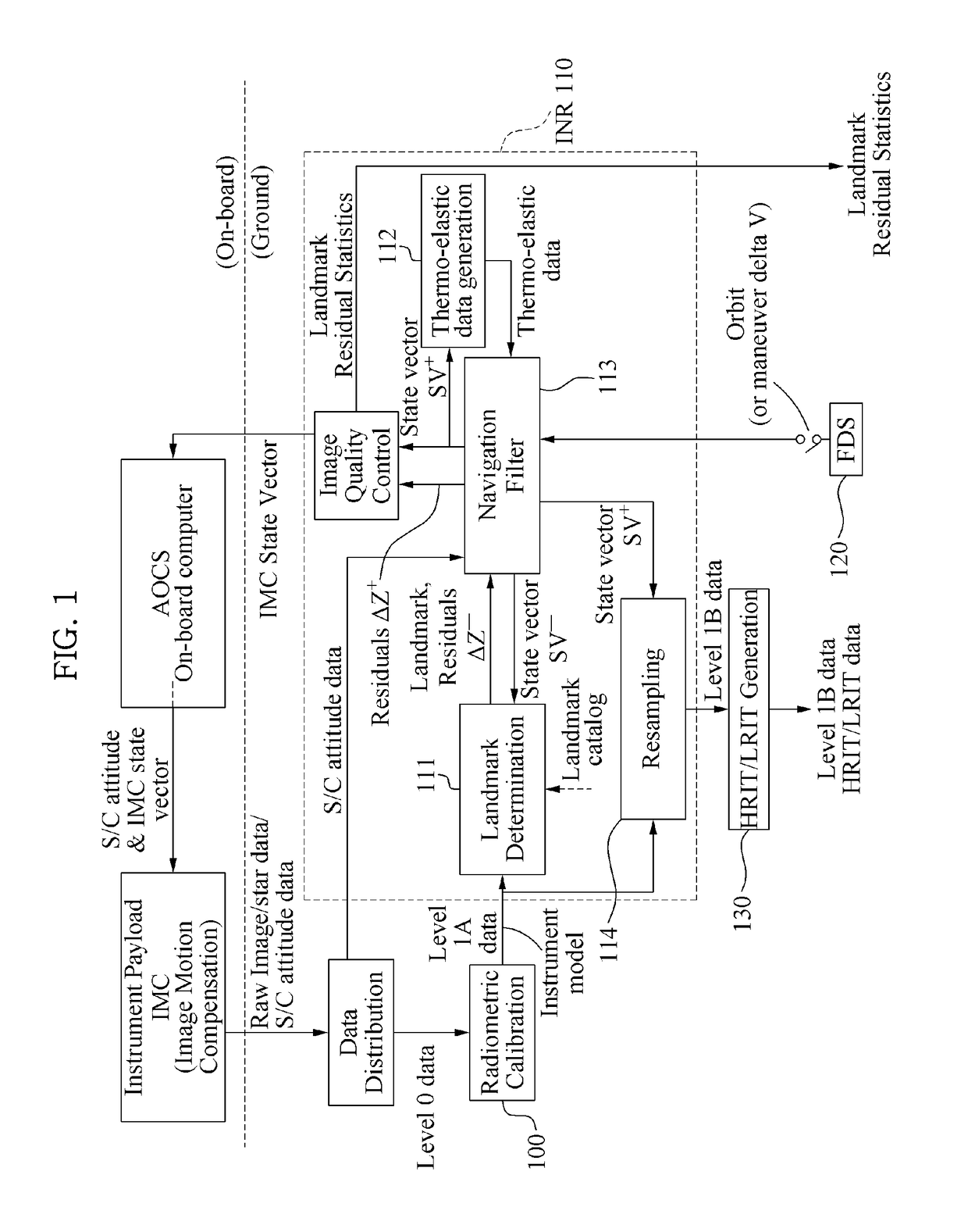
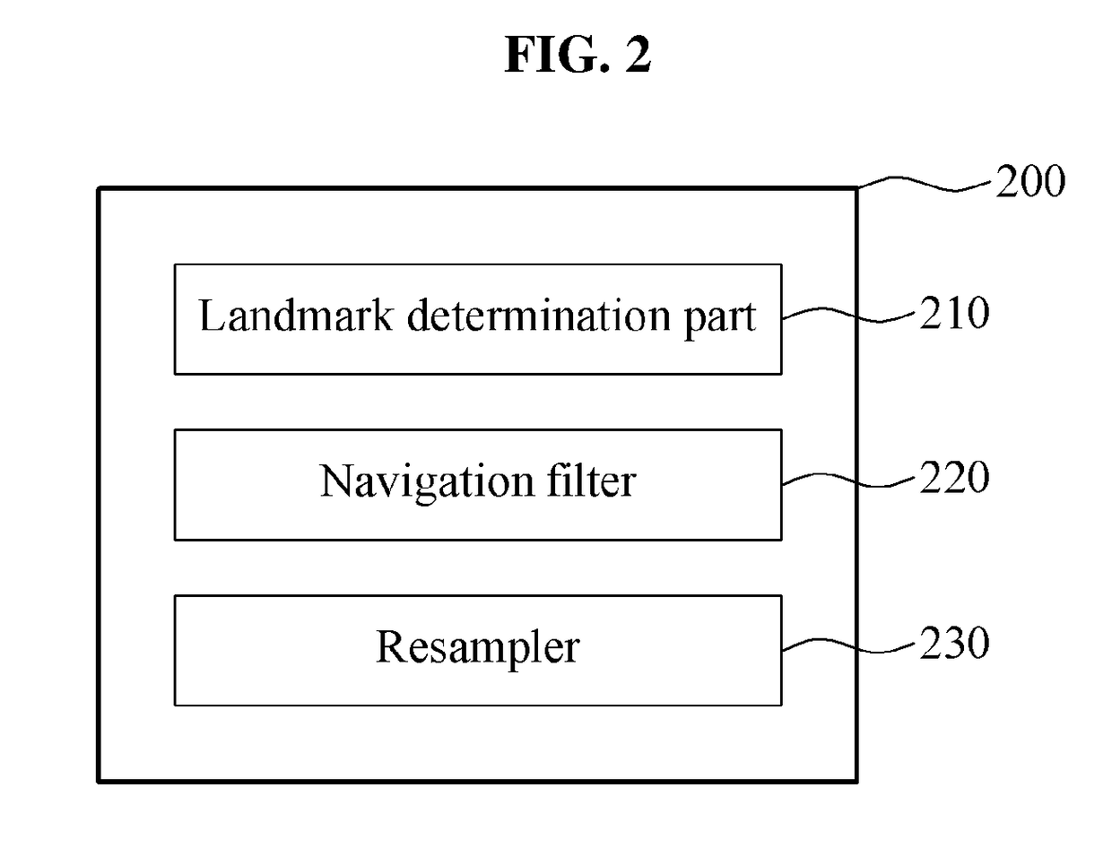
Provided is an apparatus for geometrically correcting an image from a geostationary remote sensing satellite, the apparatus being configured to perform the image navigation and registration on image data from a geostationary remote sensing satellite. The apparatus includes the landmark determination part configured to acquire landmark information associated with a first image and the navigation filter configured to calculate a state vector for correcting at least one of the attitude error, the orbit error, and the payload misalignment error with respect to the first image based on the landmark information.

Description

TECHNICAL FIELD[0001]The following descriptions relate to technology for performing image navigation and registration on image data from a geostationary remote sensing satellite and, more particularly, to a method of correcting a geometric distortion in an image from a geostationary remote sensing satellite based on landmark information.BACKGROUND ART[0002]In general, an observation satellite, or a remote sensing satellite, located on the geostationary orbit may employ the image navigation and registration (INR) scheme to correct a geometric distortion in a satellite image for providing accurate observation information. A satellite INR system may model an error-caused process with respect to a pixel position in an image and correct the error such that the error is maintained to be within an allowable range. For example, the attitude, orbit, and satellite payload misalignment errors may be the source of the errors and the targets to be corrected.[0003]In the INR system, the reference...

Claims


Application Information

Patent Timeline
Patent Type & Authority Applications(United States)
IPC IPC(8): G06T5/20B64G1/10G01C21/24
CPCG06T5/20B64G1/1021G06T2207/20024B64G2001/1028G01C21/24B64G1/242B64G1/244B64G1/1028G01S19/40G01S19/20
Inventor KIM, HANDOLKAMEL, AHMEDYANG, DOCHULPARK, CHULMINWOO, JIN
Owner KOREA AEROSPACE RES INST
Learn More