

Link level wind factor computation for efficient drone routing using 3D city map data
- Summary
- Abstract
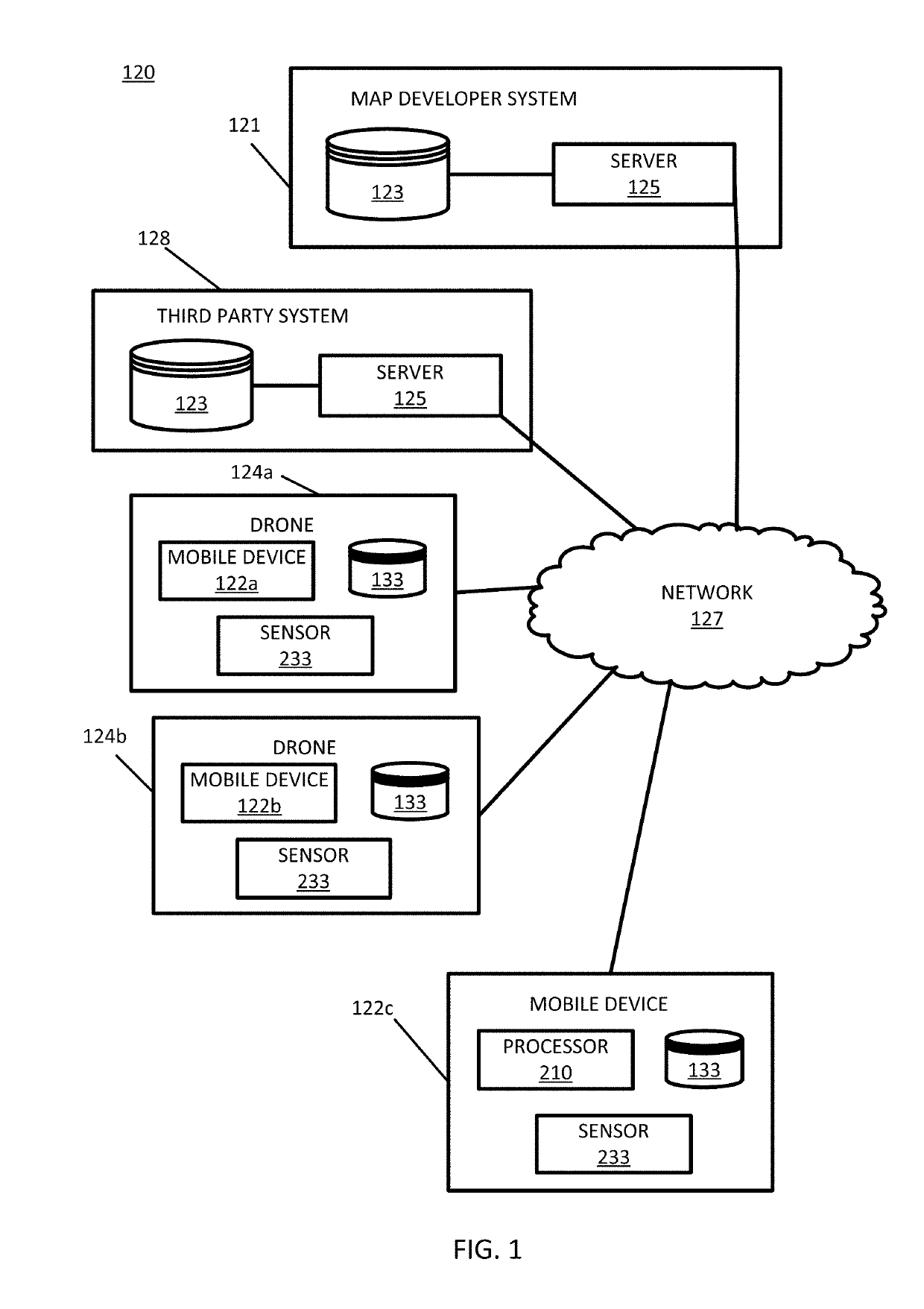
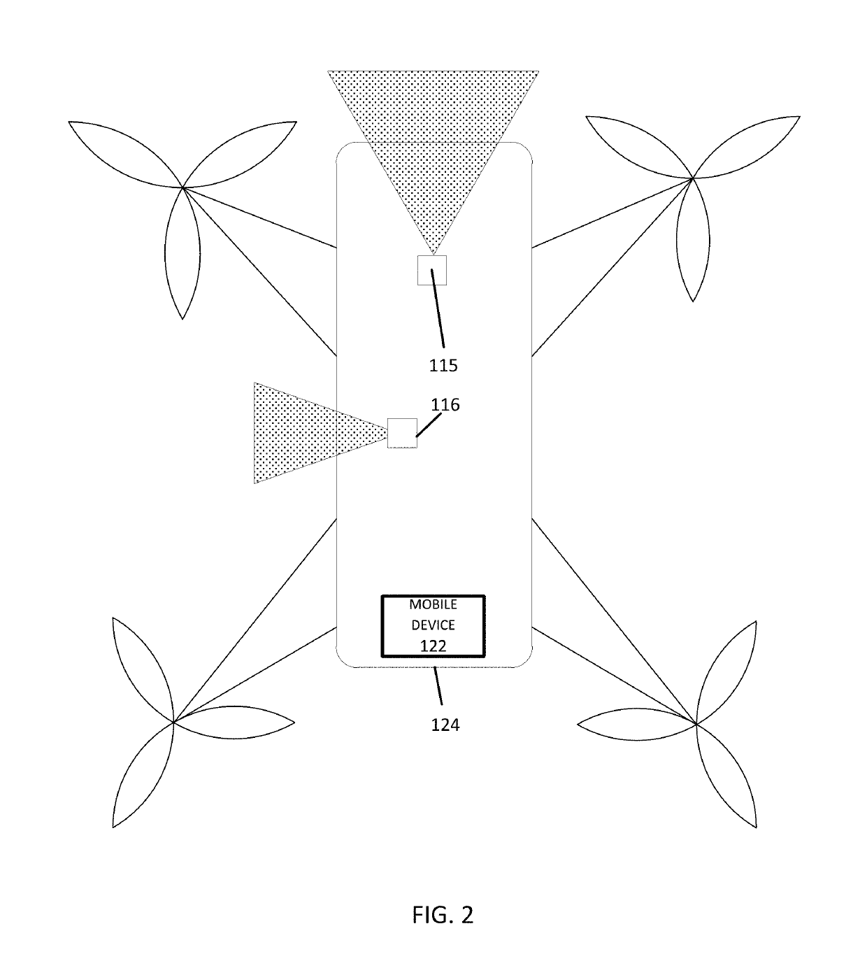
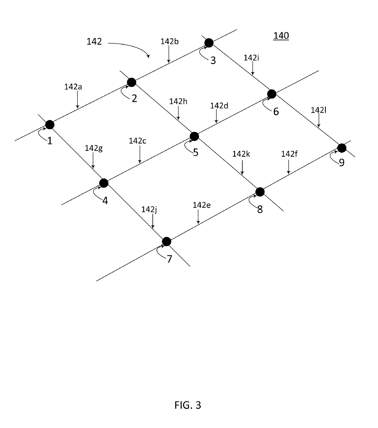
- Description
- Claims
- Application Information
AI Technical Summary
Benefits of technology
Problems solved by technology
Method used
Image

Examples
embodiment 1
[0150]A method of determining link level wind factors for unmanned aerial vehicle (UAV) routing. The method comprising: accessing, by a processor, three-dimensional (3D) features from 3D map data for a location and road link data for a road link network associated with the location; accessing, by the processor, wind condition data for the location; applying, by the processor, a wind model for the location based on the 3D features and the wind condition data; assigning, by the processor, wind factor values for a plurality of altitudes of UAV air space above a link of the road link network based on the wind model; associating, by the processor, the wind factor values and the road link data for the link of the road link network; and storing the wind factor values in a database.
embodiment 2
[0151]The method of embodiment 1, wherein applying the wind model comprises: performing a computational fluid dynamics simulation over the 3D map data associated with the location.
embodiment 3
[0152]The method of embodiment 1 or 2, wherein applying the wind model comprises: receiving real time wind data from sensors at the location, wherein at least one wind factor value is refined based on real time wind data received from sensors at the location.
PUM
 Abstract
Description
Claims
Application Information