
System and method for multimodal mapping and localization

a multimodal mapping and localization technology, applied in the field of image processing, can solve the problems of poor performance in indoor or poor signal environment, high computational load for localization, inaccuracy,

Active Publication Date: 2019-10-31
BEIJING JINGDONG SHANGKE INFORMATION TECH CO LTD +1
View PDF8 Cites 38 Cited by
  • Summary
  • Abstract
  • Description
  • Claims
  • Application Information

AI Technical Summary

Benefits of technology

The present invention has certain advantages over existing technology. These advantages include, but are not limited to, improved efficiency, better performance, and better overall user experience.

Problems solved by technology

However, it is a challenge to achieve instant pose recovery and instant localization.
Stereo-camera based visual inertial odometry (VIO) method can help a robot to recover a pose with instant shots from two frames, but the computational load for localization is very costly for large map and inaccuracy exists when the map has many similar areas / regions.
GPS can guide the robot to do localization outdoor quickly with limited accuracy, but has very poor performance in indoor or poor signal environment.
Therefore, an unaddressed need exists in the art to address the aforementioned deficiencies and inadequacies.

Method used


Image

  • System and method for multimodal mapping and localization
  • System and method for multimodal mapping and localization
  • System and method for multimodal mapping and localization

Examples


Embodiment Construction

[0094]The present invention is more particularly described in the following examples that are intended as illustrative only since numerous modifications and variations therein will be apparent to those skilled in the art. Various embodiments of the invention are now described in detail. Referring to the drawings, like numbers, if any, indicate like components throughout the views. As used in the description herein and throughout the claims that follow, the meaning of “a”, “an”, and “the” includes plural reference unless the context clearly dictates otherwise. Also, as used in the description herein and throughout the claims that follow, the meaning of “in” includes “in” and “on” unless the context clearly dictates otherwise. Moreover, titles or subtitles may be used in the specification for the convenience of a reader, which shall have no influence on the scope of the present invention. Additionally, some terms used in this specification are more specifically defined below.

[0095]The...


PUM


Abstract

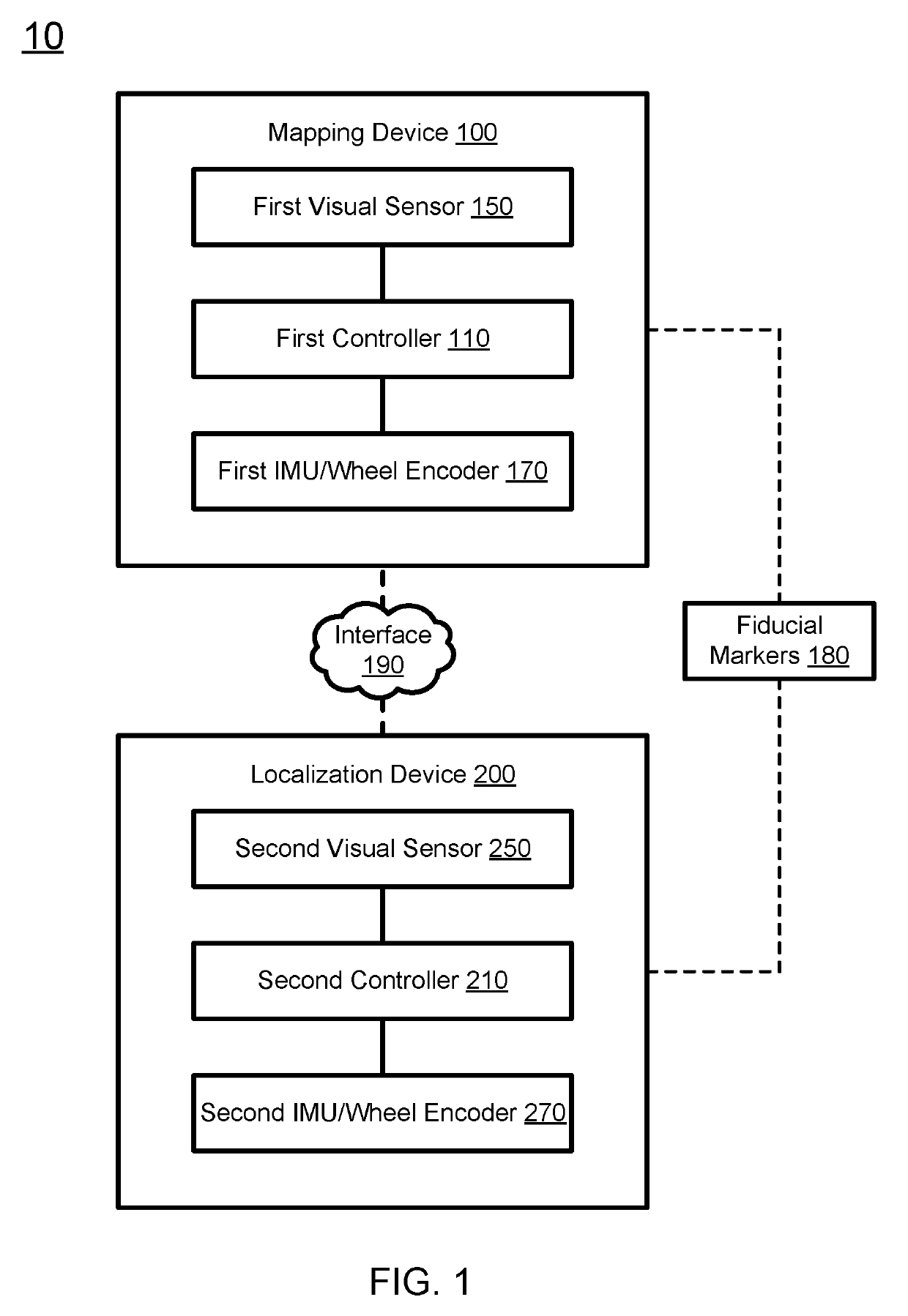
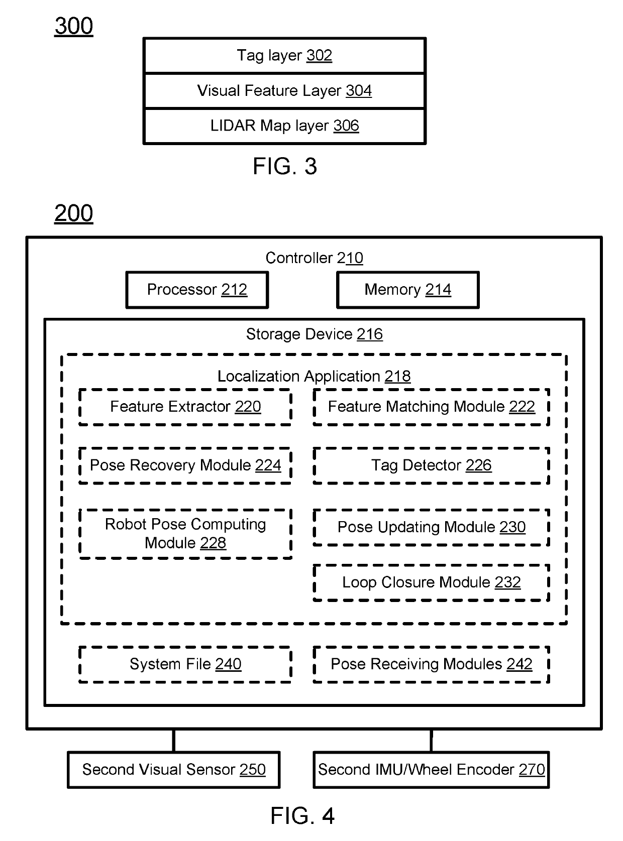
A system for mapping and localization includes first and second robotic devices and fiducial tags placed at predetermined positions of an environment. The quality of the first robotic device is better than the second robotic device. The first robotic device prepares a high resolution multilayer map, and the second robotic device uses the multilayer map for fast and accurate localization. The first robotic device has a visual sensor and a light detection and ranging (LIDAR) device, and is configured to prepare the multilayer map by: constructing a feature point cloud layer of the environment using images captured by the visual sensor; building a tag layer comprising identifications and locations of the tags; constructing an occupancy map using LIDAR scans; and forming the multilayer map having the feature point cloud layer, the tag layer, and the occupancy map layer, which share the same coordinate system.

Description

FIELD OF THE INVENTION[0001]The present invention relates generally to the field of image processing, and more particularly to systems and methods for fast robot localization using multimodal.BACKGROUND OF THE INVENTION[0002]The background description provided herein is for the purpose of generally presenting the context of the invention. Work of the presently named inventors, to the extent it is described in this background section, as well as aspects of the description that may not otherwise qualify as prior art at the time of filing, are neither expressly nor impliedly admitted as prior art against the present invention.[0003]In robotics research, simultaneous localization and mapping (SLAM) can be implemented in many ways in combination with different sensor modalities, including light detection and ranging (LIDAR), camera, inertial measurement unit (IMU), global positioning system (GPS), etc. However, it is a challenge to achieve instant pose recovery and instant localization. ...

Claims


Application Information

Patent Timeline
Patent Type & Authority Applications(United States)
IPC IPC(8): B25J9/16G01S17/89G06T7/73
CPCG06T7/73B25J9/1697G06T2207/10028B25J9/1694B25J9/1664Y10S901/47G01S17/89G06T2207/10004G01C21/165G01C21/20G06T7/74G06T2207/30252G05D1/0274G06T2207/30244G05D1/0248G05D1/027G05D1/0234
Inventor QI, CHENGZHICHENG, HUI
Owner BEIJING JINGDONG SHANGKE INFORMATION TECH CO LTD
Learn More