
Aiding location determinations in satellite positioning system receivers

a satellite positioning system and location determination technology, applied in the field of wireless receivers, can solve the problems of poor satellite geometry, excessive position error, and inability to acquire three or four satellites, and achieve the accuracy of position computation of e-otd location technology, which is often less than the accuracy requirements

Inactive Publication Date: 2005-01-04
CSR TECH INC
View PDF13 Cites 189 Cited by
  • Summary
  • Abstract
  • Description
  • Claims
  • Application Information

AI Technical Summary

Problems solved by technology

Acquisition of three or four satellites however may not always be possible, for example, when attempting to determine location from inside buildings and in other areas where satellite signal strength is attenuated.
Even where satellite signal strength is not an issue, poor satellite geometry may produce excessive position error.
The position computation accuracy of E-OTD location technology however is often less than the accuracy requirements imposed by the FCC for E-911 compliance.
The inaccuracies of E-OTD location computations are attributed largely to its relatively poor measurement quality and to its susceptibility to signal multi-path interference.

Method used


Image

  • Aiding location determinations in satellite positioning system receivers
  • Aiding location determinations in satellite positioning system receivers
  • Aiding location determinations in satellite positioning system receivers

Examples


Embodiment Construction

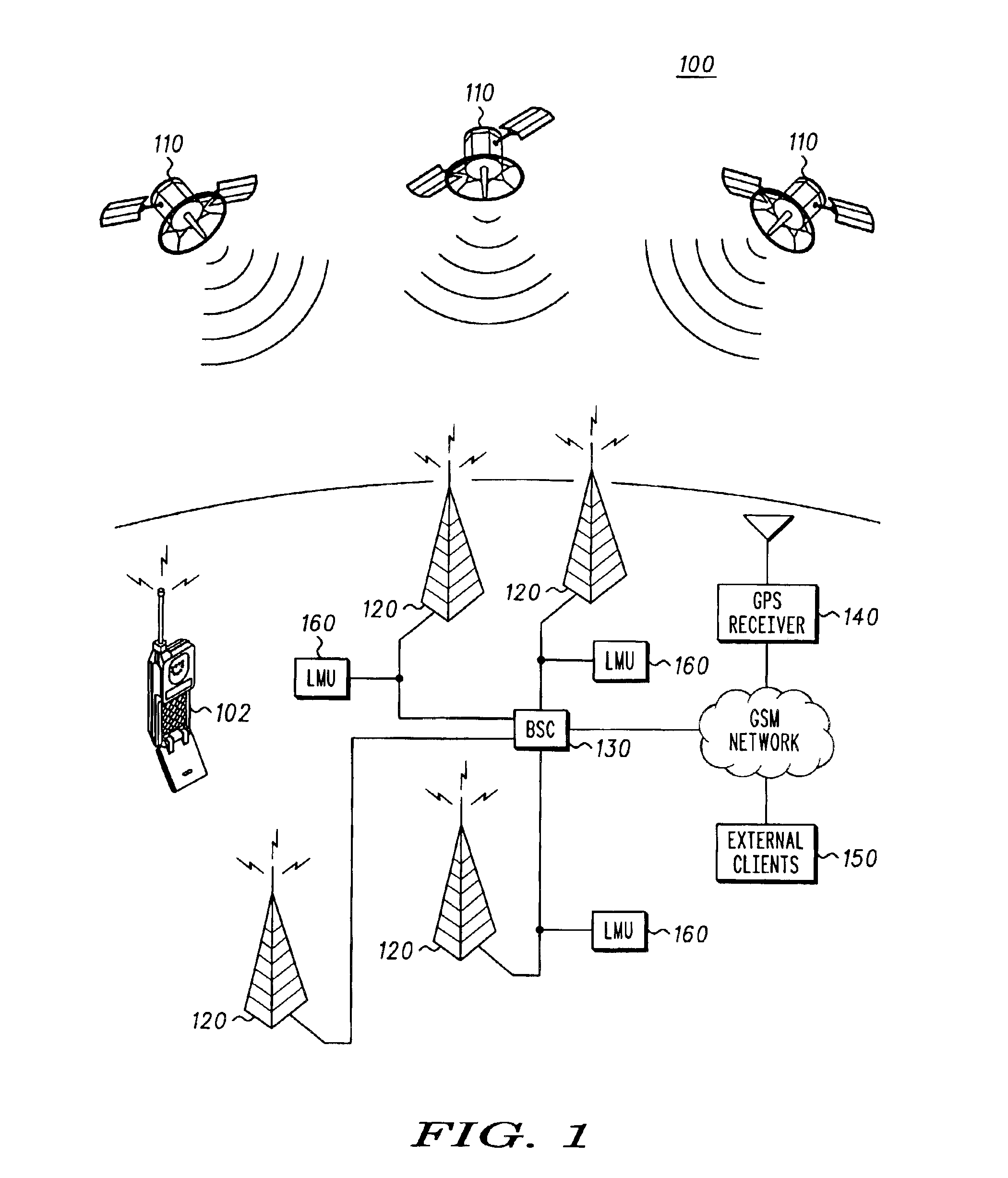
FIG. 1 illustrates an exemplary wireless communications network in the form of a Global System for Mobile communications (GSM) network 100 that provides wireless communications for GSM mobile wireless communication devices, for example, mobile station (MS) 102, also referred to herein as mobile wireless communications devices or as user equipment. The mobile wireless communication devices may be wireless cellular telephones, or two-way pagers, or wireless enabled personal digital assistants (PDAs) or notebook or laptop computers, or other radio communications devices, anyone of which may be a cellular communications service subscriber device or subscriber terminal.

According to one aspect of the disclosure, the mobile station 102 is a satellite receiver equipped mobile station, for example, a satellite positioning system (SPS) enabled mobile station or a satellite transceiver enabled mobile station. FIG. 1 illustrates a plurality of satellites 110, which may constitute part of an ear...


PUM


Abstract

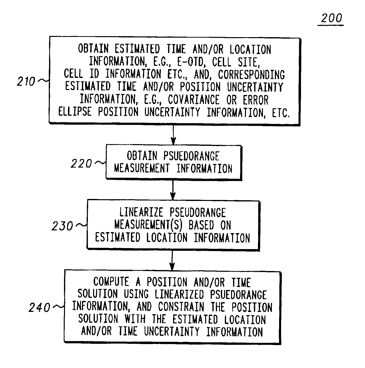
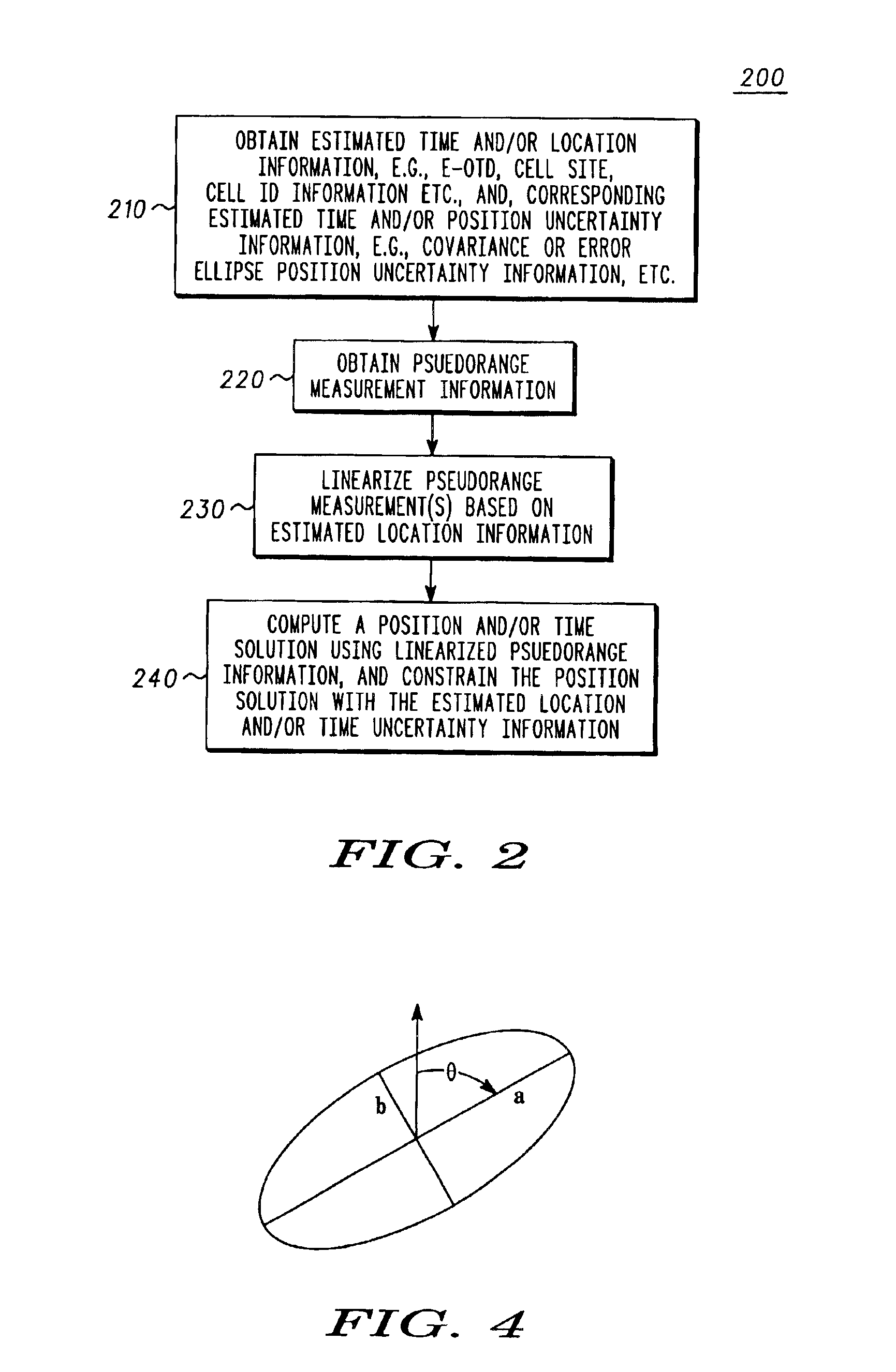
A method for locating a satellite positioning system receiver, for example, a satellite positioning system enabled wireless communications device in cellular network, including obtaining a coarse position and / or a time estimate (210), and computing a satellite positioning system based position and / or time solution (240) that is constrained by uncertainty information associated with the coarse position and / or a time estimate. The uncertainty constraints may also be used to identify erroneous measurements used to compute the position solution.

Description

FIELD OF THE DISCLOSUREThe present disclosure relates generally to locating wireless receivers, and more particularly to constraining satellite positioning system based location determinations using uncertainty information, for example, coarse location and / or coarse time uncertainty information in satellite positioning system enabled wireless communications devices, and methods therefor.BACKGROUND OF THE DISCLOSUREThe use of Global Positioning System (GPS) based location determinations in cellular telephone handsets to satisfy the E-911 location requirement mandated by the Federal Communications Commission (FCC) and to support value-added commercial applications requires that the GPS receiver embedded in the cellular handset acquire a minimum of numbers GPS satellites having an acceptable geometrical configuration. If altitude is known reasonably accurately, the GPS receiver may compute its location upon acquiring at least threes satellites, otherwise at least four satellites must b...

Claims


Application Information

Patent Timeline
Patent Type & Authority Patents(United States)
IPC IPC(8): G01S1/00
CPCG01S19/06G01S19/50G01S19/42
Inventor GEIER, GEORGE J.DECLERCK, WILLIAM P.KING, THOMAS M.STEPHEN, JAMES EDWARD
Owner CSR TECH INC
Learn More