Eureka AIR delivers breakthrough ideas for toughest innovation challenges, trusted by R&D personnel around the world.

System for estimating thickness of thin subsurface strata

a thin subsurface strata and thickness technology, applied in the field of seismic data processing, can solve the problems of blurring the image of the subsurface, insufficient seismic data resolution, and inability to accurately depict thin subsurface strata with clarity,

Inactive Publication Date: 2006-01-10
APACHE CORPORATION
View PDF6 Cites 13 Cited by
  • Summary
  • Abstract
  • Description
  • Claims
  • Application Information

AI Technical Summary

Problems solved by technology

However, the resolution of seismic data is not fine enough to depict “thin” beds with clarity.
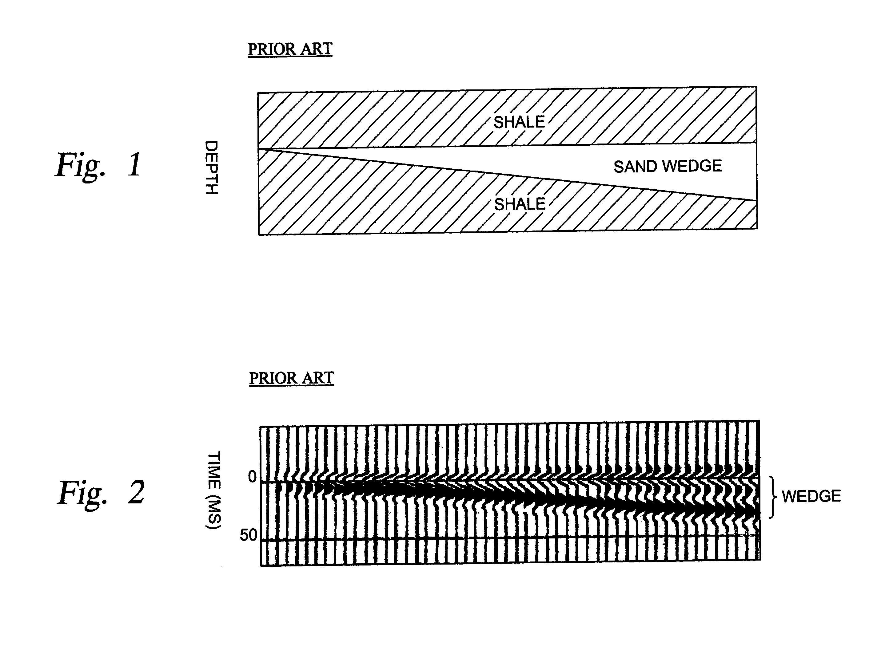
Where a stratum (or layer) in the earth's subsurface is not sufficiently thick, the returning reflection from the top and the bottom of the layer overlap, thereby blurring the image of the subsurface.
The success of this method is limited because of the need for careful seismic processing in order to establish the correct wavelet phase and to control the relative trace-to-trace seismic trace amplitudes.

Method used


Image

  • System for estimating thickness of thin subsurface strata
  • System for estimating thickness of thin subsurface strata
  • System for estimating thickness of thin subsurface strata

Examples


Embodiment Construction

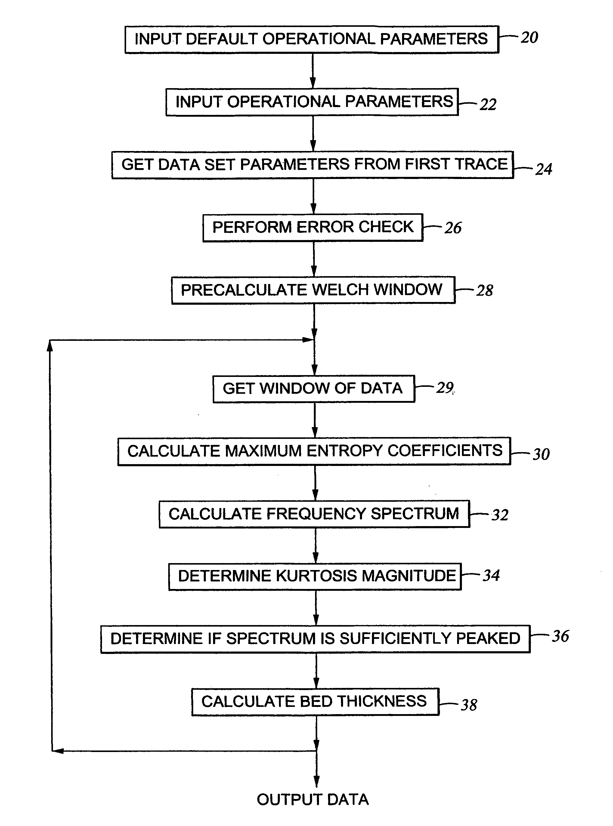
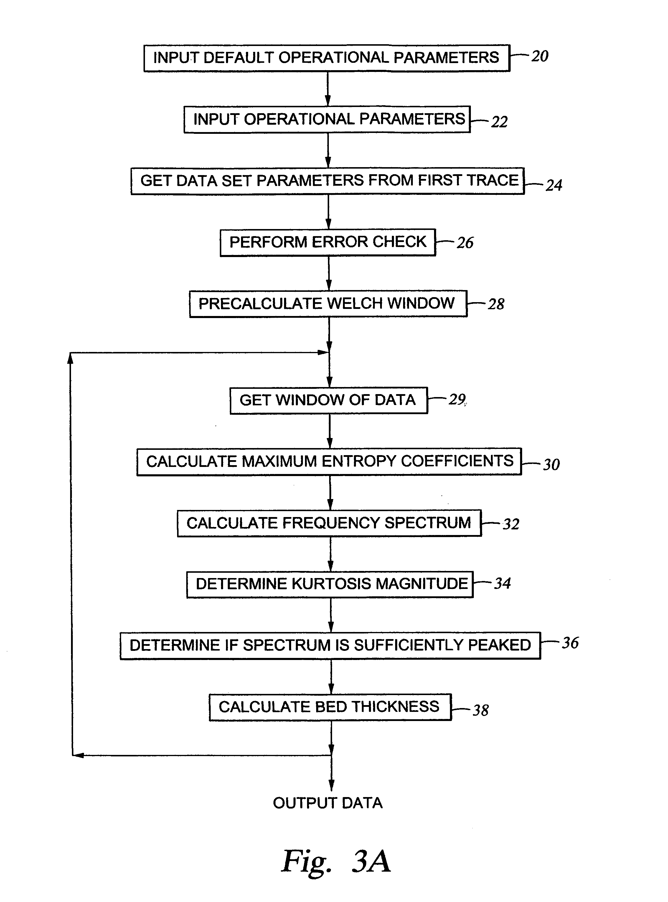
[0032]The invention comprises a system for processing seismic data to detect the presence of thin beds. The data may be either two-dimensional (2-D) data gathered at a succession of data points along a line on the earth's surface, or the data may be three-dimensional (3-D) data gathered from seismic data points distributed, typically in a grid pattern, within an area of the earth's surface. A seismic signal that is transmitted into the earth for purposes of conducting a seismic survey will typically include substantial energy within a frequency range extending from as low as 5 Hz. up to at least 60 Hz. When this energy reaches a thin bed in the earth's subsurface, a portion of the incident energy will be reflected from the upper interface of the thin bed and from the lower interface of the bed. If the bed were thicker, the reflection from the upper interface and from the lower interface would appear separately in the resulting seismic data and it would be possible to determine the b...


PUM


Abstract

The invention comprises a method for processing seismic data to generate data related to the location of thin beds in the earth's subsurface. Seismic data windows are defined extending over selected portions of a group of spatially related seismic data traces. Frequency spectra of successively selected windows of the seismic data are generated by applying a transform having poles on the unit z-circle, where z is the z-transform, to the data windows; and the frequency spectra are utilized to generate data related to the location of thin beds in the earth's subsurface.

Description

BACKGROUND OF THE INVENTION[0001]1. Field of the Invention[0002]This invention is related to seismic data processing. More specifically, the invention is related to a system for processing seismic data to more clearly delineate thin beds in the earth's subsurface.[0003]2. Description of Related Art[0004]A seismic survey is an attempt to map the subsurface of the earth by sending sound energy down into the ground and recording the reflected energy that returns from reflecting interfaces between rock layers below. On land, the source of the down-going sound energy is typically seismic vibrators or explosives. In marine environments the source is typically air guns. During a seismic survey, the energy source is moved across the earth's surface and a seismic energy signal is generated at successive locations. Each time a seismic energy signal is generated, the reflected energy is recorded at a large number of locations on the surface of the earth. In a two dimensional (2-D) seismic surv...

Claims


Application Information

Patent Timeline
IPC IPC(8): G06G7/48
CPCG01V1/32G01V2210/48G01V2210/63
Inventor JARCHOW, CRAIG M.
Owner APACHE CORPORATION
Why Eureka
Eureka Blog
Learn More