Method for using remotely sensed data to provide agricultural information

a technology of remote sensing and agricultural information, applied in the field of providing agricultural information, can solve the problems of skewing information on the area of interest, adverse effects of raw data, etc., and achieve the effects of reducing the adverse effects of the sensor and/or atmosphere, facilitating producers and and reducing the effect of atmospheric and/or other sources of skewing or error

Active Publication Date: 2006-06-27
JPMORGAN CHASE BANK NA
View PDF6 Cites 82 Cited by
  • Summary
  • Abstract
  • Description
  • Claims
  • Application Information

AI Technical Summary

Benefits of technology

[0005]The present invention reduces the adverse effects of the sensor and / or atmosphere so that more consistent agricultural information is produced thereby rendering the information easier for producers and others in the agricultural industry to utilize. In other words, the invention produces more consistent agricultural information between different areas of interest. Consequently, if a producer has two different areas of land that are each planted with the same crop, a particular type of agricultural information produced by the invention on each of the two areas is substantially consistently represented, thereby facilitating the producers ability to compare the two crops to one another.
[0006]In one embodiment, the present invention includes the steps of receiving information that defines the area of interest of the recipient of the agricultural information and receiving remote imaging data on the area of interest. The remote imaging data or raw data, which is typically produced by a sensor associated with a satellite or aircraft, is processed to produce reflectance factor data on the area of interest. To elaborate, the raw data is subject to effects that skew information on the area of interest. For example, the atmosphere between the area of interest and the sensor, whether satellite or aircraft based, if not taken into account, skews the agricultural information on the area of interest. By processing the raw data to produce reflectance factor data, the effects of the atmosphere and / or other sources of skewing or error are significantly reduced. The method further involves using the reflectance factor data to produce agricultural information on the area of interest. In one embodiment, the reflectance factor data is produced using agricultural scene objects.

Problems solved by technology

To elaborate, the raw data is subject to effects that skew information on the area of interest.

Method used


Image

  • Method for using remotely sensed data to provide agricultural information
  • Method for using remotely sensed data to provide agricultural information
  • Method for using remotely sensed data to provide agricultural information

Examples


Embodiment Construction

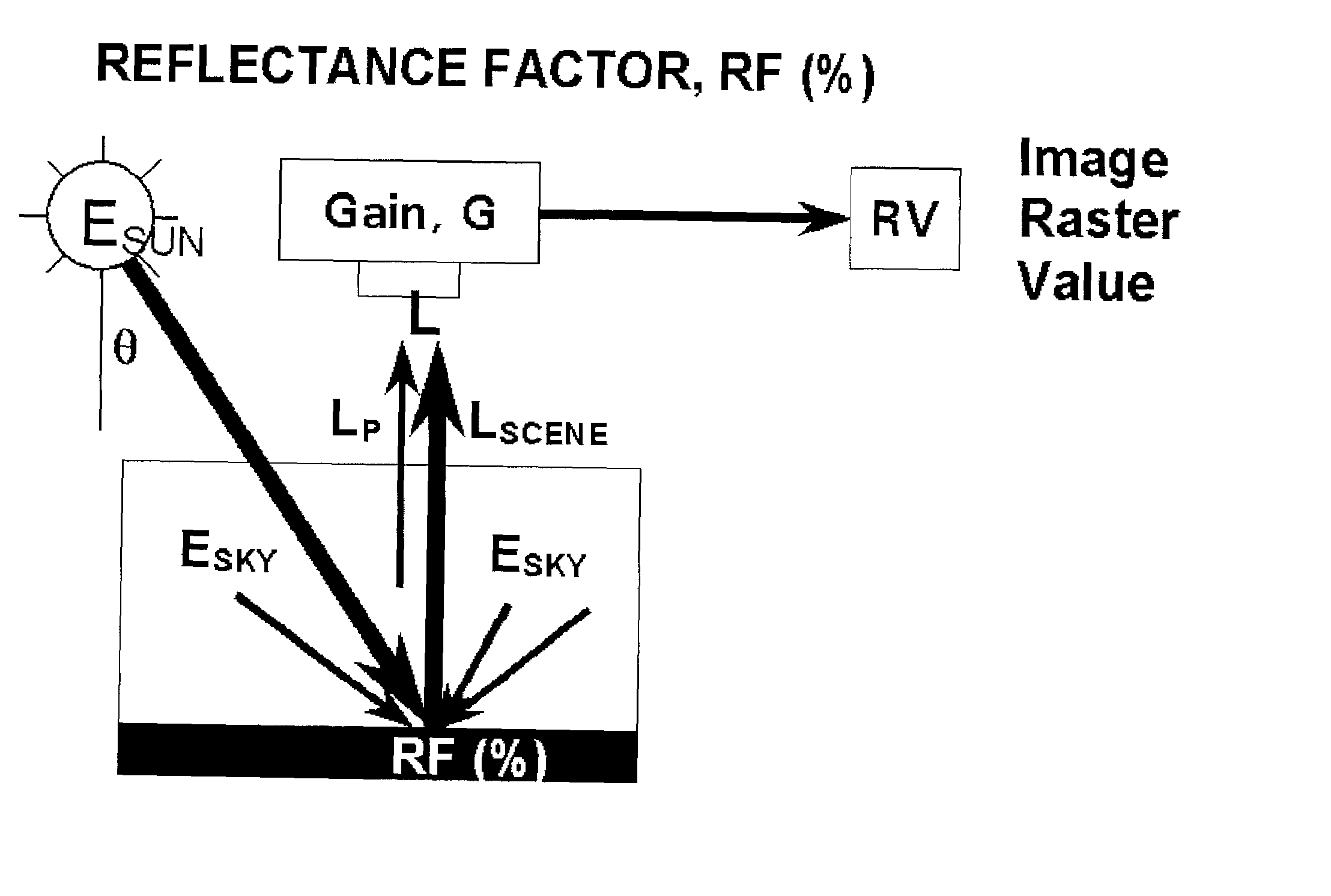
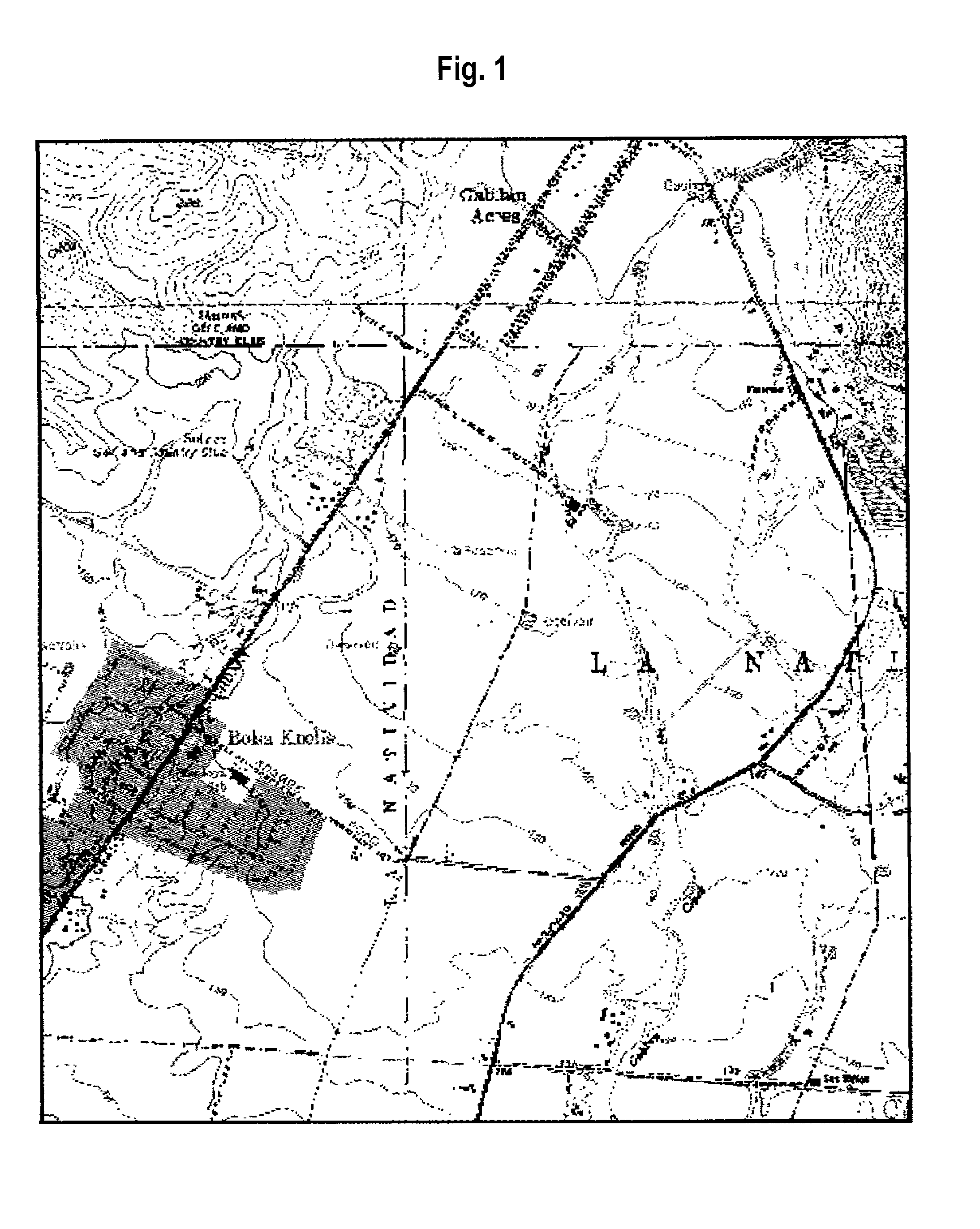
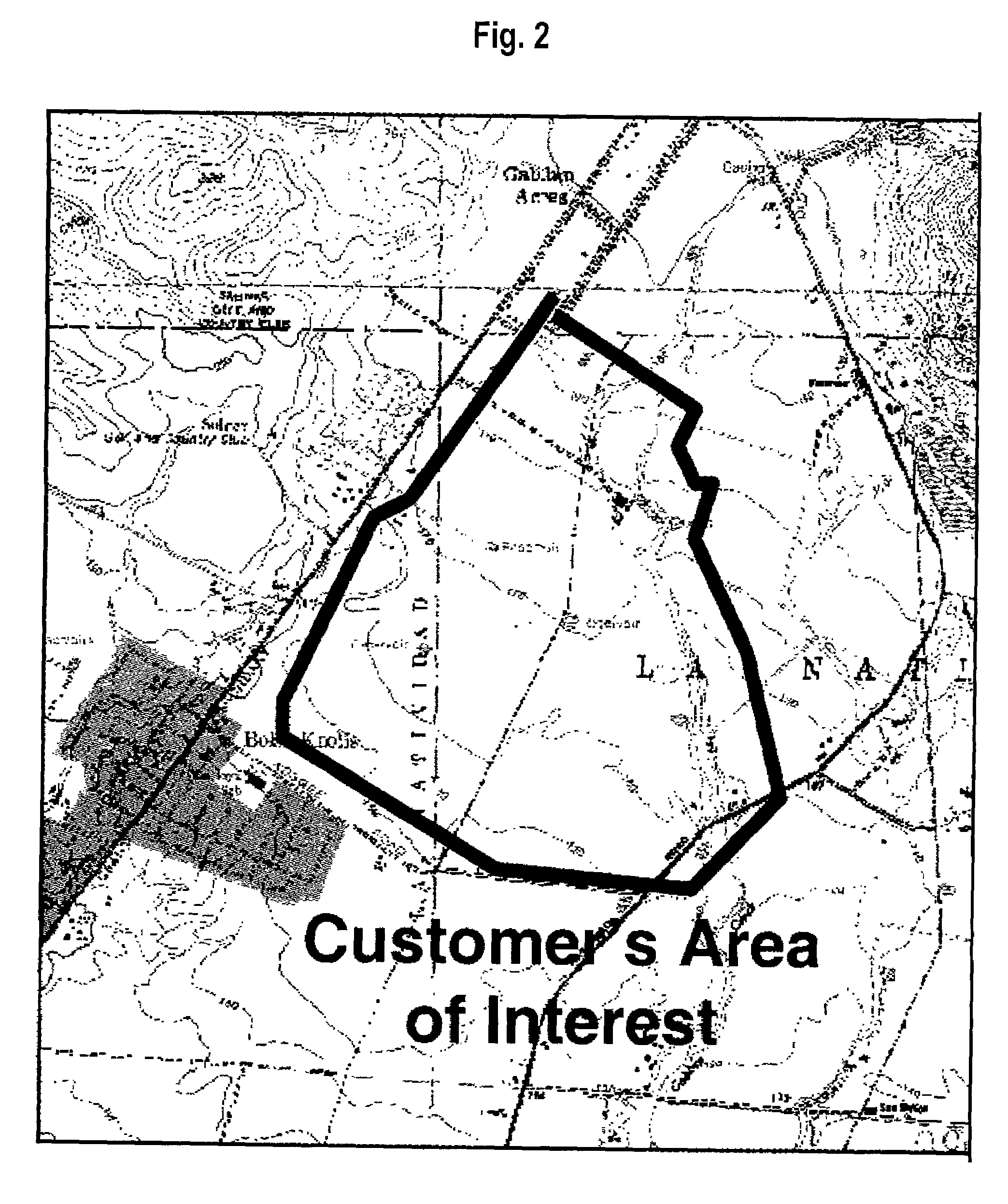
[0019]Generally, the present invention is directed to the production of agricultural information that is correlated to an area of interest (AOI), which is typically one or more fields. The process involved in producing the agricultural information includes receiving information that identifies the AOI, which is typically provided by the entity requesting the information. Also included in the process is receiving raw imaging data on the area of interest from which agricultural information on the AOI can be derived. The raw data is processed to produce reflectance factor data, thereby substantially reducing the skewing effects attributable to the atmosphere and the sensor used to produce the data. The reflectance factor data is further processed to produce agricultural information that is correlated to the AOI.

[0020]Having generally described the process for producing the agricultural information, an embodiment of the process is described in greater detail. To provide agricultural inf...


PUM


Abstract

The present invention is directed to a method for producing agricultural information on an area of interest, with the information based on raw, remote imaging data that is typically produced by a sensor associated with a satellite or aircraft. In one embodiment, the method includes processing raw, remote imaging data to produce reflectance factor data on the land of interest. The reflectance factor data is then used to produce agriculturally significant information. In one embodiment, a soil zone index map is produced for the land of interest. In another embodiment, the reflectance factor data is used to produce a green vegetation index map. In yet a further embodiment, the reflectance factor data at two points in time is used to produce a map for the land of interest that indicates the change in the green vegetation index over time.

Description

FIELD OF THE INVENTION[0001]The present invention is directed to a method for providing agriculture information on an area of interest, with the agricultural information being derived from the raw image data produced by a remote sensor associated with a remote sensing platform.BACKGROUND OF THE INVENTION[0002]The profit margins associated with the production and marketing of many crops have been generally decreasing for a number of years. This decrease in profit margins has caused many of the producers in the industry to turn to technology for information that facilitates the management of the crop producing land to increase the yield and / or reduce losses due to disease, drought and the like.[0003]Presently, one method for producing crop related information that allows the producers to manage crop producing land is to use remote sensing platforms (e.g., aircraft, satellites, and land vehicles) that are equipped with sensors that allow raw image data to be collected on the agricultur...

Claims


Application Information

Patent Timeline
Patent Type & Authority Patents(United States)
IPC IPC(8): G06K9/00
CPCA01B79/005G01N21/4738G06K9/00657G01N2021/4733G01N2021/1797G06V20/188
Inventor KNOBLAUCH, GREGORY E.DINVILLE, ANDREW P.PARIS, JACK F.
Owner JPMORGAN CHASE BANK NA
Why Eureka
Try Eureka