AINS land surveyor system with reprocessing, AINS-LSSRP
- Summary
- Abstract
- Description
- Claims
- Application Information
AI Technical Summary
Benefits of technology
Problems solved by technology
Method used
Image
Examples
Embodiment Construction
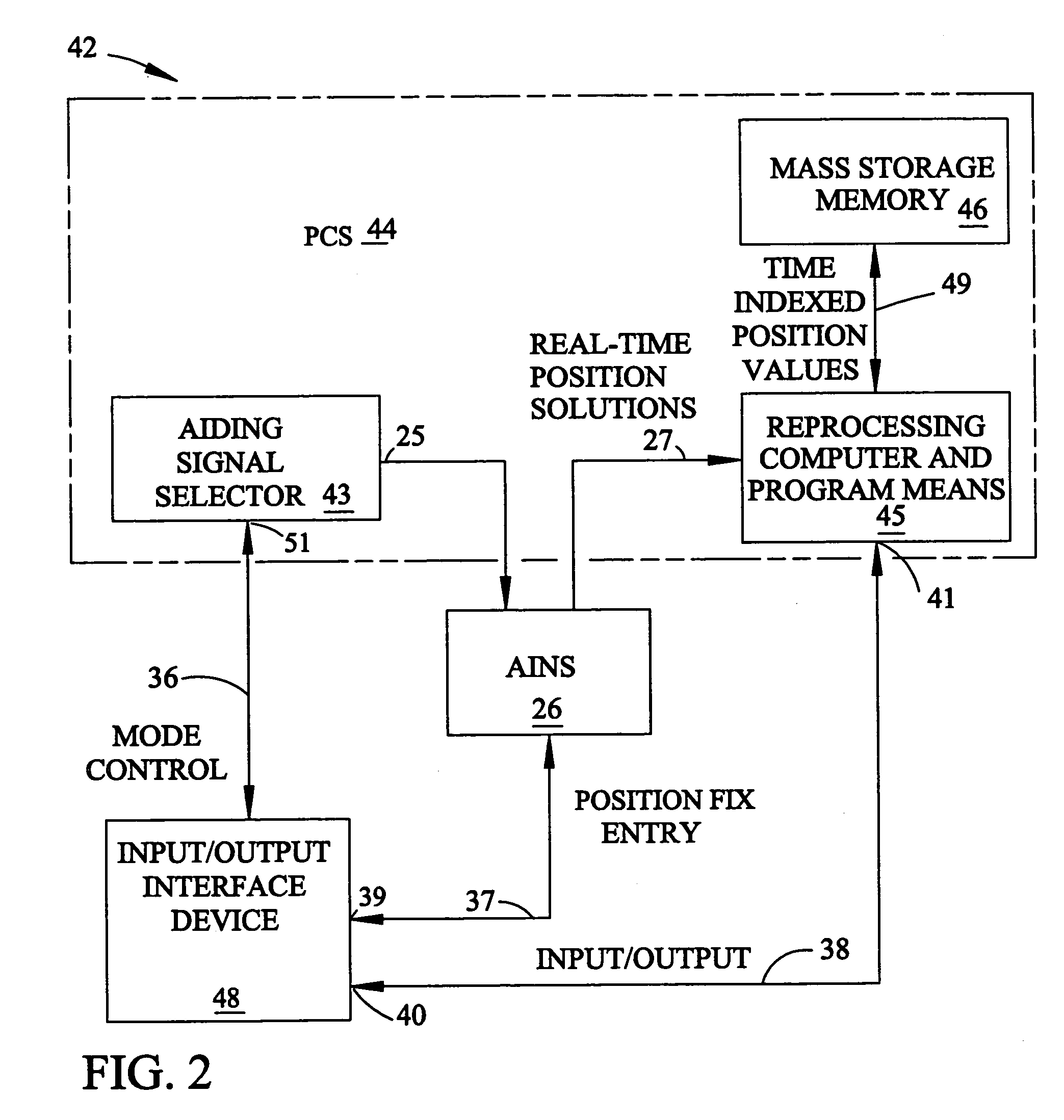
[0025]The invention taught herein improves the accuracy of reported stake positions by combining the benefits of an AINS, such as the AINS used in an Applanix Position and Orientation System for Land Survey (POS / LS) with the steps of onboard data reprocessing. The combination forms an AINS-Land Surveyor System with Reprocessing (AINS-LSSRP) represented by block 42 in FIG. 2. In operation and use, a surveyor begins a survey interval or leg from a position fix (PF) location having a precisely known location. The surveyor initializes the present position of his AINS-LSSRP using differential GPS or a pre-surveyed marker. The surveyor then follows predetermined survey lines or paths that run for several kilometers in accordance with desired grid locations on a map. The surveyor may follow a zigzag pattern where the survey lines go into tree covered areas and where GPS contact is sometimes lost. In some rain forests, such as those in Indonesia, GPS can be lost for an entire day. The surve...
PUM
 Abstract
Description
Claims
Application Information
 - R&D
- Intellectual Property
- Life Sciences
- Materials
- Tech Scout
- Unparalleled Data Quality
- Higher Quality Content
- 60% Fewer Hallucinations
Browse by: Latest US Patents, China's latest patents, Technical Efficacy Thesaurus, Application Domain, Technology Topic, Popular Technical Reports.
© 2025 PatSnap. All rights reserved.Legal|Privacy policy|Modern Slavery Act Transparency Statement|Sitemap|About US| Contact US: help@patsnap.com


