System and method for facilitating ad hoc compilation of geospatial data for on-line collaboration

a geospatial data and ad hoc technology, applied in the field of online data collaboration, can solve the problems of inability to share personalized travel information, information may not be of the type or caliber sought, and esoteric information is rar

Active Publication Date: 2008-12-16
GROUNDSPEAK
View PDF23 Cites 17 Cited by
  • Summary
  • Abstract
  • Description
  • Claims
  • Application Information

AI Technical Summary

Problems solved by technology

However, such information generally remains personal to the user, unless specifically shared or posted through some form of digital data communications, such as e-mail, text messaging, or Web sites.
However, other readers must use search engines or similar technologies to mine pertinent travel information out of the blog and, once found, such information may not be of the type or caliber sought.
These databases are often well-indexed and searchable, but esoteric information is rare and the sharing of personalized travel information is generally unsupported or unavailable.
Furthermore, locations of arcane or limited interest, such as vacuum cleaner museums, may not be available in locational information databases.
As well, these types of locations may not be of a sufficient interest level to warrant the time and expense of a dedicated Web site for those aficionados so inclined.
Moreover, the structure and content is generally managed by a private database administrator, which does not allow for shared on-line customization or collaboration.

Method used


Image

  • System and method for facilitating ad hoc compilation of geospatial data for on-line collaboration
  • System and method for facilitating ad hoc compilation of geospatial data for on-line collaboration
  • System and method for facilitating ad hoc compilation of geospatial data for on-line collaboration

Examples


example web pages

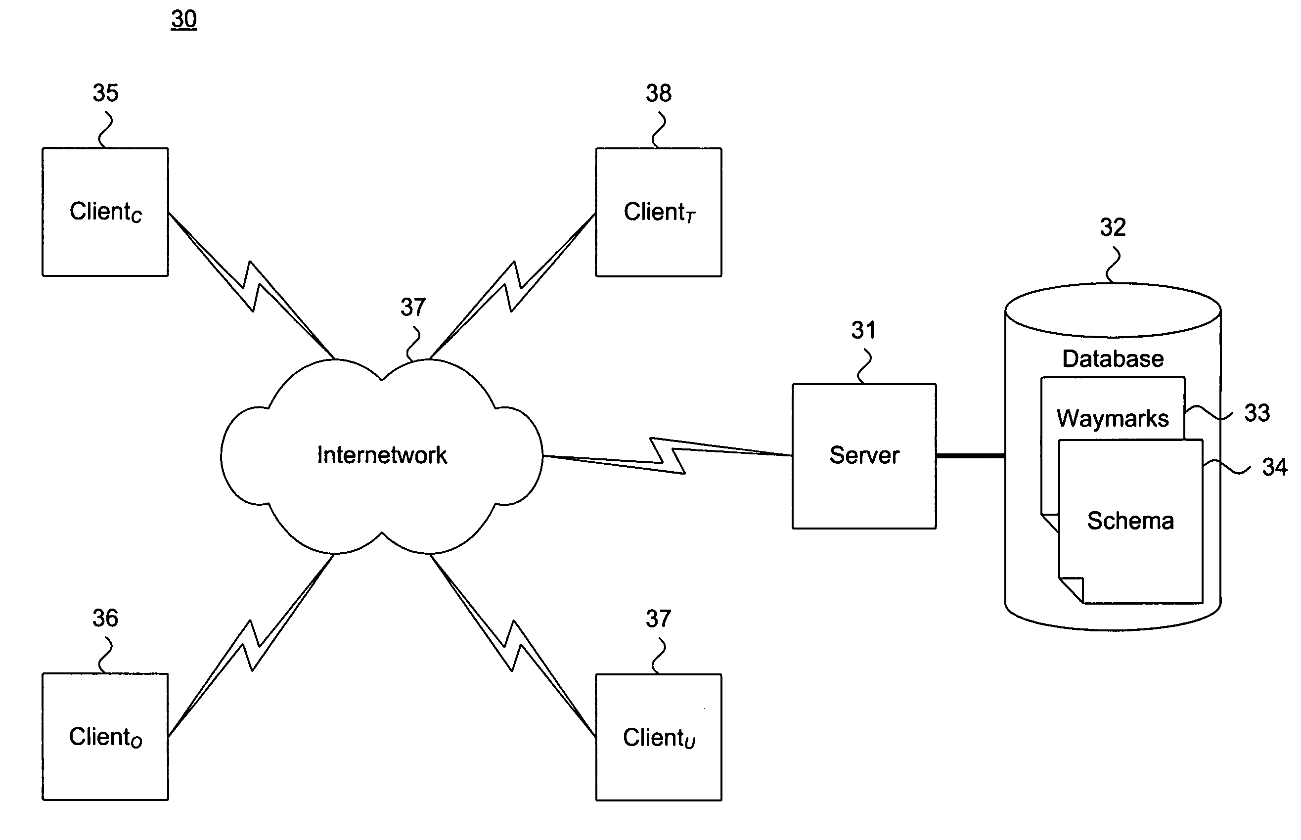
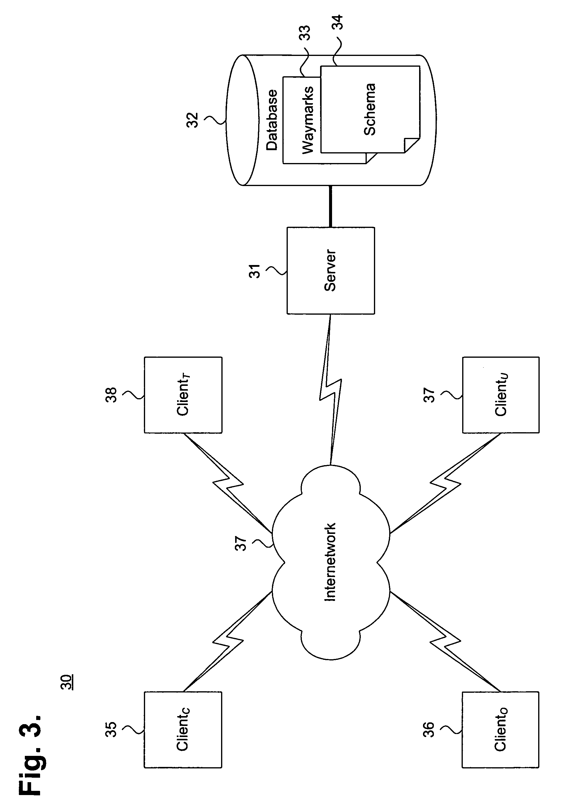
[0044]A standardized Web-based user interface allows on-line clients 35, 36, 37 that are executing Web browsers to manage, navigate, and search the waymarks. FIG. 8 is a screen shot 80 showing, by way of example, a Web page 81 for navigating a set of directories 82 of waymarks 44. To facilitate navigation in an outline format, the set of directories 82 are presented as links to Web pages of individual categories. In addition, the set of directories presented can be refined by applying a filter 83 to limit scope.

[0045]A creator 61 can edit their own categories. FIG. 9 is a screen shot 90 showing, by way of example, a Web page 91 for editing a category 92 of waymarks. The creator 61 can edit the category to modify the properties that are displayed to waymark owners 62 and users 63. Other options 93 could be available, for instance, to add variables, manage the category, transfer ownership, and view variables.

[0046]Similarly, a creator 61 can manage the variables currently defined for ...


PUM


Abstract

A system and method for facilitating ad hoc compilation of geospatial data for on-line collaboration is provided. One or more categories under which to store waymarks in a geospatial data sharing database with an exportable schema are dynamically defined. Each waymark associates geospatial data with metadata as an unstructured information cache. At least one variable is dynamically associated with each such category to identify the metadata. One or more attributes specifying a type of metadata storable in identity are defined with each such variable. The categories are published on-line by storing the geospatial data and the metadata as waymarks under one such category and accessing the stored waymarks in response to user requests.

Description

FIELD OF THE INVENTION[0001]The invention relates in general to on-line data collaboration and, specifically, to a system and method for facilitating ad hoc compilation of geospatial data for on-line collaboration.BACKGROUND OF THE INVENTION[0002]Global Positioning System (GPS) receivers have become increasingly popular as personal navigational aids and, more frequently, as features integrated into consumer electronics, such as cellular telephones and wireless personal data assistants, as well as automobile navigation systems. GPS signals are received from a constellation of navigational satellites and processed into locational coordinates. GPS receivers are passive devices that provide locational data only, which must be combined with maps, charts, and other navigational aids to bring meaning to the latitude and longitude coordinates. Integrating GPS receivers into consumer electronics or navigation systems has enabled users to retrieve helpful travel-related information and, in so...

Claims


Application Information

Patent Timeline
Patent Type & Authority Patents(United States)
IPC IPC(8): G06F7/00G06F17/30G01S19/17G01S19/05G01S19/07G01S19/20G01S19/41
CPCG06F17/30241G06F17/30873G06F17/30595Y10S707/99932Y10S707/99933G06F16/284G06F16/29G06F16/954
Inventor IRISH, JEREMY A.BOOTS, SEAN E.ALVORD, ELIAS C.
Owner GROUNDSPEAK
Why Eureka
Try Eureka