
GPS data management module for use in location-based service systems

a technology of location-based service and data management module, which is applied in the direction of location information based service, instruments, measurement devices, etc., can solve the problems of reducing the efficiency and accuracy of gps measurements, reducing the efficiency of gps-based lbs indoors, and lack of consistent positioning coverage as a user commutes from one coverage area to another

Active Publication Date: 2012-09-11
RADIO IP SOFTWARE
View PDF47 Cites 3 Cited by
  • Summary
  • Abstract
  • Description
  • Claims
  • Application Information

AI Technical Summary

Benefits of technology

"The invention provides a location based service system that includes a mobile client with a GPS device for determining its position and a server for monitoring the position. The client communicates its position to the server if the GPS device does not provide access through a wireless communication protocol. The system can also automatically access the position through the network and communicate it to the server if needed. The technical effect of this invention is to enable accurate and efficient location based services for mobile clients."

Problems solved by technology

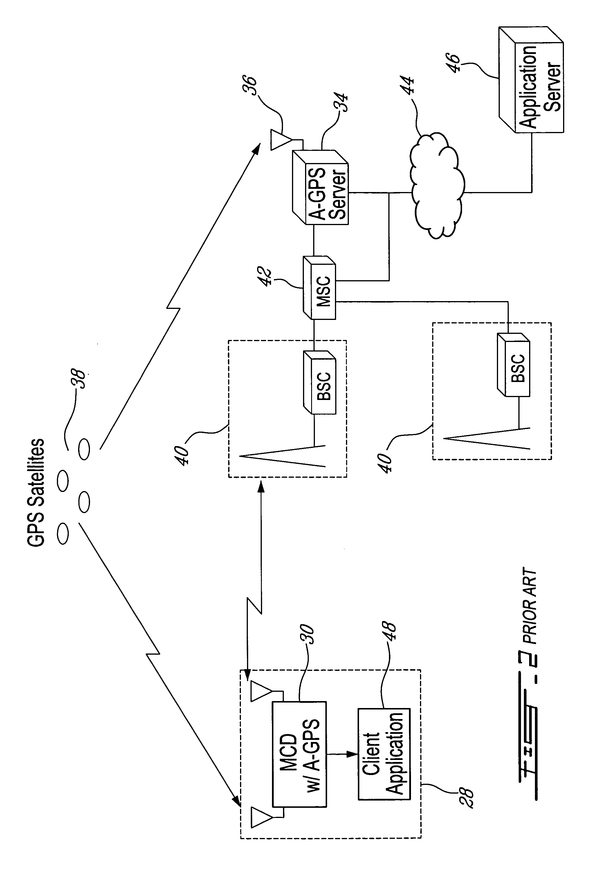
Consequently, a GPS-based LBS will be far less efficient indoors, or even in a dense urban setting where signal interference and multiple reflections may drastically reduce the efficiency and accuracy of GPS measurements.
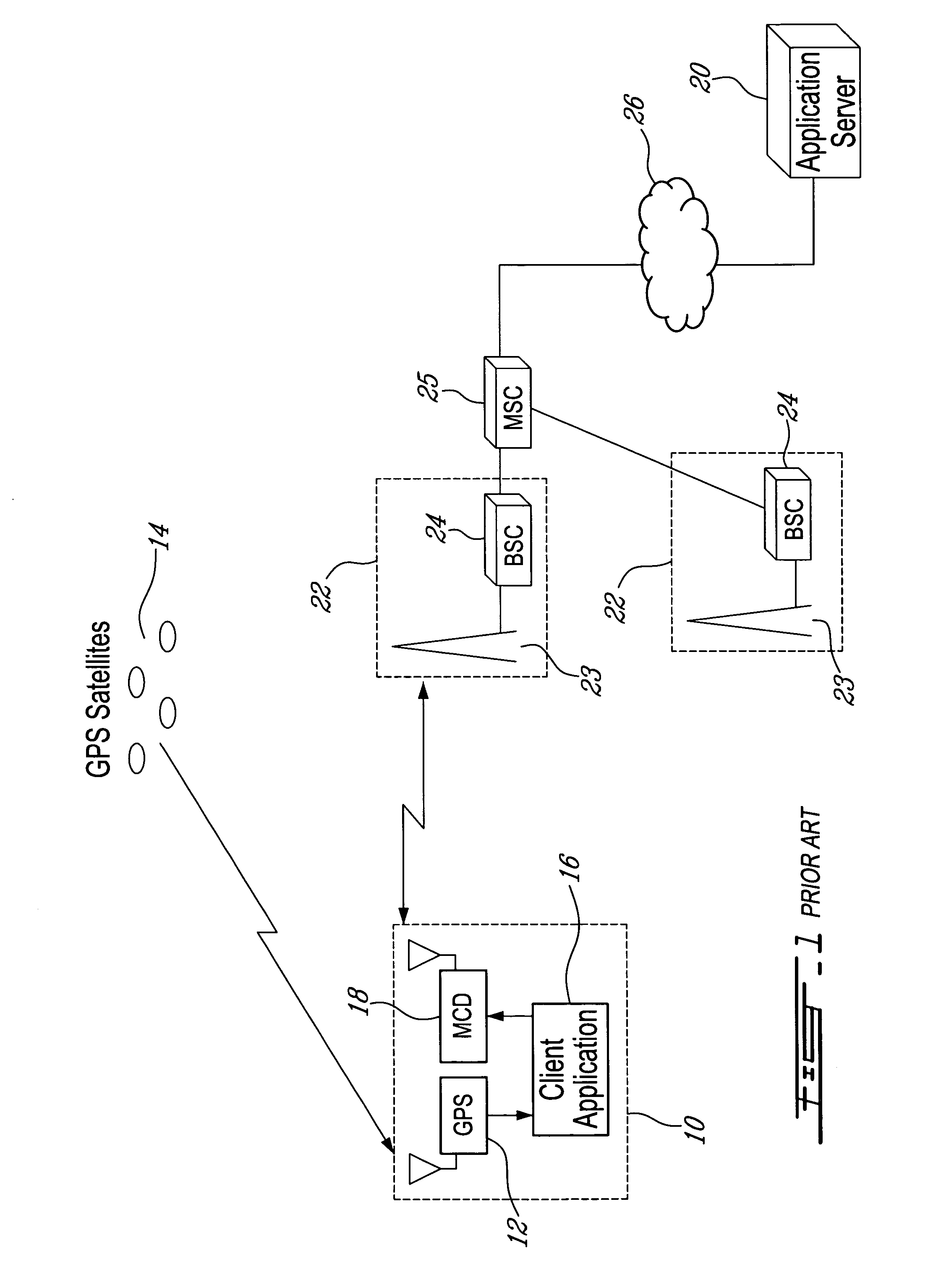
Furthermore, since a stand-alone GPS receiver does not generally provide a communication link with any public or proprietary wireless communication network, the GPS receiver will be coupled with an appropriate mobile communication device (MCD) to communicate its position to an LBS platform and application server through a supported wireless network.
One particular limitation of prior art AVL systems, and generally of LBS systems, is the lack of consistent positioning coverage as a user commutes from one coverage area to another.
For instance, a user equipped with a GSM based A-GPS mobile device may not get full coverage in a CDMA rich area.
Furthermore, as network structures and technologies evolve, a user equipped with state-of-the-art instrumentation may not get satisfactory coverage in areas still served by legacy networks, and vice versa.
For example, some digital MCDs were not developed to operate within analogue networks, or again, are not compatible with competing digital networks.
Consequently, though the above user may be well equipped in one area, the equipment may lose positioning accuracy and efficiency in another area, or lose coverage entirely.
Alternatively, an LBS for criminal tracking may also require a reliable and consistent tracking mechanism; however, prior art LBS systems are not configured to address plural GPS and communication resources.
Consequently, prior art LBS clients may get confused in the presence of plural GPS sources, particularly in the presence of both GPS and A-GPS sources where data may or may not need to be sent by the client application to the application server.

Method used


Image

  • GPS data management module for use in location-based service systems
  • GPS data management module for use in location-based service systems
  • GPS data management module for use in location-based service systems

Examples


Embodiment Construction

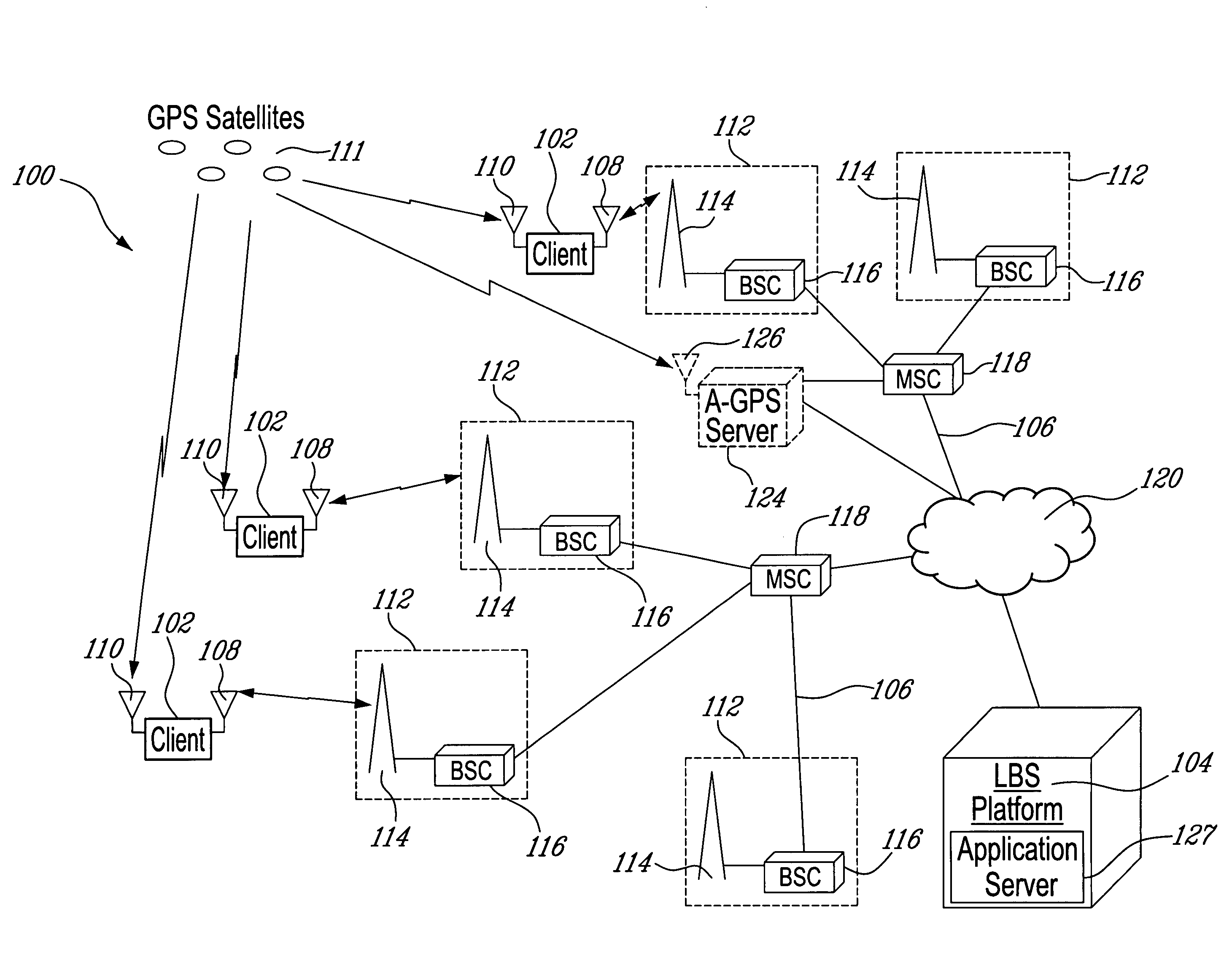
[0036]Referring to FIG. 3, a location-based service (LBS) system, generally referred to using the reference numeral 100 and in accordance with an example embodiment of the invention, will now be presented. As will be further discussed hereinbelow, the LBS system 100, as described herein, may comprise any suitable LBS system using GPS positioning solutions. Namely, the system 100 provides users the option to combine plural radio and GPS sources within a single client for increased radio and GPS coverage. In an automatic vehicle location (AVL) system, for example, this feature reduces the likelihood that the service provider will lose contact with and / or lose track of its clients at any time.

[0037]Still referring to FIG. 3, the LBS system 100 generally comprises at least one mobile client as in 102 in communication with an LBS platform 104 using at least one wireless communication network as in 106. Each client 102 is generally equipped with at least one mobile communication device (M...


PUM


Abstract

A system and method are presented to provide radio and GPS coverage versatility in a location-based service (LBS) system, such as an automatic vehicle location (AVL) system. A mobile client in communication with one or more servers of an LBS system includes one or more mobile communication devices and one or more GPS devices for establishing a position of the client. The client is configured to determine whether none of the one or more GPS devices provide the server access to the position through a wireless protocol implemented therewith, or whether the position should be communicated to the server using the one or more communication devices.

Description

CROSS REFERENCE TO RELATED APPLICATIONS[0001]This application claims priority on U.S. Provisional Patent Application No. 60 / 712,830 filed on Sep. 1, 2005. The entire content of which is herein incorporated by reference.FIELD OF THE INVENTION[0002]The disclosure relates to a Global Positioning System (GPS) data management module that is used in managing GPS data and, in particular, to a GPS data management module for use in location-based service (LBS) systems.BACKGROUND OF THE INVENTION[0003]The advancement of wireless communication technologies and networking systems has provided users of such technologies a variety of communication services. Namely, wireless communication services provide, amongst others, voice, email, internet, messaging and data communications between various wireless, network and wireline devices connected directly or indirectly to any one or more of numerous existing wireless networks in operation around the globe.[0004]One type of wireless service gaining pop...

Claims


Application Information

Patent Timeline
Patent Type & Authority Patents(United States)
IPC IPC(8): H04W24/00G01S19/14H04W4/02H04W4/021H04W4/029
CPCG01S5/0018H04W4/02H04W4/04H04W4/021H04W4/029
Inventor EMOND, GERMAIN
Owner RADIO IP SOFTWARE
Learn More