Use of self and neighboring vehicle GPS/GNSS data to estimate current and approaching sky visibility changes
a technology for estimating the change in visibility of the sky and the distance, applied in the field of vehicle satellite navigation systems, can solve the problems of affecting the accuracy of vehicle positioning,
- Summary
- Abstract
- Description
- Claims
- Application Information
AI Technical Summary
Benefits of technology
Problems solved by technology
Method used
Image
Examples
Embodiment Construction
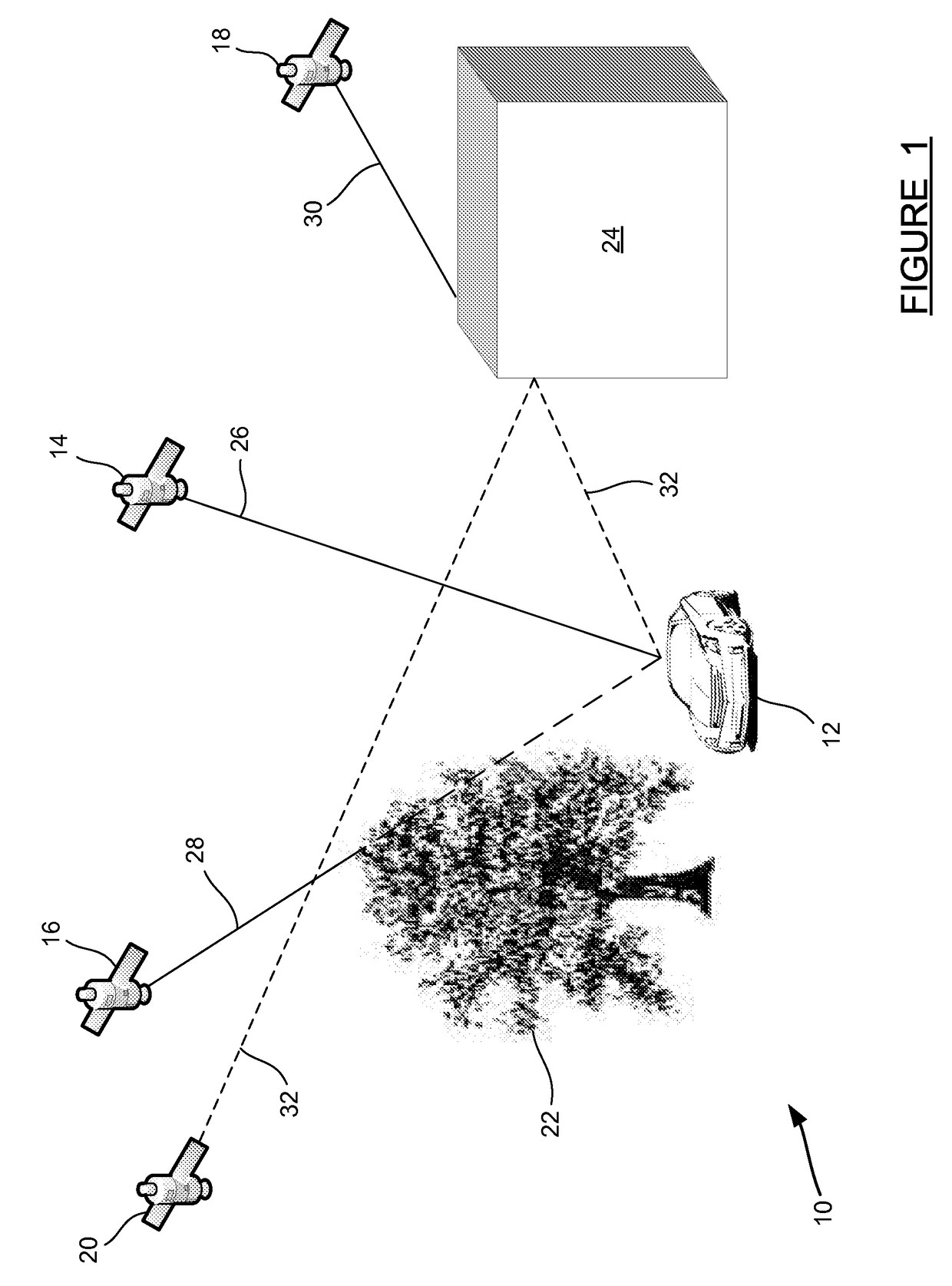
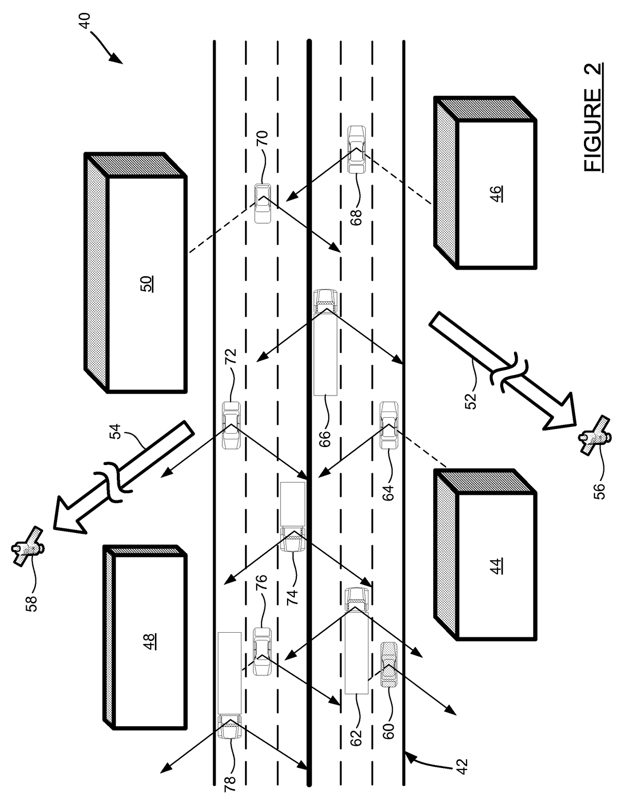
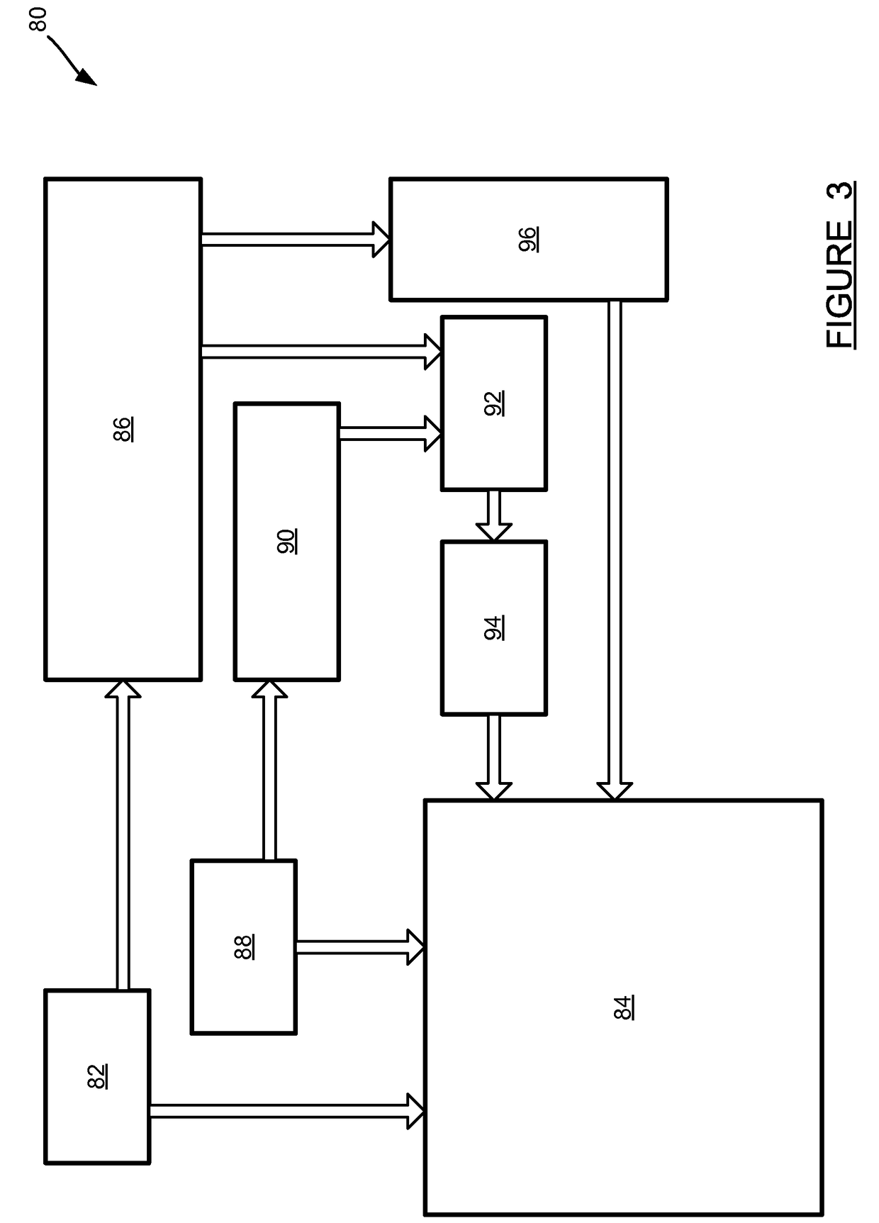
[0013]The following discussion of the embodiments of the invention directed to a method for constructing a sky visibility map is merely exemplary in nature, and is in no way intended to limit the invention or its applications or uses.
[0014]Global Navigation Satellite Systems (GNSS) is the generic name given to satellite-based navigation systems. The Global Positioning System (GPS) in the United States, and GLONASS in Russia are examples of fully operational Global Navigation Satellite Systems. Systems in Europe (Galileo) and China (Compass) are also planned for full GNSS capability. Using GNSS, a receiver device can determine its location (latitude and longitude) and elevation, as long as it can receive a signal from four or more GNSS satellites simultaneously. This is the case in standalone GNSS operation as the receiver has four unknowns to estimate, three position unknowns and the timing error. GNSS aiding techniques may reduce this requirement to three or even fewer satellites, ...
PUM
 Abstract
Description
Claims
Application Information
 - R&D
- Intellectual Property
- Life Sciences
- Materials
- Tech Scout
- Unparalleled Data Quality
- Higher Quality Content
- 60% Fewer Hallucinations
Browse by: Latest US Patents, China's latest patents, Technical Efficacy Thesaurus, Application Domain, Technology Topic, Popular Technical Reports.
© 2025 PatSnap. All rights reserved.Legal|Privacy policy|Modern Slavery Act Transparency Statement|Sitemap|About US| Contact US: help@patsnap.com


