

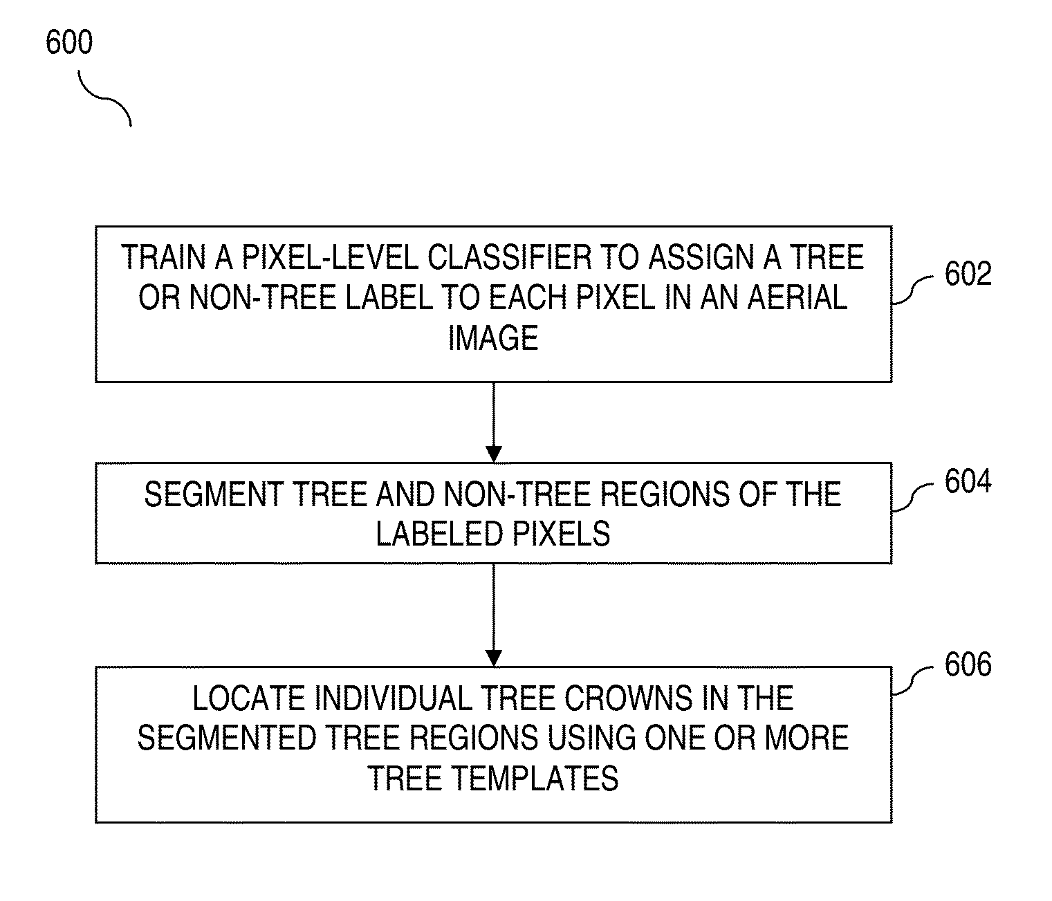
Tree detection form aerial imagery
a tree detection and aerial imagery technology, applied in the field of image detection and satellite and aerial imagery, can solve the problems of inability to directly apply features to tree detection, limited remote sensing imagery,
- Summary
- Abstract
- Description
- Claims
- Application Information
AI Technical Summary
Benefits of technology
Problems solved by technology
Method used
Image

Examples
Embodiment Construction
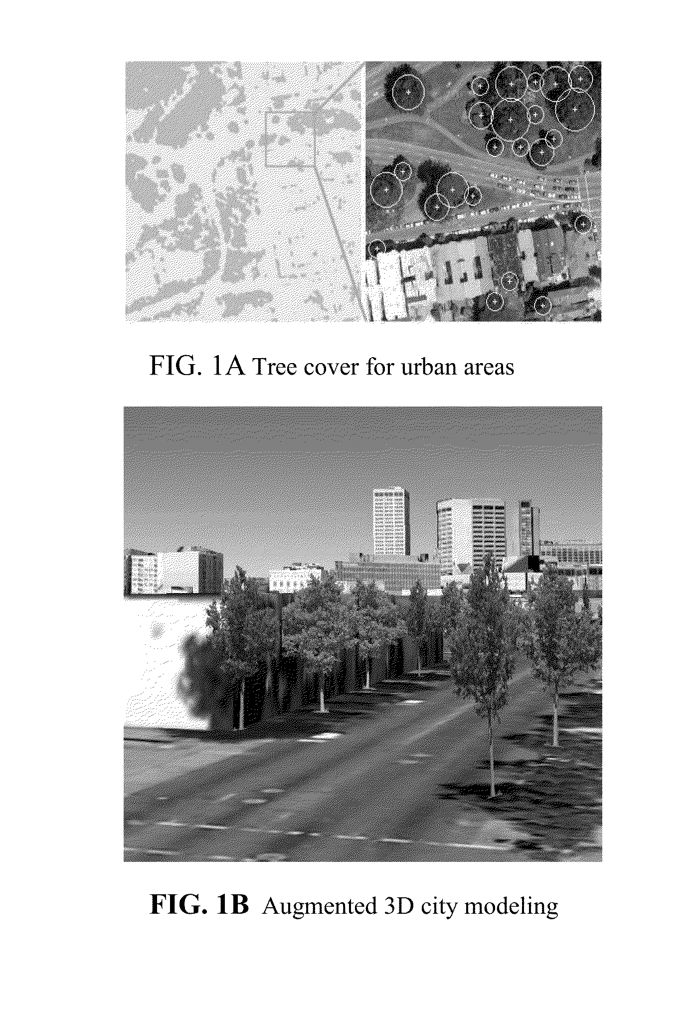
[0018]Aerial imagery captures a wide variety of natural and man-made objects on Earth. Aerial imagery, as used herein, includes imagery captured from a perspective above the ground. Such aerial imagery may include imagery captured from a tower, building or plane and may also include satellite imagery or airborne imagery. Detecting such objects may benefit Geographical Information Systems (GIS). Embodiments of the present invention are directed to tree detection from aerial or satellite imagery. Tree detection results can assist in various applications such as urban planning and 3D city modeling, as shown in FIG. 1.
[0019]FIG. 1 shows two sample applications for tree detection from aerial imagery, according to embodiments. FIG. 1(a)(left) shows the tree cover for the north-west region of San Francisco, which is based on the results of tree segmentation discussed below. FIG. 1(a)(right) shows a zoom-in view of detected tree crowns. The study of tree cover has a potential impact on urba...
PUM
 Abstract
Description
Claims
Application Information