Tiling of map data

Active Publication Date: 2014-09-30
APPLE INC
View PDF25 Cites 80 Cited by
  • Summary
  • Abstract
  • Description
  • Claims
  • Application Information

AI Technical Summary

Benefits of technology

[0003]Methods, program products, and systems for using a map tiles to determine a location of a mobile device are described. To reduce memory and storage requirements at the mobile device and to reduce the time needed t

Problems solved by technology

In many places, GPS signals can be non-existent, weak, or subject to interference such that it is not possible to determine a location using the GPS receiver on

Method used


Image

  • Tiling of map data
  • Tiling of map data
  • Tiling of map data

Examples


Embodiment Construction

Tiling of Map Data

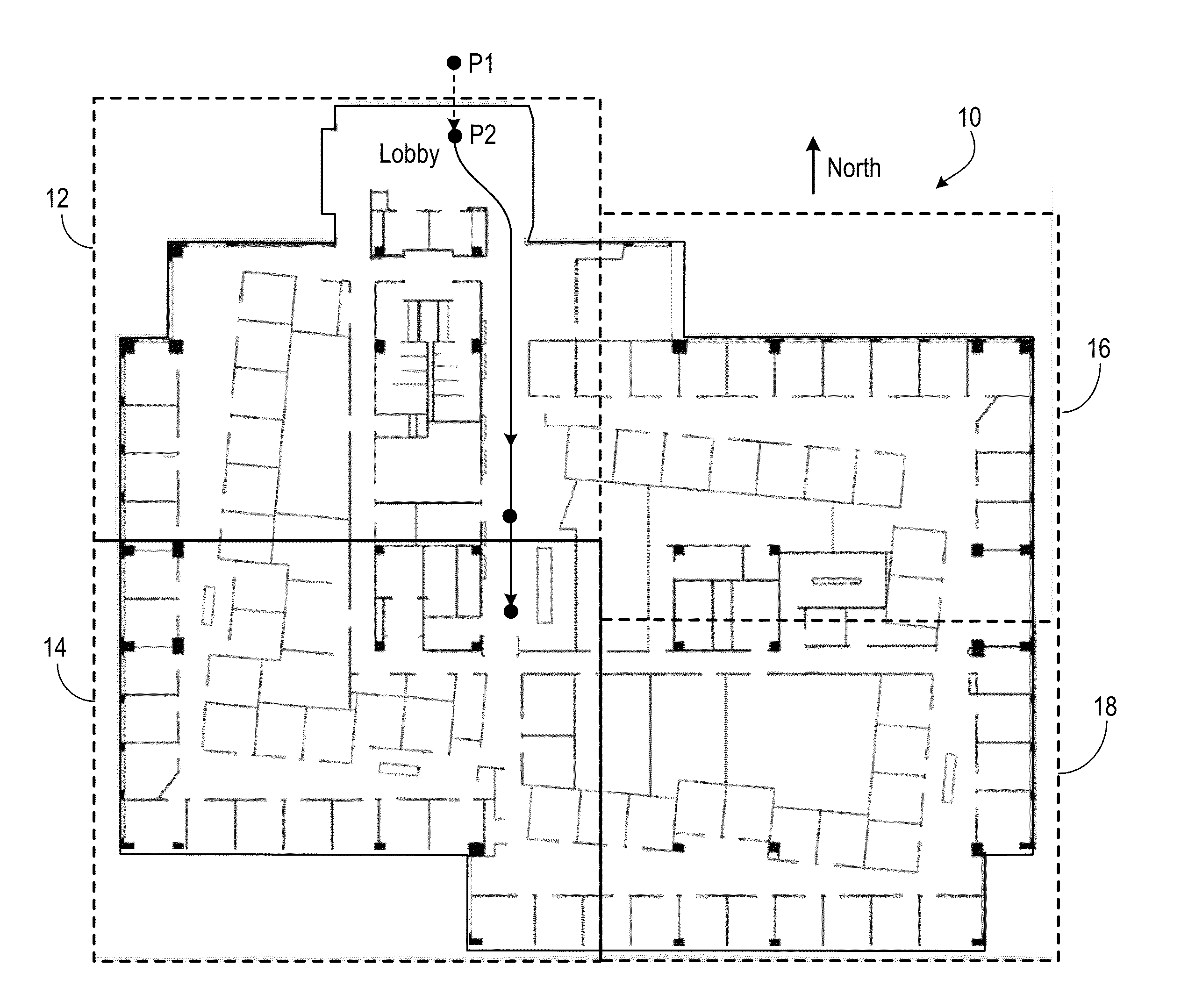
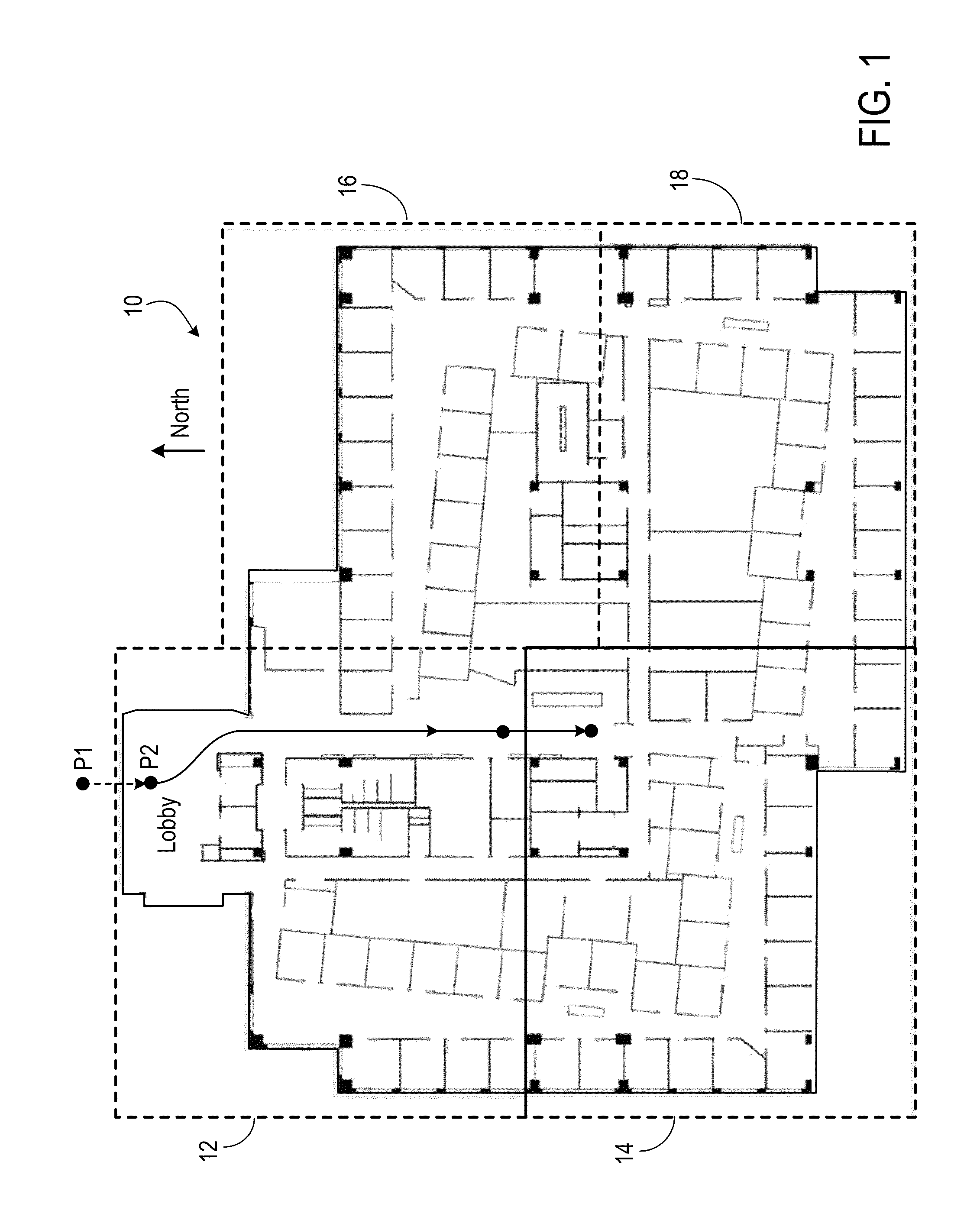
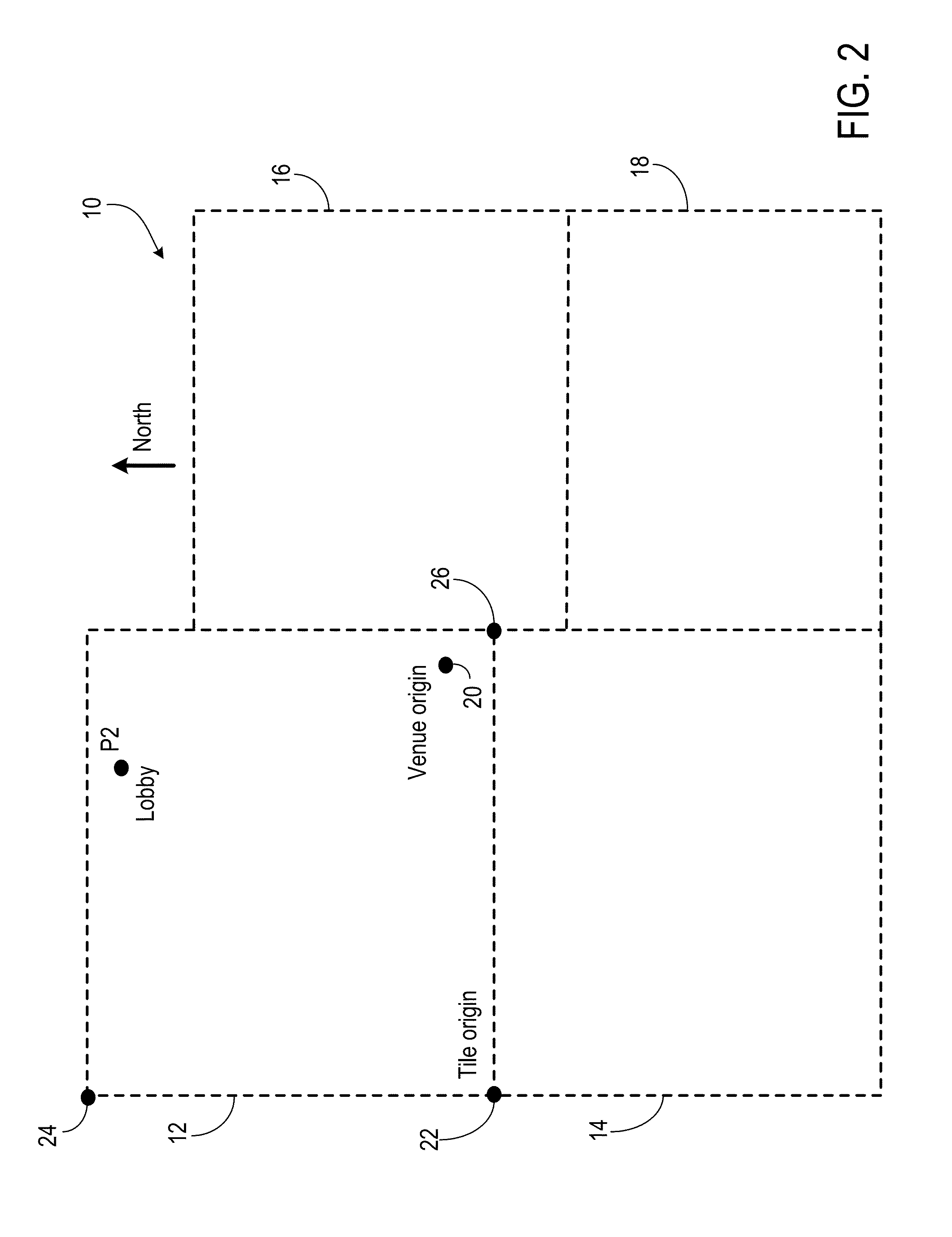
[0035]A mobile device can determine its location in a venue based on map data associated with the venue. The map data can be downloaded from a server through a wireless network connection. The map data can be divided into several files, referred to as “map tiles” or “tiles,” in which each tile includes map data associated with a portion of the venue. For example, if the venue is a multi-floor building, each tile may include map data associated with one floor of the building. A single floor can also be divided into multiple tiles. For example, if the venue is a large shopping mall, each floor of the mall may be divided into several sections, and each tile can include map data associated with one of the sections. When a user carrying the mobile device walks around the venue, relevant tiles of map data are downloaded to the mobile device and used to determine the location of the mobile device. By downloading map data associated with a portion of the venue instead of t...


PUM


Abstract

A mobile device can send a request to a server having a plurality of tiles of location data associated with a venue, each tile having location data associated with a portion of the venue, the request including data representing an estimated location of the mobile device. The mobile device can receive a first tile of location data sent from the server, the first tile being associated with a first portion of the venue that includes the estimated location. The mobile device can receive a first sensor reading and determine a first location of the mobile device at the venue using the first sensor reading and the first tile of location data. The mobile device may receive a second tile of location data sent from the server, the second tile being associated with a second portion of the venue. The mobile device may receive a second sensor reading and determine a second location of the mobile device at the venue using the second sensor reading and the second tile of location data.

Description

TECHNICAL FIELD[0001]This disclosure relates generally to location determination.BACKGROUND[0002]Some mobile devices have features to determine a geographic location. For example, a mobile device can include a receiver for receiving signals from a global positioning system (GPS). The mobile device can determine a geographic location, including latitude and longitude, using the GPS signals. In many places, GPS signals can be non-existent, weak, or subject to interference such that it is not possible to determine a location using the GPS receiver on a mobile device. For example, a conventional mobile device often fails to determine a location based on GPS signals when the device is inside a building or tunnel.SUMMARY[0003]Methods, program products, and systems for using a map tiles to determine a location of a mobile device are described. To reduce memory and storage requirements at the mobile device and to reduce the time needed to provide an initial location estimate, a mobile devic...

Claims


Application Information

Patent Timeline
IPC IPC(8): H04W24/00H04W4/33H04W4/021H04W4/029H04W4/80
CPCH04W4/043H04W4/008H04W4/027G01S5/0278H04W4/80H04W4/021G01C21/206G01C21/383G01C21/3881G01S5/02525G01S5/02528H04W4/33H04W4/029
Inventor MARTI, LUKAS M.MAYOR, ROBERTMA, SHANNON M.
Owner APPLE INC
Why Eureka
Try Eureka