Radar altimeter and measurement method for position of aircraft by the radar altimeter

A technology of altimeter and testing method, applied in the field of positioning and navigation, can solve the problems of radar altimeter echo signal leading edge slowing down, reducing radar altimeter measurement precision, affecting echo signal capture, etc., to achieve navigation information and completeness , measurement accuracy improvement, the effect of improving measurement accuracy

Inactive Publication Date: 2007-08-15
UNIV OF ELECTRONICS SCI & TECH OF CHINA
View PDF0 Cites 50 Cited by
  • Summary
  • Abstract
  • Description
  • Claims
  • Application Information

AI Technical Summary

Problems solved by technology

Due to the influence of terrain and topography, radar altimeter echo signals are prone to frontal slowing, waveform broadening and splitting, etc.
The existence of these phenomena affects the capture of the echo signal and reduces the measurement accuracy of the radar altimeter

Method used


Image

  • Radar altimeter and measurement method for position of aircraft by the radar altimeter
  • Radar altimeter and measurement method for position of aircraft by the radar altimeter
  • Radar altimeter and measurement method for position of aircraft by the radar altimeter

Examples


Embodiment Construction

[0021] The present invention will be further described below in conjunction with the accompanying drawings and implementation examples.

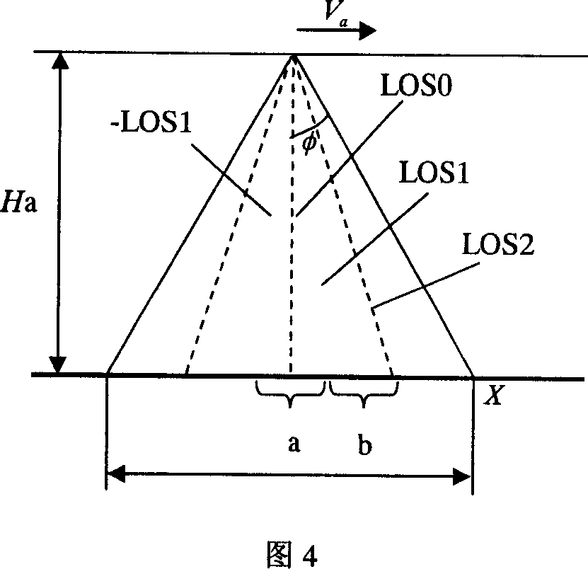
[0022] Suppose the flight height H of the carrier aircraft a = 5000m, when the working frequency is Ku band, choose the baseline length 0.5836m, according to the relationship between ranging accuracy and frequency and baseline, the distance-phase accuracy ratio at this time can be obtained

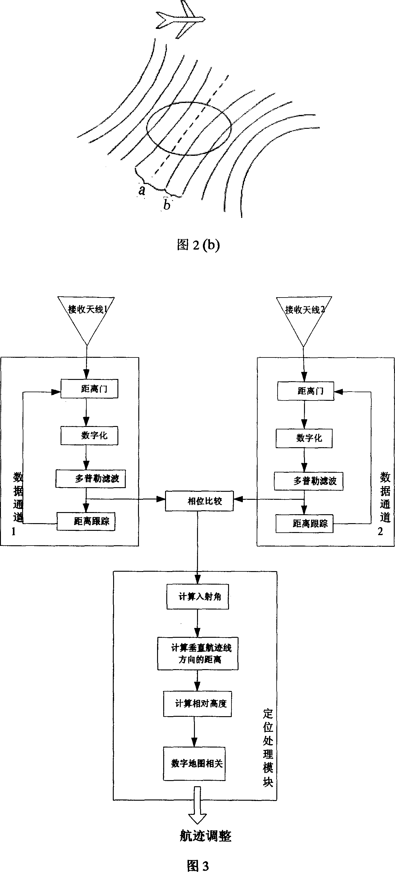
[0023] According to the signal processing flow in Figure 3, first apply the Doppler filter to antenna 1 to select and receive the echo of Doppler strip B and save it, and at the same time use the coarse-precision high-speed tracking loop of channel 1 to obtain the antenna 1 A rough estimate of the distance value from the region's highest point. In the next time interval, the area where the Doppler strip a is located directly below the carrier aircraft is transformed into Doppler strip b at the same time. At this time, the narrow-band high-precision tr...


PUM


Abstract

This invention relates to one radar height meter and its fly device position measurement method in positioning guide field, wherein, the meter comprises one emission antenna and two receive antenna on both sides of load machine to form base line vertical to fly route; the invention method comprises the following steps: adopting one emission antenna and two receive antenna; computing fly distance to aim through two antenna signal phase difference; using Doppler displacement information to compute aim position to improve distance and height measurement accuracy.

Description

technical field [0001] The invention belongs to the field of positioning and navigation, and in particular relates to high-precision radar height measurement and terrain-assisted navigation technology. Background technique [0002] The radar altimeter is an altimeter radar mounted on aircraft, satellites and other flying platforms, which can be used to measure the average height from the radar to the target surface, target fluctuation characteristics and target backscatter characteristics and other parameters. As a microwave remote sensor, the radar altimeter is less affected by climate, weather, and day and night, and has the characteristics of all-weather and all-day time. It can be used in orbit measurement, ballistic correction, cruise guidance, aerospace landing, geodesy, oceanographic mapping, etc. [0003] So far, the development of radar altimeter has gone through four stages. Among them, the AHV altimeter developed by the French T.T.R company (applied to aircraft ...

Claims


Application Information

Patent Timeline
Patent Type & Authority Applications(China)
IPC IPC(8): G01S13/06G01S13/08
Inventor 皮亦鸣付毓生曹宗杰闵锐范录宏王海江王金峰周鹏杨永红
Owner UNIV OF ELECTRONICS SCI & TECH OF CHINA
Why Eureka
Try Eureka