City coordinate position grid and matched mark component

A technology for positioning grids and city components, which is applied in the field of geographical coordinate positioning grids and their identification components, and navigation identification components, can solve problems such as lack of urban geospatial coordinate positioning, unfavorable urban management level, limited, etc., to improve urban The effect of management level and management efficiency, good social benefits and economic benefits

Inactive Publication Date: 2008-04-30
陈俊林
View PDF1 Cites 10 Cited by
  • Summary
  • Abstract
  • Description
  • Claims
  • Application Information

AI Technical Summary

Problems solved by technology

[0006] The obvious disadvantages of this grid division method are: firstly, it does not have the coordinate positioning of urban geographic space, and it is difficult to realize the self-guided positioning and navigation of managers and citizens; secondly, it does not have an intuitive quick search function
It is not conducive to timely discovery and rapid treatment of urban management problems
Fifth, it does not have the function of self-guided navigation in the city (the image is called the city's "GPS" environmental function), which is not conducive to further improving the efficiency of urban management; sixth, it does not have the function of fine expansion under coordinate positioning, which is not conducive to the city's sustainable development
Therefore, the limitations are too large, and the rapid response ability and functional coverage ability are still limited, which is not conducive to the improvement of urban management level

Method used


Image

  • City coordinate position grid and matched mark component
  • City coordinate position grid and matched mark component
  • City coordinate position grid and matched mark component

Examples


Embodiment Construction

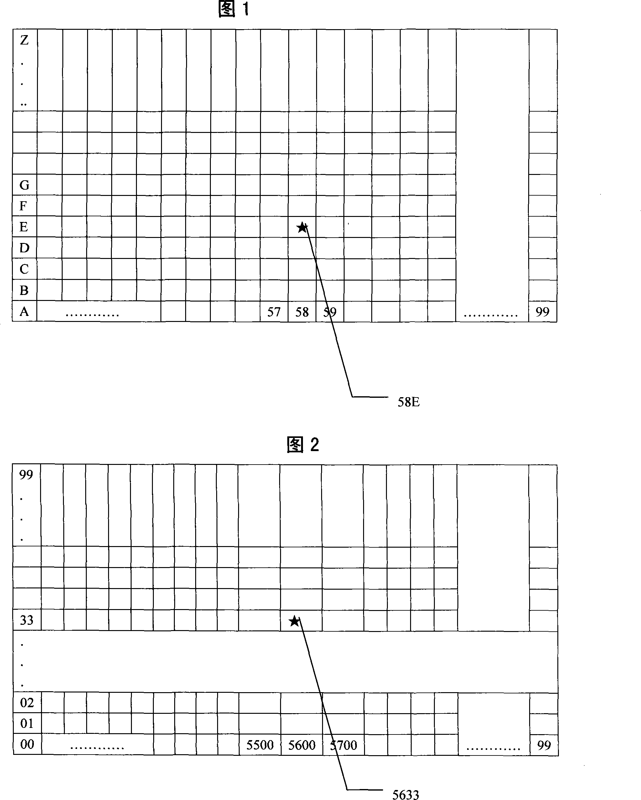
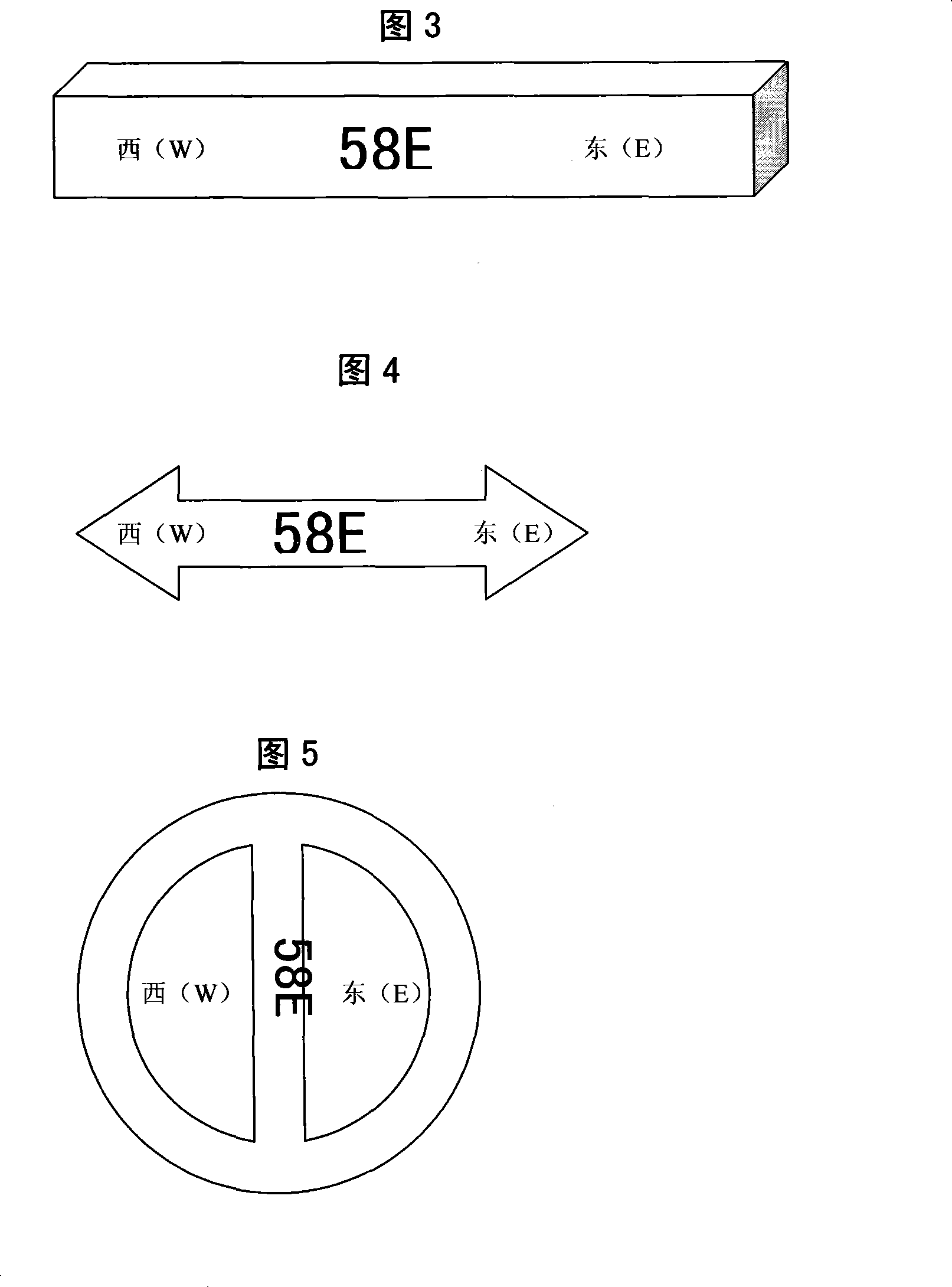
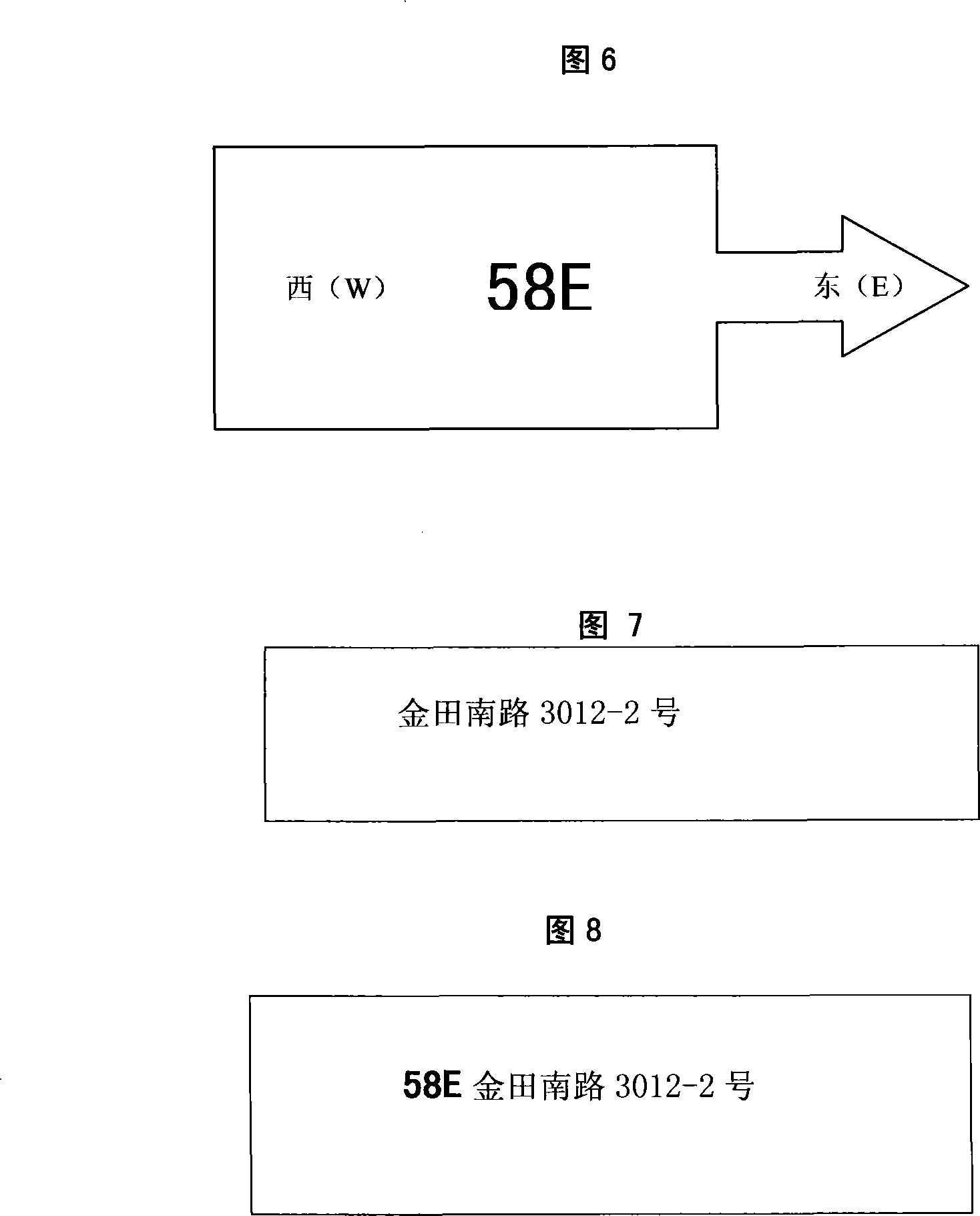
[0044] 1. The present invention is used in digital urban management engineering construction. In the construction of digital urban management, the code is integrated with the positioning grid number, so that there is a high degree of correlation between components, events, grid codes and geographical locations. We know that grid division is required before conducting a census of urban management objects. The division of unit grids in the past was only divided according to certain rules, and the responsibility of urban management and jurisdiction was divided into units. For urban managers, each grid was just a field of responsibility. Although it can cover every inch of land in the city, it does not have precise coordinate positioning and interactive functions. When used in urban management, the components managed by the five-level urban management department of city, district, street, community, and unit grid only need to add the positioning grid number, such as 33F, and the ...


PUM


Abstract

The invention relates to a method for dividing urban coordinated positioning grid and a navigation mark component arranged. The coordinated positioning grid has a positioning grid number consisting of district number and track number obtained by selecting the division region of a urban map, determining the reference point for dividing grids and dividing along the east-west and south-north direction of a city. The positioning grid number is associated with the height of the urban geographical position, and the grid number having direction mark can be labeled on urban components such as doorplate, traffic sign, sideway, street, road surface, lamp post, bus station board, telephone booth, manhole cover, and postal code plate to form a urban position grid group with accurate positioning, fast response and self-service navigation, thereby to automatically form the urban GPS environment. The invention can provide a valued support platform with accurate positioning, fast response and self-service navigation functions for city operation, doorplate regimentation, alarm and rescue, fire control, medical assistance, postal service and self-service tourism.

Description

technical field [0001] The invention relates to a geographic coordinate positioning grid and its marking components, in particular to a city coordinate positioning grid division method and matching navigation marking components, belonging to the field of urban infrastructure construction. technical background [0002] With the development of the global economy, cities around the world are developing rapidly. my country's urban construction has entered a period of rapid development, with high-rise buildings rising from the ground and roads criss-crossing, and various urban management problems follow. We know that efficient urban management is closely related to urban events and the spatial and geographic positioning of urban components. In the current urban management, the scientific, standardized, simple and convenient positioning of urban events and the geographical location of urban components is a bottleneck in modern urban management system engineering. [0003] Becaus...

Claims


Application Information

Patent Timeline
Patent Type & Authority Applications(China)
IPC IPC(8): G09B29/10G09B29/00
Inventor 陈俊林
Owner 陈俊林
Why Eureka
Try Eureka